TopoQuest Logo
Do you find TopoQuest useful?
Help keep TopoQuest running and adding new maps/features by donating!
Bitcoin:  19c7KJd3qBynnjoSw5npx9KScwjBe4ifkT
Litecoin:  LXs6TkuXGGXo1vDsWCkWVdjQX94eUKd6ui
Home View Maps Find Maps Find Places Resources & Links


Iron Mountain SW, Wisconsin Topographic Map

USGS Map Title: Iron Mountain SW, WI
USGS Map MRC: 45088G2
DRG (GeoTIFF) Download: o45088g2.tif


Neighboring USGS Topographic Map Quads:


  Florence West, WI  
45088H3
 

  Florence East, WI  
45088H2
 

  Randville, MI  
45088H1
 

  Florence SE, WI  
45088G3
 

  Iron Mountain SW, WI  
45088G2
 

  Iron Mountain, MI  
45088G1
 

  Goodman, WI  
45088F3
 

  Dunbar, WI  
45088F2
 

  Dunbar NE, WI  
45088F1


Map MRC Location:

N46°
W89°
N46°
W88°
H8 H7 H6 H5 H4 H3 H2 H1
G8 G7 G6 G5 G4 G3 G2 G1
F8 F7 F6 F5 F4 F3 F2 F1
E8 E7 E6 E5 E4 E3 E2 E1
D8 D7 D6 D5 D4 D3 D2 D1
C8 C7 C6 C5 C4 C3 C2 C1
B8 B7 B6 B5 B4 B3 B2 B1
A8 A7 A6 A5 A4 A3 A2 A1
N45°
W89°
N45°
W88°

Iron Mountain SW, WI USGS 1:24K Topographic Map Preview:
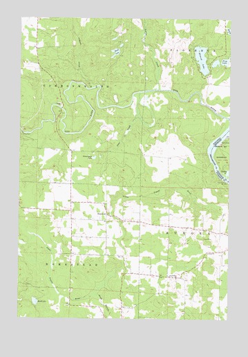
Iron Mountain SW, WI USGS Topographic Map
Click on map above to begin viewing in our Map Viewer.

This topographic map contains these locations and features:
Feature Name Type Latitude Longitude GNIS ID View Map
0.82 ReservoirReservoirN45.8133°W88.2285°1792550View Map
Aurora Free ChurchChurchN45.7669°W88.1562°1561021View Map
Bass LakeLakeN45.8566°W88.1338°2784006View Map
Brown School (historical)SchoolN45.7905°W88.1985°1845370View Map
Ellwood LakeLakeN45.8583°W88.1424°1564552View Map
Fairview School (historical)SchoolN45.7675°W88.1543°1845376View Map
Frog LakeLakeN45.8578°W88.1275°1565351View Map
Hauserman LakeLakeN45.8170°W88.2057°1566149View Map
Henry Ford DamDamN45.8077°W88.1254°628117View Map
Henry Ford DamDamN45.8077°W88.1254°1566309View Map
HomesteadLocaleN45.7936°W88.1982°1566637View Map
Homestead Volunteer Fire DepartmentBuildingN45.7903°W88.1983°2696914View Map
Hord LakeLakeN45.7568°W88.2398°1566693View Map
Johnson CreekStreamN45.8458°W88.2087°1567216View Map
Kingsford FlowageReservoirN45.8075°W88.1256°2784009View Map
Lepage CreekStreamN45.8458°W88.1690°1567987View Map
Lindow G7265 DamDamN45.8133°W88.2285°1792549View Map
Pine CreekStreamN45.8444°W88.1793°1571431View Map
Pine River Power PlantBuildingN45.8269°W88.2485°1845389View Map
Roach School (historical)SchoolN45.8158°W88.2196°1845393View Map
Sand LakeLakeN45.8608°W88.1938°1573680View Map
South Branch Little Popple RiverStreamN45.7608°W88.2040°1574404View Map
Spread Eagle Barrens State Natural AreaParkN45.8416°W88.1462°2060878View Map
Spring LakeLakeN45.8702°W88.1260°1574688View Map
Town of AuroraCivilN45.7672°W88.1267°1582734View Map
Town of CommonwealthCivilN45.8575°W88.2404°1583008View Map

Note: Coordinates in the location and feature list above are referenced to NAD83 datum.


Copyright (C) 2008-2025 Ryan Niemi / Sunset Dynamics ... All Rights Reserved