TopoQuest Logo
Do you find TopoQuest useful?
Help keep TopoQuest running and adding new maps/features by donating!
Bitcoin:  19c7KJd3qBynnjoSw5npx9KScwjBe4ifkT
Litecoin:  LXs6TkuXGGXo1vDsWCkWVdjQX94eUKd6ui
Home View Maps Find Maps Find Places Resources & Links


Addison, Ohio Topographic Map

USGS Map Title: Addison, OH
USGS Map MRC: 38082H2
DRG (GeoTIFF) Download: o38082h2.tif


Neighboring USGS Topographic Map Quads:


  Wilkesville, OH  
39082A3
 

  Rutland, OH  
39082A2
 

  Pomeroy, OH  
39082A1
 

  Vinton, OH  
38082H3
 

  Addison, OH  
38082H2
 

  Cheshire, OH  
38082H1
 

  Rodney, OH  
38082G3
 

  Gallipolis, OH  
38082G2
 

  Beech Hill, WV  
38082G1


Map MRC Location:

N39°
W83°
N39°
W82°
H8 H7 H6 H5 H4 H3 H2 H1
G8 G7 G6 G5 G4 G3 G2 G1
F8 F7 F6 F5 F4 F3 F2 F1
E8 E7 E6 E5 E4 E3 E2 E1
D8 D7 D6 D5 D4 D3 D2 D1
C8 C7 C6 C5 C4 C3 C2 C1
B8 B7 B6 B5 B4 B3 B2 B1
A8 A7 A6 A5 A4 A3 A2 A1
N38°
W83°
N38°
W82°

Addison, OH USGS 1:24K Topographic Map Preview:
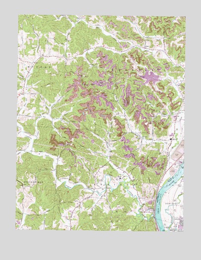
Addison, OH USGS Topographic Map
Click on map above to begin viewing in our Map Viewer.

This topographic map contains these locations and features:
Feature Name Type Latitude Longitude GNIS ID View Map
Addaville Elementary SchoolSchoolN38.9059°W82.1721°1080999View Map
AddisonPopulated PlaceN38.8862°W82.1463°1037320View Map
Addison Post OfficePost OfficeN38.8862°W82.1457°1987885View Map
Bell Lick RunStreamN38.9970°W82.2015°1037823View Map
BellmeadePopulated PlaceN38.8806°W82.1274°1553849View Map
Berrys LandingLocaleN38.9012°W82.1410°1051218View Map
Blosser CreekStreamN38.9198°W82.2390°1038130View Map
BulavillePopulated PlaceN38.9001°W82.1829°1062677View Map
Bulaville Post Office (historical)Post OfficeN38.9001°W82.1832°1987908View Map
Campaign CemeteryCemeteryN38.9256°W82.2124°1068750View Map
Campaign ChurchChurchN38.9248°W82.2129°1038775View Map
Campaign CreekStreamN38.8831°W82.1457°1066627View Map
Carter and Evans LakeReservoirN38.8795°W82.2477°1079515View Map
Carter and Evans Lake DamDamN38.8801°W82.2465°1079514View Map
EnoPopulated PlaceN38.9723°W82.2371°1062752View Map
Eno ChurchChurchN38.9726°W82.2382°1068767View Map
Eno Post Office (historical)Post OfficeN38.9723°W82.2374°1987731View Map
Enterprise ChurchChurchN38.9387°W82.2160°1040216View Map
Flatfork RunStreamN38.8954°W82.1874°1079656View Map
Fulton CemeteryCemeteryN38.8842°W82.1929°1040721View Map
Gallia County Sanitary LandfillLocaleN38.9842°W82.2394°2635453View Map
Gavin Fly Ash DamDamN38.9641°W82.1436°1079197View Map
Gavin Fly Ash ImpoundmentReservoirN38.9647°W82.1511°1079198View Map
Gravel Hill CemeteryCemeteryN38.9448°W82.1299°1041078View Map
Halfhill CemeteryCemeteryN38.9851°W82.2124°1041242View Map
Honey HollowValleyN38.9012°W82.1871°1079657View Map
Jessie CreekStreamN38.9798°W82.1413°1066774View Map
KygerPopulated PlaceN38.9815°W82.1549°1064956View Map
Kyger CemeteryCemeteryN38.9859°W82.1535°1042353View Map
Kyger ChurchChurchN38.9601°W82.1301°1070807View Map
Kyger CreekStreamN38.9062°W82.1346°1066789View Map
Kyger Creek High SchoolSchoolN38.9287°W82.1346°1042354View Map
Kyger Creek Power PlantBuildingN38.9145°W82.1288°1068778View Map
Kyger Post Office (historical)Post OfficeN38.9820°W82.1554°1988250View Map
Kyger United Methodist ChurchChurchN38.9809°W82.1554°1068779View Map
Lemley CemeteryCemeteryN38.9601°W82.1871°1042488View Map
Lewis CemeteryCemeteryN38.8931°W82.1326°1541805View Map
Lime Kiln CreekStreamN38.8990°W82.1429°1067112View Map
Little Campaign CreekStreamN38.9037°W82.1674°1066808View Map
Little Kyger ChurchChurchN38.9298°W82.1563°1071008View Map
Little Kyger CreekStreamN38.9204°W82.1363°1042668View Map
Little Kyger GrangeLocaleN38.9292°W82.1568°1042669View Map
Little White Oak CreekStreamN38.9259°W82.2376°1066815View Map
Lock and Dam Number 25 (historical)DamN38.9051°W82.1324°1051236View Map
Locust Lane (historical)Populated PlaceN38.8834°W82.1318°1560245View Map
Machir LandingLocaleN38.9167°W82.1332°1549541View Map
Mason County Emergency Ambulance ServiceBuildingN38.8826°W82.1269°2581138View Map
McCarty CemeteryCemeteryN38.9431°W82.1332°1043150View Map
Moore CemeteryCemeteryN38.9398°W82.1768°1043464View Map
Oil HollowValleyN38.9187°W82.1832°1079658View Map
Poplar RidgeRidgeN38.9584°W82.1932°1044694View Map
Poplar Ridge CemeteryCemeteryN38.9640°W82.2007°1068789View Map
Poplar Ridge ChurchChurchN38.9640°W82.2013°1044696View Map
Prospect CemeteryCemeteryN38.9006°W82.2451°1964070View Map
Prospect ChurchChurchN38.9009°W82.2454°1044779View Map
Prospect HillSummitN38.9015°W82.2451°1079659View Map
Prospect Hill (historical)Populated PlaceN38.8992°W82.2443°1067564View Map
Rife CemeteryCemeteryN38.9048°W82.1871°1045014View Map
Rife CemeteryCemeteryN38.9620°W82.1285°1045015View Map
River Bend SubdivisionPopulated PlaceN38.8759°W82.1429°1698938View Map
Robinson CemeteryCemeteryN38.9628°W82.2463°1045097View Map
Rothgeb CemeteryCemeteryN38.9037°W82.1426°1964072View Map
Roush CemeteryCemeteryN38.9256°W82.1374°1045229View Map
Roush CemeteryCemeteryN38.9517°W82.1254°1045230View Map
Stingy RunStreamN38.9595°W82.1310°1046699View Map
Tara EstatesPopulated PlaceN38.8881°W82.1504°1698946View Map
Township of AddisonCivilN38.8907°W82.1782°1086132View Map
Township of CheshireCivilN38.9695°W82.1578°1086133View Map
Turkey RunStreamN38.9462°W82.1268°1047201View Map
Van Zant CemeteryCemeteryN38.9992°W82.2035°1964077View Map
Wesley ChapelChurchN38.9981°W82.2029°1047689View Map
Whiteoak School (historical)SchoolN38.9426°W82.2304°1079660View Map
YorkPopulated PlaceN38.9059°W82.1254°1556041View Map

Note: Coordinates in the location and feature list above are referenced to NAD83 datum.


Copyright (C) 2008-2024 Ryan Niemi / Sunset Dynamics ... All Rights Reserved