TopoQuest Logo
Do you find TopoQuest useful?
Help keep TopoQuest running and adding new maps/features by donating!
Bitcoin:  19c7KJd3qBynnjoSw5npx9KScwjBe4ifkT
Litecoin:  LXs6TkuXGGXo1vDsWCkWVdjQX94eUKd6ui
Home View Maps Find Maps Find Places Resources & Links


Rutland, Ohio Topographic Map

USGS Map Title: Rutland, OH
USGS Map MRC: 39082A2
DRG (GeoTIFF) Download: o39082a2.tif


Neighboring USGS Topographic Map Quads:


  Vales Mills, OH  
39082B3
 

  Albany, OH  
39082B2
 

  Shade, OH  
39082B1
 

  Wilkesville, OH  
39082A3
 

  Rutland, OH  
39082A2
 

  Pomeroy, OH  
39082A1
 

  Vinton, OH  
38082H3
 

  Addison, OH  
38082H2
 

  Cheshire, OH  
38082H1


Map MRC Location:

N40°
W83°
N40°
W82°
H8 H7 H6 H5 H4 H3 H2 H1
G8 G7 G6 G5 G4 G3 G2 G1
F8 F7 F6 F5 F4 F3 F2 F1
E8 E7 E6 E5 E4 E3 E2 E1
D8 D7 D6 D5 D4 D3 D2 D1
C8 C7 C6 C5 C4 C3 C2 C1
B8 B7 B6 B5 B4 B3 B2 B1
A8 A7 A6 A5 A4 A3 A2 A1
N39°
W83°
N39°
W82°

Rutland, OH USGS 1:24K Topographic Map Preview:
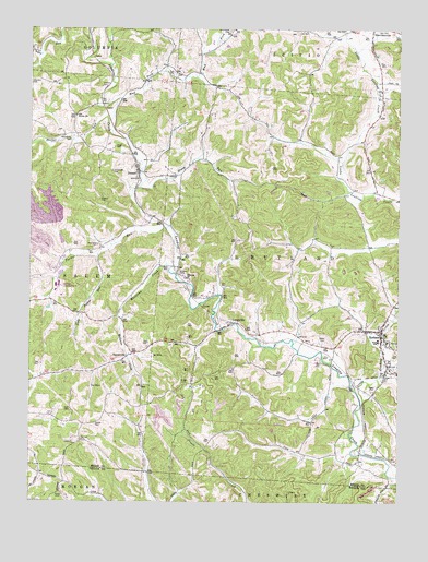
Rutland, OH USGS Topographic Map
Click on map above to begin viewing in our Map Viewer.

This topographic map contains these locations and features:
Feature Name Type Latitude Longitude GNIS ID View Map
Buckhorn (historical)Populated PlaceN39.0729°W82.2021°1069861View Map
Coy Hill CemeteryCemeteryN39.0162°W82.2324°1039428View Map
DexterPopulated PlaceN39.0873°W82.2129°1039695View Map
Dexter Church of ChristChurchN39.0873°W82.2129°1069860View Map
Dexter Post OfficePost OfficeN39.0876°W82.2124°2036282View Map
Dexter RunStreamN39.1006°W82.2235°1066676View Map
Disciple ChurchChurchN39.0592°W82.1968°1039715View Map
Folden CemeteryCemeteryN39.0798°W82.2261°1040540View Map
Goff CemeteryCemeteryN39.0240°W82.2357°1040932View Map
Gomer CemeteryCemeteryN39.0203°W82.2274°1040937View Map
Grass RunStreamN39.0834°W82.2129°1041059View Map
HanesvillePopulated PlaceN39.0373°W82.2185°1062802View Map
Hanesville Post Office (historical)Post OfficeN39.0376°W82.2179°2036281View Map
Higley CemeteryCemeteryN39.0295°W82.1340°1041570View Map
Hugg CemeteryCemeteryN39.0939°W82.2212°1041857View Map
Lambert PondReservoirN39.1035°W82.1584°1077967View Map
Lambert Pond DamDamN39.1034°W82.1582°1077966View Map
LangsvillePopulated PlaceN39.0470°W82.1815°1064968View Map
Langsville Post OfficePost OfficeN39.0473°W82.1818°2036286View Map
Little Leading CreekStreamN39.0256°W82.1374°1042671View Map
Little Parker RunStreamN39.0648°W82.2265°1042680View Map
Longstretch CemeteryCemeteryN39.0872°W82.2219°1042771View Map
Malloons CreekStreamN39.0615°W82.2026°1070834View Map
Martinsburg (historical)Populated PlaceN39.1065°W82.2193°1069859View Map
McCaskey CemeteryCemeteryN39.0678°W82.2268°1043151View Map
Meigs Mine Number One Water Supply DamDamN39.0684°W82.2382°1079181View Map
Meigs Mine Number One Water Supply ReservoirReservoirN39.0691°W82.2393°1079182View Map
Midway CemeteryCemeteryN39.0609°W82.1993°1043296View Map
Miles CemeteryCemeteryN39.0417°W82.1496°1043307View Map
Miller CemeteryCemeteryN39.0015°W82.2382°1043349View Map
Mud ForkStreamN39.1062°W82.2199°1043692View Map
Old Dexter ChurchChurchN39.1020°W82.2346°1044101View Map
Parker RunStreamN39.0726°W82.2029°1066885View Map
Pearsol CemeteryCemeteryN39.1098°W82.2260°1044351View Map
RutlandPopulated PlaceN39.0454°W82.1304°1049143View Map
Rutland Church of ChristChurchN39.0484°W82.1285°1069862View Map
Rutland Elementary SchoolSchoolN39.0426°W82.1288°1049503View Map
Rutland Emergency Medical ServicesBuildingN39.0432°W82.1309°2550766View Map
Rutland Fire DepartmentBuildingN39.0450°W82.1311°2549622View Map
Rutland High SchoolSchoolN39.0426°W82.1318°1068841View Map
Rutland Post OfficePost OfficeN39.0459°W82.1304°2036288View Map
Township of RutlandCivilN39.0566°W82.1488°1086615View Map
Village of RutlandCivilN39.0410°W82.1279°2399150View Map
Vonschriltz CemeteryCemeteryN39.0967°W82.2363°1047469View Map
White Oak CemeteryCemeteryN39.1248°W82.1826°1047878View Map
Wright CemeteryCemeteryN39.0312°W82.1974°1048153View Map

Note: Coordinates in the location and feature list above are referenced to NAD83 datum.


Copyright (C) 2008-2025 Ryan Niemi / Sunset Dynamics ... All Rights Reserved