TopoQuest Logo
Do you find TopoQuest useful?
Help keep TopoQuest running and adding new maps/features by donating!
Bitcoin:  19c7KJd3qBynnjoSw5npx9KScwjBe4ifkT
Litecoin:  LXs6TkuXGGXo1vDsWCkWVdjQX94eUKd6ui
Home View Maps Find Maps Find Places Resources & Links


Gore Springs, Mississippi Topographic Map

USGS Map Title: Gore Springs, MS
USGS Map MRC: 33089G5
DRG (GeoTIFF) Download: o33089g5.tif


Neighboring USGS Topographic Map Quads:


  Coffeeville, MS  
33089H6
 

  Benwood, MS  
33089H5
 

  Skuna, MS  
33089H4
 

  Kincaid, MS  
33089G6
 

  Gore Springs, MS  
33089G5
 

  Big Creek, MS  
33089G4
 

  Duck Hill, MS  
33089F6
 

  Sweatman, MS  
33089F5
 

  Cadaretta, MS  
33089F4


Map MRC Location:

N34°
W90°
N34°
W89°
H8 H7 H6 H5 H4 H3 H2 H1
G8 G7 G6 G5 G4 G3 G2 G1
F8 F7 F6 F5 F4 F3 F2 F1
E8 E7 E6 E5 E4 E3 E2 E1
D8 D7 D6 D5 D4 D3 D2 D1
C8 C7 C6 C5 C4 C3 C2 C1
B8 B7 B6 B5 B4 B3 B2 B1
A8 A7 A6 A5 A4 A3 A2 A1
N33°
W90°
N33°
W89°

Gore Springs, MS USGS 1:24K Topographic Map Preview:
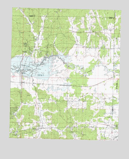
Gore Springs, MS USGS Topographic Map
Click on map above to begin viewing in our Map Viewer.

This topographic map contains these locations and features:
Feature Name Type Latitude Longitude GNIS ID View Map
Bullpen CreekStreamN33.8496°W89.5934°667784View Map
Butputter CreekStreamN33.8148°W89.6015°667864View Map
Clanton Lake DamDamN33.7651°W89.5801°682330View Map
Clark CreekStreamN33.8229°W89.5529°668514View Map
Cole Creek (historical)LocaleN33.8584°W89.5167°683060View Map
Coles CreekStreamN33.8207°W89.5165°668684View Map
Cowpen CreekStreamN33.8204°W89.5951°668908View Map
Gillon SchoolSchoolN33.7623°W89.5940°670394View Map
Gore SpringsPopulated PlaceN33.7543°W89.6165°670539View Map
Gore Springs Baptist ChurchChurchN33.7565°W89.6129°683073View Map
Gore Springs CemeteryCemeteryN33.7537°W89.6151°705790View Map
Gore Springs High SchoolSchoolN33.7551°W89.6179°705791View Map
Gore Springs Post OfficePost OfficeN33.7570°W89.6151°2768684View Map
Gore Springs Volunteer Fire Department Station 1BuildingN33.7565°W89.6178°2666038View Map
Gores Spring ChurchChurchN33.7548°W89.6148°683074View Map
GraysportLocaleN33.8034°W89.6126°683076View Map
Graysport CrossingPopulated PlaceN33.8165°W89.6137°691904View Map
Jones CemeteryCemeteryN33.8521°W89.5459°671970View Map
Jones ChapelChurchN33.8518°W89.5459°671985View Map
Little Rock ChurchChurchN33.7721°W89.5092°672672View Map
Magnolia Memorial Roadside ParkParkN33.7593°W89.5976°683090View Map
Martin Line SchoolSchoolN33.7723°W89.5087°673196View Map
Mount Nebo CemeteryCemeteryN33.8534°W89.5290°674086View Map
Mount Nebo ChurchChurchN33.8537°W89.5290°674097View Map
North Graysport Public Use AreaParkN33.8323°W89.6098°683093View Map
Parker CemeteryCemeteryN33.7918°W89.6051°675460View Map
Pine Grove CemeteryCemeteryN33.8715°W89.5731°675816View Map
Pine Grove ChurchChurchN33.8718°W89.5731°675849View Map
Pleasant Grove CemeteryCemeteryN33.7573°W89.5515°675985View Map
Pleasant Grove CemeteryCemeteryN33.7584°W89.5404°675986View Map
Pleasant Grove ChurchChurchN33.7571°W89.5517°676029View Map
Pleasant Grove ChurchChurchN33.7551°W89.5412°683100View Map
Pleasant Grove SchoolSchoolN33.7548°W89.5404°676052View Map
Pleasant Hill CemeteryCemeteryN33.7873°W89.5404°676053View Map
Pleasant Hill ChurchChurchN33.7871°W89.5404°676079View Map
Shiloh CemeteryCemeteryN33.8473°W89.5042°677672View Map
Shiloh ChurchChurchN33.8471°W89.5040°677698View Map
South Graysport Public Use AreaParkN33.8126°W89.6126°683108View Map
Supervisor District 3CivilN33.8162°W89.6135°711865View Map
SusiePopulated PlaceN33.7543°W89.5501°683110View Map
Williams CemeteryCemeteryN33.7851°W89.5634°679708View Map
Williamsville (historical)LocaleN33.7898°W89.5159°683116View Map
Yeager CreekStreamN33.8284°W89.5679°679930View Map
YoungsPopulated PlaceN33.8532°W89.5345°679970View Map
Youngs CreekStreamN33.8357°W89.5498°679973View Map

Note: Coordinates in the location and feature list above are referenced to NAD83 datum.


Copyright (C) 2008-2024 Ryan Niemi / Sunset Dynamics ... All Rights Reserved