TopoQuest Logo
Do you find TopoQuest useful?
Help keep TopoQuest running and adding new maps/features by donating!
Bitcoin:  19c7KJd3qBynnjoSw5npx9KScwjBe4ifkT
Litecoin:  LXs6TkuXGGXo1vDsWCkWVdjQX94eUKd6ui
Home View Maps Find Maps Find Places Resources & Links


Cadaretta, Mississippi Topographic Map

USGS Map Title: Cadaretta, MS
USGS Map MRC: 33089F4
DRG (GeoTIFF) Download: o33089f4.tif


Neighboring USGS Topographic Map Quads:


  Gore Springs, MS  
33089G5
 

  Big Creek, MS  
33089G4
 

  Calhoun City, MS  
33089G3
 

  Sweatman, MS  
33089F5
 

  Cadaretta, MS  
33089F4
 

  Bellefontaine, MS  
33089F3
 

  Lodi, MS  
33089E5
 

  Little Sand Creek, MS  
33089E4
 

  Eupora, MS  
33089E3


Map MRC Location:

N34°
W90°
N34°
W89°
H8 H7 H6 H5 H4 H3 H2 H1
G8 G7 G6 G5 G4 G3 G2 G1
F8 F7 F6 F5 F4 F3 F2 F1
E8 E7 E6 E5 E4 E3 E2 E1
D8 D7 D6 D5 D4 D3 D2 D1
C8 C7 C6 C5 C4 C3 C2 C1
B8 B7 B6 B5 B4 B3 B2 B1
A8 A7 A6 A5 A4 A3 A2 A1
N33°
W90°
N33°
W89°

Cadaretta, MS USGS 1:24K Topographic Map Preview:
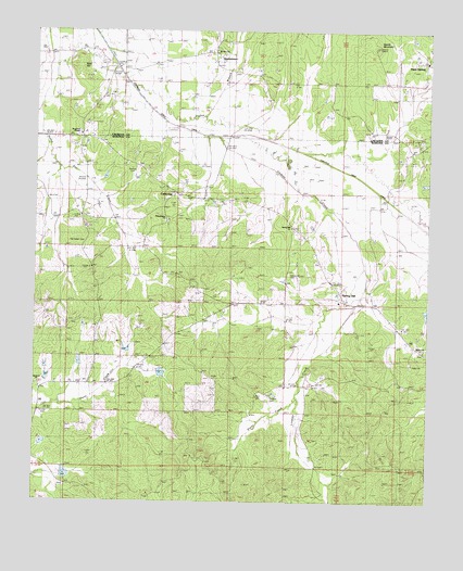
Cadaretta, MS USGS Topographic Map
Click on map above to begin viewing in our Map Viewer.

This topographic map contains these locations and features:
Feature Name Type Latitude Longitude GNIS ID View Map
Bald HillSummitN33.7390°W89.4867°683358View Map
Bethel CemeteryCemeteryN33.7457°W89.4426°666888View Map
Bogue Watershed Y-30-104 DamDamN33.6601°W89.4834°682276View Map
Bogue Watershed Y-30-54 DamDamN33.6318°W89.4917°682256View Map
Bogue Watershed Y-30-55 DamDamN33.6401°W89.4984°682262View Map
Bogue Watershed Y-30-66DamN33.6568°W89.4634°682272View Map
Bogue Watershed Y-30-85 DamDamN33.6635°W89.4717°682281View Map
Bogue Watershed Y-30-99 DamDamN33.6568°W89.4984°682273View Map
Bradsford CemeteryCemeteryN33.7226°W89.4856°667507View Map
Bradsford ChapelChurchN33.7226°W89.4856°667508View Map
CadarettaPopulated PlaceN33.7062°W89.4512°667900View Map
DentontownPopulated PlaceN33.7410°W89.4429°669233View Map
Doolittle Chapel SchoolSchoolN33.7021°W89.4226°693099View Map
Embry CemeteryCemeteryN33.6657°W89.3765°669760View Map
Embry ChurchChurchN33.6657°W89.3765°669761View Map
Harmony ChurchChurchN33.6565°W89.4990°670941View Map
Horse Pen SchoolSchoolN33.7482°W89.4990°671470View Map
Ingrams CemeteryCemeteryN33.6346°W89.4851°682843View Map
Lindsay CreekStreamN33.7221°W89.4417°672504View Map
Lowrimore CemeteryCemeteryN33.6384°W89.4037°672935View Map
Mount Zion ChurchChurchN33.7457°W89.4426°666941View Map
Philadelphia CemeteryCemeteryN33.6998°W89.4581°675675View Map
Philadelphia ChurchChurchN33.6998°W89.4581°675679View Map
Pittman CemeteryCemeteryN33.7137°W89.4695°682856View Map
Pryor CemeteryCemeteryN33.6529°W89.4287°676407View Map
Pryor CreekStreamN33.6823°W89.3940°676409View Map
Roberts CemeteryCemeteryN33.6523°W89.4242°676706View Map
Sandy MountainSummitN33.7460°W89.3923°683392View Map
Spring HillPopulated PlaceN33.6785°W89.4015°682864View Map
Spring Hill CemeteryCemeteryN33.6859°W89.4190°678101View Map
Spring Hill ChurchChurchN33.6860°W89.4190°678130View Map
Spring Hill SchoolSchoolN33.6785°W89.4026°678145View Map
Supervisor District 2CivilN33.6853°W89.4252°712135View Map
Travis Hughes Lake DamDamN33.6768°W89.3751°682296View Map
Village of Slate SpringsCivilN33.7417°W89.3752°2407550View Map

Note: Coordinates in the location and feature list above are referenced to NAD83 datum.


Copyright (C) 2008-2025 Ryan Niemi / Sunset Dynamics ... All Rights Reserved