TopoQuest Logo
Do you find TopoQuest useful?
Help keep TopoQuest running and adding new maps/features by donating!
Bitcoin:  19c7KJd3qBynnjoSw5npx9KScwjBe4ifkT
Litecoin:  LXs6TkuXGGXo1vDsWCkWVdjQX94eUKd6ui
Home View Maps Find Maps Find Places Resources & Links


Sweatman, Mississippi Topographic Map

USGS Map Title: Sweatman, MS
USGS Map MRC: 33089F5
DRG (GeoTIFF) Download: o33089f5.tif


Neighboring USGS Topographic Map Quads:


  Kincaid, MS  
33089G6
 

  Gore Springs, MS  
33089G5
 

  Big Creek, MS  
33089G4
 

  Duck Hill, MS  
33089F6
 

  Sweatman, MS  
33089F5
 

  Cadaretta, MS  
33089F4
 

  Eskridge, MS  
33089E6
 

  Lodi, MS  
33089E5
 

  Little Sand Creek, MS  
33089E4


Map MRC Location:

N34°
W90°
N34°
W89°
H8 H7 H6 H5 H4 H3 H2 H1
G8 G7 G6 G5 G4 G3 G2 G1
F8 F7 F6 F5 F4 F3 F2 F1
E8 E7 E6 E5 E4 E3 E2 E1
D8 D7 D6 D5 D4 D3 D2 D1
C8 C7 C6 C5 C4 C3 C2 C1
B8 B7 B6 B5 B4 B3 B2 B1
A8 A7 A6 A5 A4 A3 A2 A1
N33°
W90°
N33°
W89°

Sweatman, MS USGS 1:24K Topographic Map Preview:
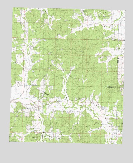
Sweatman, MS USGS Topographic Map
Click on map above to begin viewing in our Map Viewer.

This topographic map contains these locations and features:
Feature Name Type Latitude Longitude GNIS ID View Map
AlvaPopulated PlaceN33.6379°W89.5073°666240View Map
Bethel ChurchChurchN33.6523°W89.6167°666938View Map
Blackjack ChurchChurchN33.6965°W89.5815°674719View Map
Bogue Watershed Y-30-105 DamDamN33.7085°W89.6001°682308View Map
Bogue Watershed Y-30-106 DamDamN33.7001°W89.5701°682300View Map
Bogue Watershed Y-30-107 DamDamN33.7201°W89.5934°682311View Map
Bogue Watershed Y-30-20 DamDamN33.7035°W89.5967°682303View Map
Bogue Watershed Y-30-43 DamDamN33.6268°W89.5534°682253View Map
Bogue Watershed Y-30-51 DamDamN33.6368°W89.5367°682259View Map
Bogue Watershed Y-30-57 DamDamN33.6601°W89.5101°682277View Map
Bogue Watershed Y-30-58 DamDamN33.6735°W89.5251°682294View Map
Bogue Watershed Y-30-84 DamDamN33.6718°W89.5334°682290View Map
Bogue Watershed Y-30-90 DamDamN33.6968°W89.5617°682298View Map
Center CemeteryCemeteryN33.6421°W89.5795°668230View Map
Center Hill ChurchChurchN33.6415°W89.5795°668232View Map
Centerside SchoolSchoolN33.6421°W89.6029°668263View Map
Chapel Hill CemeteryCemeteryN33.7065°W89.5220°668317View Map
Church Hill ChurchChurchN33.7060°W89.5217°668329View Map
Coffe BranchStreamN33.6593°W89.5642°668643View Map
Cox and Carver CemeteryCemeteryN33.6609°W89.5056°682830View Map
Dunn CemeteryCemeteryN33.6562°W89.5223°669517View Map
Dunn CreekStreamN33.6529°W89.5312°690083View Map
Dunns Store (historical)BuildingN33.6632°W89.5348°711110View Map
East Fork Bogue CreekStreamN33.6504°W89.5065°669574View Map
Harmony CemeteryCemeteryN33.6612°W89.5056°670930View Map
Hopewell ChurchChurchN33.6346°W89.5070°683310View Map
Jordans CemeteryCemeteryN33.6523°W89.6201°672029View Map
Larg BranchStreamN33.6376°W89.5904°683316View Map
LilacPopulated PlaceN33.6696°W89.5884°692004View Map
Little Mouse CreekStreamN33.6390°W89.5901°672650View Map
Marshill CemeteryCemeteryN33.6282°W89.5956°673165View Map
Marshill ChurchChurchN33.6290°W89.5973°673166View Map
MistertonPopulated PlaceN33.7079°W89.5823°692079View Map
Mouse CreekStreamN33.6598°W89.6020°674418View Map
Parker CemeteryCemeteryN33.6412°W89.5053°682854View Map
Powell CreekStreamN33.6626°W89.6245°676405View Map
Providence (historical)LocaleN33.7137°W89.6204°683102View Map
Providence Baptist ChurchChurchN33.7140°W89.6179°676390View Map
Providence CemeteryCemeteryN33.7137°W89.6179°676369View Map
Providence SchoolSchoolN33.7390°W89.5676°676401View Map
Red Hill BranchStreamN33.6621°W89.5779°683328View Map
Red Hill CemeteryCemeteryN33.6696°W89.5887°676530View Map
Red Hill ChurchChurchN33.6701°W89.5890°676538View Map
ReddingPopulated PlaceN33.7226°W89.5131°692166View Map
Saint Mark ChurchChurchN33.6668°W89.5495°683329View Map
SweatmanPopulated PlaceN33.6343°W89.5798°678459View Map
Unity ChurchChurchN33.6693°W89.5854°679139View Map
Windham DamDamN33.6735°W89.5601°682295View Map

Note: Coordinates in the location and feature list above are referenced to NAD83 datum.


Copyright (C) 2008-2025 Ryan Niemi / Sunset Dynamics ... All Rights Reserved