TopoQuest Logo
Do you find TopoQuest useful?
Help keep TopoQuest running and adding new maps/features by donating!
Bitcoin:  19c7KJd3qBynnjoSw5npx9KScwjBe4ifkT
Litecoin:  LXs6TkuXGGXo1vDsWCkWVdjQX94eUKd6ui
Home View Maps Find Maps Find Places Resources & Links


Gorman Falls, Texas Topographic Map

USGS Map Title: Gorman Falls, TX
USGS Map MRC: 31098A4
DRG (GeoTIFF) Download: o31098a4.tif


Neighboring USGS Topographic Map Quads:


  Wolf Ridge, TX  
31098B5
 

  Lometa, TX  
31098B4
 

  Ogles, TX  
31098B3
 

  Bend, TX  
31098A5
 

  Gorman Falls, TX  
31098A4
 

  Nix, TX  
31098A3
 

  Indian Hills, TX  
30098H5
 

  Tow, TX  
30098H4
 

  Naruna, TX  
30098H3


Map MRC Location:

N32°
W99°
N32°
W98°
H8 H7 H6 H5 H4 H3 H2 H1
G8 G7 G6 G5 G4 G3 G2 G1
F8 F7 F6 F5 F4 F3 F2 F1
E8 E7 E6 E5 E4 E3 E2 E1
D8 D7 D6 D5 D4 D3 D2 D1
C8 C7 C6 C5 C4 C3 C2 C1
B8 B7 B6 B5 B4 B3 B2 B1
A8 A7 A6 A5 A4 A3 A2 A1
N31°
W99°
N31°
W98°

Gorman Falls, TX USGS 1:24K Topographic Map Preview:
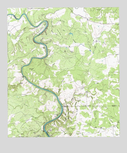
Gorman Falls, TX USGS Topographic Map
Click on map above to begin viewing in our Map Viewer.

This topographic map contains these locations and features:
Feature Name Type Latitude Longitude GNIS ID View Map
Beartrack CanyonValleyN31.1066°W98.4502°1351708View Map
Big SpringSpringN31.0432°W98.4113°1352142View Map
Big ThicketWoodsN31.1132°W98.4375°1352166View Map
Brahma CanyonValleyN31.1034°W98.4589°1352822View Map
Bull KnobSummitN31.0827°W98.4334°1353246View Map
Burnt Canyon SpringSpringN31.0069°W98.4540°1353367View Map
Buzzard MountainSummitN31.0024°W98.4306°1353450View Map
Cave PondLakeN31.0094°W98.4028°1354008View Map
Charley Springs MountainSummitN31.0952°W98.4370°1354324View Map
Cherokee CreekStreamN31.1179°W98.4953°1373067View Map
Coffin SpringSpringN31.0348°W98.4219°1354730View Map
Coffin Springs CanyonValleyN31.0380°W98.4264°1354731View Map
Colorado Bend State ParkParkN31.0396°W98.4839°2028521View Map
Colorado Bend State Park TrailTrailN31.0416°W98.4581°2032850View Map
Cracker NeckValleyN31.0034°W98.4362°1355298View Map
Devils HollowValleyN31.1063°W98.4697°1355969View Map
Eagle DrawValleyN31.0898°W98.4592°1356532View Map
Goodland RidgeRidgeN31.0124°W98.3814°1358155View Map
Gorman CreekStreamN31.0588°W98.4817°1358198View Map
Gorman FallsFallsN31.0582°W98.4823°1358200View Map
Gorman SpringSpringN31.0521°W98.4859°1358202View Map
Greenwood MountainSummitN31.0080°W98.4278°1358413View Map
High GateGapN31.0874°W98.4292°1359150View Map
Hog HollowValleyN31.0965°W98.4043°1359364View Map
Horsetooth GullyValleyN31.1002°W98.4309°1359682View Map
Hughes HollowValleyN31.0763°W98.4603°1359801View Map
Hurley HollowValleyN31.0396°W98.4452°1359847View Map
Indian PointCliffN31.1052°W98.4564°1359979View Map
Jackson RanchLocaleN31.0916°W98.4011°1360115View Map
Jennings CreekStreamN31.0002°W98.4628°1374282View Map
Lemons RidgeRidgeN31.0385°W98.4711°1361081View Map
Lemons Springs CampLocaleN31.0207°W98.4436°1361082View Map
Live Oak RidgeRidgeN31.0899°W98.4089°1361553View Map
Lynch CreekStreamN31.1121°W98.4586°1361997View Map
Lynch CreekStreamN31.1138°W98.4103°1361998View Map
McAnelly CreekStreamN31.1196°W98.4803°1362360View Map
McCrea BranchStreamN31.0313°W98.3992°1362403View Map
McCrea TankReservoirN31.0150°W98.3755°1362404View Map
Middle Fork Yancey CreekStreamN31.0432°W98.4111°1388229View Map
North Fork Yancey CreekStreamN31.0416°W98.4242°1364070View Map
Old Letdown PointSummitN31.0654°W98.4742°1364443View Map
Patterson RidgeRidgeN31.0202°W98.4353°1364881View Map
Patterson SpringsSpringN31.0085°W98.4086°1998651View Map
Post Oak CreekStreamN31.0057°W98.4589°1365652View Map
Post Oak DrawValleyN31.1176°W98.4577°1365657View Map
Post Oak FallsFallsN31.0056°W98.4593°1365658View Map
Post Oak RidgeRidgeN31.0207°W98.4278°1365663View Map
Post Oak SpringSpringN31.0047°W98.4687°1365667View Map
Quail RidgeRidgeN31.1013°W98.4164°1365883View Map
Rattlesnake BranchStreamN31.0313°W98.3992°1366030View Map
Red Rock CanyonValleyN31.0323°W98.4353°1366209View Map
Smith RanchLocaleN31.0513°W98.4006°1368501View Map
South Fork Yancy CreekStreamN31.0429°W98.4111°1368688View Map
Southwest Ledge QuarriesMineN31.1229°W98.3945°1368851View Map
Spicewood CreekStreamN31.0141°W98.4570°1368897View Map
Sullivan KnobSummitN31.0821°W98.4264°1369339View Map
Sulphur SpringSpringN31.0867°W98.4579°1369367View Map
Tie Slide CreekStreamN31.0693°W98.4806°1369926View Map
Upper End TankReservoirN31.0019°W98.3795°1370505View Map
Vann BranchStreamN31.0249°W98.4014°1370586View Map
Vann CampLocaleN31.0060°W98.4559°1370587View Map
Vann RanchLocaleN31.0082°W98.3973°1370588View Map
Windy CanyonValleyN31.0910°W98.4625°1371792View Map
Wolf HollowValleyN31.0166°W98.4481°1371856View Map
Yancey CreekStreamN31.0307°W98.4392°1372006View Map
Yates BranchStreamN31.0213°W98.4598°1372015View Map

Note: Coordinates in the location and feature list above are referenced to NAD83 datum.


Copyright (C) 2008-2024 Ryan Niemi / Sunset Dynamics ... All Rights Reserved