TopoQuest Logo
Do you find TopoQuest useful?
Help keep TopoQuest running and adding new maps/features by donating!
Bitcoin:  19c7KJd3qBynnjoSw5npx9KScwjBe4ifkT
Litecoin:  LXs6TkuXGGXo1vDsWCkWVdjQX94eUKd6ui
Home View Maps Find Maps Find Places Resources & Links


Goshen, Missouri Topographic Map

USGS Map Title: Goshen, MO
USGS Map MRC: 40093D6
DRG (GeoTIFF) Download: o40093d6.tif


Neighboring USGS Topographic Map Quads:


  Akron, MO  
40093E7
 

  Pleasanton, IA  
40093E6
 

  Lineville, IA  
40093E5
 

  Cainsville, MO  
40093D7
 

  Goshen, MO  
40093D6
 

  Princeton, MO  
40093D5
 

  Mount Moriah, MO  
40093C7
 

  Modena, MO  
40093C6
 

  Mill Grove, MO  
40093C5


Map MRC Location:

N41°
W94°
N41°
W93°
H8 H7 H6 H5 H4 H3 H2 H1
G8 G7 G6 G5 G4 G3 G2 G1
F8 F7 F6 F5 F4 F3 F2 F1
E8 E7 E6 E5 E4 E3 E2 E1
D8 D7 D6 D5 D4 D3 D2 D1
C8 C7 C6 C5 C4 C3 C2 C1
B8 B7 B6 B5 B4 B3 B2 B1
A8 A7 A6 A5 A4 A3 A2 A1
N40°
W94°
N40°
W93°

Goshen, MO USGS 1:24K Topographic Map Preview:
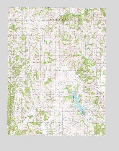
Goshen, MO USGS Topographic Map
Click on map above to begin viewing in our Map Viewer.

This topographic map contains these locations and features:
Feature Name Type Latitude Longitude GNIS ID View Map
Cain School (historical)SchoolN40.4022°W93.7452°715188View Map
Campbell LakeReservoirN40.4391°W93.7145°762463View Map
Campbell Lake DamDamN40.4383°W93.7136°762462View Map
GoshenPopulated PlaceN40.3828°W93.6797°740879View Map
Goshen CemeteryCemeteryN40.3806°W93.6969°1940204View Map
Goshen ChurchChurchN40.3806°W93.6972°718628View Map
Hamblin School (historical)SchoolN40.4025°W93.6691°735639View Map
Hanes ChurchChurchN40.4106°W93.7463°719056View Map
Lake PahoReservoirN40.4076°W93.6603°758322View Map
Lake Paho DamDamN40.3983°W93.6569°760365View Map
Lake Paho State Wildlife AreaParkN40.4106°W93.6611°743614View Map
Liberty ChurchChurchN40.4867°W93.7322°720979View Map
Moss School (historical)SchoolN40.4008°W93.6305°722678View Map
Oakland SchoolSchoolN40.4356°W93.7377°723678View Map
Pleasant Hill CemeteryCemeteryN40.4889°W93.6719°724520View Map
Pleasant Hill SchoolSchoolN40.4895°W93.6883°724554View Map
Pleasant Ridge ChurchChurchN40.4389°W93.6355°2702458View Map
Pleasant Ridge Church CemeteryCemeteryN40.4390°W93.6351°2702457View Map
Pleasant Ridge School (historical)SchoolN40.4381°W93.6355°724602View Map
Red Rock SchoolSchoolN40.4606°W93.7372°725163View Map
Rockhold SchoolSchoolN40.4045°W93.7044°725482View Map
Saint Paul ChurchChurchN40.4517°W93.6852°725872View Map
Scott Hill SchoolSchoolN40.4872°W93.6302°726150View Map
Township of HarrisonCivilN40.4193°W93.7080°767007View Map
Union School (historical)SchoolN40.4464°W93.6844°728043View Map
West White School (historical)SchoolN40.4872°W93.7180°728641View Map

Note: Coordinates in the location and feature list above are referenced to NAD83 datum.


Copyright (C) 2008-2025 Ryan Niemi / Sunset Dynamics ... All Rights Reserved