TopoQuest Logo
Do you find TopoQuest useful?
Help keep TopoQuest running and adding new maps/features by donating!
Bitcoin:  19c7KJd3qBynnjoSw5npx9KScwjBe4ifkT
Litecoin:  LXs6TkuXGGXo1vDsWCkWVdjQX94eUKd6ui
Home View Maps Find Maps Find Places Resources & Links


Princeton, Missouri Topographic Map

USGS Map Title: Princeton, MO
USGS Map MRC: 40093D5
DRG (GeoTIFF) Download: o40093d5.tif


Neighboring USGS Topographic Map Quads:


  Pleasanton, IA  
40093E6
 

  Lineville, IA  
40093E5
 

  Cleopatra, MO  
40093E4
 

  Goshen, MO  
40093D6
 

  Princeton, MO  
40093D5
 

  Ravanna, MO  
40093D4
 

  Modena, MO  
40093C6
 

  Mill Grove, MO  
40093C5
 

  Half Rock, MO  
40093C4


Map MRC Location:

N41°
W94°
N41°
W93°
H8 H7 H6 H5 H4 H3 H2 H1
G8 G7 G6 G5 G4 G3 G2 G1
F8 F7 F6 F5 F4 F3 F2 F1
E8 E7 E6 E5 E4 E3 E2 E1
D8 D7 D6 D5 D4 D3 D2 D1
C8 C7 C6 C5 C4 C3 C2 C1
B8 B7 B6 B5 B4 B3 B2 B1
A8 A7 A6 A5 A4 A3 A2 A1
N40°
W94°
N40°
W93°

Princeton, MO USGS 1:24K Topographic Map Preview:
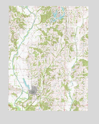
Princeton, MO USGS Topographic Map
Click on map above to begin viewing in our Map Viewer.

This topographic map contains these locations and features:
Feature Name Type Latitude Longitude GNIS ID View Map
Alvord (historical)Populated PlaceN40.4556°W93.5955°740212View Map
Ballast Pit LakeLakeN40.4086°W93.5991°713609View Map
Berndt LakeReservoirN40.4965°W93.5405°758375View Map
Berndt Lake DamDamN40.4950°W93.5402°760955View Map
Berndt Lake NE SE Section 25ReservoirN40.4933°W93.5504°762447View Map
Berndt Lake NE SE Section 25 DamDamN40.4917°W93.5502°762446View Map
Berndt Lake SW SW Section 30ReservoirN40.4896°W93.5443°762451View Map
Berndt Lake SW SW Section 30 DamDamN40.4883°W93.5452°762450View Map
Big BranchStreamN40.4195°W93.6155°714144View Map
City of PrincetonCivilN40.3966°W93.5885°2396281View Map
Collins CemeteryCemeteryN40.4069°W93.5088°716130View Map
Early School (historical)SchoolN40.4950°W93.5180°717245View Map
East Fork ChurchChurchN40.4517°W93.5547°717279View Map
East White School (historical)SchoolN40.4950°W93.5769°717353View Map
Fairly School (historical)SchoolN40.4511°W93.5541°734012View Map
Fairview CemeteryCemeteryN40.4769°W93.6228°2702451View Map
Fairview ChurchChurchN40.4767°W93.6222°717795View Map
Greenwood School (historical)SchoolN40.4225°W93.5147°718852View Map
Hidden Valley LakeReservoirN40.4827°W93.5536°737986View Map
Hidden Valley Lake DamDamN40.4800°W93.5552°761285View Map
Kelly Enterprises LakeReservoirN40.4846°W93.5568°761728View Map
Kelly Enterprises Lake DamDamN40.4833°W93.5569°761727View Map
Lake MarieReservoirN40.4894°W93.5528°758377View Map
Lake Marie DamDamN40.4867°W93.5519°760438View Map
Little RiverStreamN40.4972°W93.5955°721306View Map
Lower Girdner School (historical)SchoolN40.4245°W93.5505°721640View Map
Meisel LakeReservoirN40.3782°W93.5759°762459View Map
Meisel Lake DamDamN40.3783°W93.5769°762458View Map
Mercer CemeteryCemeteryN40.4989°W93.5324°722236View Map
Mercer CountyCivilN40.4223°W93.5686°758519View Map
Mercer County Fire Protection DistrictBuildingN40.3985°W93.5892°2621424View Map
Mercer County Home (historical)BuildingN40.4250°W93.6080°743264View Map
Mercer County Sheriff's OfficeBuildingN40.3968°W93.5856°2752372View Map
Mercer LakeReservoirN40.4875°W93.5836°735978View Map
Pops BranchStreamN40.4772°W93.5863°724756View Map
PrincetonPopulated PlaceN40.4008°W93.5805°724937View Map
Princeton CemeteryCemeteryN40.4075°W93.5794°2702460View Map
Princeton Elementary SchoolSchoolN40.3940°W93.5828°2545190View Map
Princeton Junior Senior High SchoolSchoolN40.3927°W93.5838°2545189View Map
Princeton Post OfficePost OfficeN40.3962°W93.5861°2783194View Map
Princeton-Kauffman Memorial Airport (historical)AirportN40.4183°W93.5990°758879View Map
Shook School (historical)SchoolN40.4158°W93.5013°735853View Map
Spencer School (historical)SchoolN40.3967°W93.5138°726854View Map
Township of MorganCivilN40.4200°W93.5849°767012View Map
Twin LakeReservoirN40.4869°W93.5424°758376View Map
Twin Lake DamDamN40.4850°W93.5469°760960View Map
Underwood CemeteryCemeteryN40.4500°W93.5355°727956View Map
Upper Tennessee SchoolSchoolN40.4600°W93.6213°728079View Map
Wayman Lakes (historical)LakeN40.4347°W93.6091°736363View Map
Wayman SchoolSchoolN40.4450°W93.5936°728434View Map
Wildcat CreekStreamN40.3767°W93.6083°728832View Map

Note: Coordinates in the location and feature list above are referenced to NAD83 datum.


Copyright (C) 2008-2025 Ryan Niemi / Sunset Dynamics ... All Rights Reserved