TopoQuest Logo
Do you find TopoQuest useful?
Help keep TopoQuest running and adding new maps/features by donating!
Bitcoin:  19c7KJd3qBynnjoSw5npx9KScwjBe4ifkT
Litecoin:  LXs6TkuXGGXo1vDsWCkWVdjQX94eUKd6ui
Home View Maps Find Maps Find Places Resources & Links


Granite Chief, California Topographic Map

USGS Map Title: Granite Chief, CA
USGS Map MRC: 39120B3
DRG (GeoTIFF) Download: o39120b3.tif


Neighboring USGS Topographic Map Quads:


  Soda Springs, CA  
39120C4
 

  Norden, CA  
39120C3
 

  Truckee, CA  
39120C2
 

  Royal Gorge, CA  
39120B4
 

  Granite Chief, CA  
39120B3
 

  Tahoe City, CA  
39120B2
 

  Bunker Hill, CA  
39120A4
 

  Wentworth Springs, CA  
39120A3
 

  Homewood, CA  
39120A2


Map MRC Location:

N40°
W121°
N40°
W120°
H8 H7 H6 H5 H4 H3 H2 H1
G8 G7 G6 G5 G4 G3 G2 G1
F8 F7 F6 F5 F4 F3 F2 F1
E8 E7 E6 E5 E4 E3 E2 E1
D8 D7 D6 D5 D4 D3 D2 D1
C8 C7 C6 C5 C4 C3 C2 C1
B8 B7 B6 B5 B4 B3 B2 B1
A8 A7 A6 A5 A4 A3 A2 A1
N39°
W121°
N39°
W120°

Granite Chief, CA USGS 1:24K Topographic Map Preview:
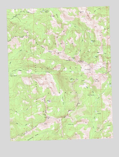
Granite Chief, CA USGS Topographic Map
Click on map above to begin viewing in our Map Viewer.

This topographic map contains these locations and features:
Feature Name Type Latitude Longitude GNIS ID View Map
Big SpringSpringN39.1493°W120.2697°257012View Map
Big Spring TrailTrailN39.1477°W120.2696°275151View Map
Billys PeakSummitN39.2374°W120.2741°277259View Map
Chief CreekStreamN39.2260°W120.2835°258272View Map
Five LakesLakeN39.1757°W120.2502°223566View Map
Five Lakes Creek TrailTrailN39.1435°W120.2763°1655217View Map
Granite ChiefSummitN39.1982°W120.2869°260740View Map
Granite Chief TrailTrailN39.2099°W120.2616°1655218View Map
Granite Chief WildernessReserveN39.1364°W120.2959°1655282View Map
Grouse CanyonValleyN39.1319°W120.2744°260939View Map
Heavens GateGapN39.1494°W120.3313°261217View Map
Johnson MonumentLocaleN39.1407°W120.3346°261984View Map
Little Needle LakeLakeN39.1810°W120.2993°262677View Map
Lyon PeakSummitN39.2069°W120.3155°263084View Map
Mildred LakesLakeN39.1613°W120.3288°263565View Map
Mildred RidgeRidgeN39.1577°W120.3316°263566View Map
Mount MildredSummitN39.1460°W120.3299°263568View Map
Mountain Meadow LakeLakeN39.2170°W120.2741°263903View Map
Needle LakeLakeN39.2009°W120.2975°264019View Map
Needle PeakSummitN39.2007°W120.3008°264020View Map
Painted RockSummitN39.2421°W120.3205°264451View Map
Painted Rock TrailTrailN39.2352°W120.3010°1655230View Map
Picayune ValleyBasinN39.1624°W120.3119°264695View Map
Shanks CoveBasinN39.1402°W120.3013°266041View Map
Shanks Cove TrailTrailN39.1402°W120.3044°275150View Map
Shirley LakeLakeN39.2021°W120.2699°266125View Map
Soda SpringsSpringN39.2474°W120.3263°267374View Map
Soda SpringsPopulated PlaceN39.2471°W120.3252°1701188View Map
Squaw PeakSummitN39.1807°W120.2696°267636View Map
Squaw Valley Ski AreaLocaleN39.1913°W120.2519°1662379View Map
Talbot CampgroundLocaleN39.1871°W120.3738°268067View Map
Talbot CreekStreamN39.1874°W120.3730°268068View Map
Tinker KnobSummitN39.2449°W120.2846°268295View Map
Watson Monument Emigrant Pass MarkerLocaleN39.1902°W120.2769°268814View Map
Whisky CreekStreamN39.1613°W120.2699°268970View Map
Whisky Creek CampLocaleN39.1660°W120.2721°268976View Map

Note: Coordinates in the location and feature list above are referenced to NAD83 datum.


Copyright (C) 2008-2024 Ryan Niemi / Sunset Dynamics ... All Rights Reserved