TopoQuest Logo
Do you find TopoQuest useful?
Help keep TopoQuest running and adding new maps/features by donating!
Bitcoin:  19c7KJd3qBynnjoSw5npx9KScwjBe4ifkT
Litecoin:  LXs6TkuXGGXo1vDsWCkWVdjQX94eUKd6ui
Home View Maps Find Maps Find Places Resources & Links


Soda Springs, California Topographic Map

USGS Map Title: Soda Springs, CA
USGS Map MRC: 39120C4
DRG (GeoTIFF) Download: o39120c4.tif


Neighboring USGS Topographic Map Quads:


  English Mountain, CA  
39120D5
 

  Webber Peak, CA  
39120D4
 

  Independence Lake, CA  
39120D3
 

  Cisco Grove, CA  
39120C5
 

  Soda Springs, CA  
39120C4
 

  Norden, CA  
39120C3
 

  Duncan Peak, CA  
39120B5
 

  Royal Gorge, CA  
39120B4
 

  Granite Chief, CA  
39120B3


Map MRC Location:

N40°
W121°
N40°
W120°
H8 H7 H6 H5 H4 H3 H2 H1
G8 G7 G6 G5 G4 G3 G2 G1
F8 F7 F6 F5 F4 F3 F2 F1
E8 E7 E6 E5 E4 E3 E2 E1
D8 D7 D6 D5 D4 D3 D2 D1
C8 C7 C6 C5 C4 C3 C2 C1
B8 B7 B6 B5 B4 B3 B2 B1
A8 A7 A6 A5 A4 A3 A2 A1
N39°
W121°
N39°
W120°

Soda Springs, CA USGS 1:24K Topographic Map Preview:
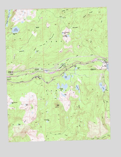
Soda Springs, CA USGS Topographic Map
Click on map above to begin viewing in our Map Viewer.

This topographic map contains these locations and features:
Feature Name Type Latitude Longitude GNIS ID View Map
Buttes Area CampLocaleN39.3518°W120.4919°220307View Map
Buzzard RoostSummitN39.3713°W120.4285°220325View Map
Camp PahatsiLocaleN39.3191°W120.4163°220478View Map
Cascade LakesReservoirN39.2953°W120.4334°220666View Map
Catfish LakeLakeN39.3343°W120.4644°220723View Map
Cold Springs CampgroundLocaleN39.3177°W120.4635°221344View Map
Derry LakeLakeN39.3660°W120.4563°276077View Map
Devils PeakSummitN39.2818°W120.4399°222321View Map
Donner SummitLocaleN39.3266°W120.3930°276078View Map
Donner Trail Elementary SchoolSchoolN39.3163°W120.4555°222510View Map
Dulzura LakeLakeN39.2977°W120.3830°1701092View Map
Fisher LakeLakeN39.2846°W120.4794°223544View Map
Glacier Lakes TrailTrailN39.3613°W120.4824°276075View Map
Glacier Trails Boy Scouts of America CampLocaleN39.3507°W120.4944°276080View Map
Hampshire Rocks CampgroundLocaleN39.3105°W120.4977°224864View Map
Heath Falls Overlook TrailTrailN39.2549°W120.4085°276132View Map
High Loch Leven LakeLakeN39.2863°W120.4970°225268View Map
Hole-In-GroundLakeN39.3559°W120.4192°225444View Map
Huntley Mill LakeLakeN39.2683°W120.4526°225801View Map
Ice LakesLakeN39.2957°W120.3846°254806View Map
Ice Lakes 1324 DamDamN39.2949°W120.3827°1664301View Map
Jerry LakeLakeN39.3660°W120.4565°226213View Map
Jones ValleyValleyN39.3396°W120.4655°226344View Map
Kidd LakeReservoirN39.3098°W120.4278°226570View Map
Kidd Lake 97-025 DamDamN39.3110°W120.4321°1663602View Map
Kidd Lake CampgrondLocaleN39.3124°W120.4216°276133View Map
Kilborn LakeLakeN39.3177°W120.4157°226572View Map
KingvalePopulated PlaceN39.3210°W120.4288°226616View Map
Kingvale Census Designated PlaceCensusN39.3203°W120.4387°2628744View Map
Lake SterlingReservoirN39.3556°W120.4885°235451View Map
Lake Sterling 97-030 DamDamN39.3571°W120.4928°1663607View Map
Lily PondLakeN39.3658°W120.4312°227100View Map
Lola Montez TrailTrailN39.3407°W120.4074°276079View Map
Long LakeLakeN39.2927°W120.4324°227579View Map
Long ValleyValleyN39.2535°W120.4177°227611View Map
Long Valley TrailTrailN39.2563°W120.4394°276135View Map
Lower Castle CreekStreamN39.3341°W120.4019°227762View Map
Lower Lola Montez LakeLakeN39.3487°W120.4243°227777View Map
Lower Peak Lake 97-037 DamDamN39.3037°W120.4393°1663614View Map
Magonigal CampLocaleN39.3743°W120.4497°227944View Map
Magonigal SummitGapN39.3571°W120.4610°1659036View Map
Mossy Pond East TrailTrailN39.3693°W120.4727°1655224View Map
Mossy Pond West TrailTrailN39.3716°W120.4805°276070View Map
Mount MarliaveSummitN39.3482°W120.4016°1655067View Map
Nancy LakeLakeN39.2892°W120.4624°229410View Map
Natalie LakeLakeN39.2770°W120.4707°1662481View Map
Palisade LakeLakeN39.2988°W120.4144°230254View Map
Palisades Creek TrailTrailN39.2663°W120.4266°1655215View Map
Sand RidgeRidgeN39.3682°W120.3988°232508View Map
Serena CreekStreamN39.2546°W120.3799°232813View Map
Serena LakeLakeN39.3013°W120.3863°1701094View Map
Soda SpringsPopulated PlaceN39.3232°W120.3799°234848View Map
Soda Springs Census Designated PlaceCensusN39.3248°W120.3787°2628790View Map
Soda Springs Post OfficePost OfficeN39.3242°W120.3839°1682973View Map
Soda Springs Ski AreaLocaleN39.3191°W120.3835°1662480View Map
Spruce (historical)Populated PlaceN39.3157°W120.4285°1701095View Map
Sterling Lake CampgroundLocaleN39.3532°W120.4941°1670056View Map
Tamarack (historical)Populated PlaceN39.3060°W120.4922°1701098View Map
Tamarack (historical)LocaleN39.3047°W120.4925°2787854View Map
Tamarack SubstationLocaleN39.3141°W120.4966°1654479View Map
TroyPopulated PlaceN39.3116°W120.4630°1660034View Map
Truckee Fire Protection District Station 97BuildingN39.3266°W120.3926°2622309View Map
Truckee Fire Protection District Station 98 Serene LakesBuildingN39.3078°W120.3869°2622205View Map
Upper Jones ValleyValleyN39.3424°W120.4494°236894View Map
Upper Lola Montez LakeLakeN39.3508°W120.4311°236898View Map
Upper Peak Lake 97-047 DamDamN39.2999°W120.4344°1663623View Map
Van Norden CampgroundLocaleN39.3213°W120.3774°1682987View Map
Warm LakeLakeN39.2660°W120.4890°237240View Map
Webster FlatFlatN39.3316°W120.4908°237386View Map

Note: Coordinates in the location and feature list above are referenced to NAD83 datum.


Copyright (C) 2008-2024 Ryan Niemi / Sunset Dynamics ... All Rights Reserved