TopoQuest Logo
Do you find TopoQuest useful?
Help keep TopoQuest running and adding new maps/features by donating!
Bitcoin:  19c7KJd3qBynnjoSw5npx9KScwjBe4ifkT
Litecoin:  LXs6TkuXGGXo1vDsWCkWVdjQX94eUKd6ui
Home View Maps Find Maps Find Places Resources & Links


Granville, Ohio Topographic Map

USGS Map Title: Granville, OH
USGS Map MRC: 40082A5
DRG (GeoTIFF) Download: o40082a5.tif


Neighboring USGS Topographic Map Quads:


  Johnstown, OH  
40082B6
 

  Fredonia, OH  
40082B5
 

  Utica, OH  
40082B4
 

  Jersey, OH  
40082A6
 

  Granville, OH  
40082A5
 

  Newark, OH  
40082A4
 

  Pataskala, OH  
39082H6
 

  Millersport, OH  
39082H5
 

  Thornville, OH  
39082H4


Map MRC Location:

N41°
W83°
N41°
W82°
H8 H7 H6 H5 H4 H3 H2 H1
G8 G7 G6 G5 G4 G3 G2 G1
F8 F7 F6 F5 F4 F3 F2 F1
E8 E7 E6 E5 E4 E3 E2 E1
D8 D7 D6 D5 D4 D3 D2 D1
C8 C7 C6 C5 C4 C3 C2 C1
B8 B7 B6 B5 B4 B3 B2 B1
A8 A7 A6 A5 A4 A3 A2 A1
N40°
W83°
N40°
W82°

Granville, OH USGS 1:24K Topographic Map Preview:
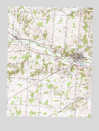
Granville, OH USGS Topographic Map
Click on map above to begin viewing in our Map Viewer.

This topographic map contains these locations and features:
Feature Name Type Latitude Longitude GNIS ID View Map
Ace Morgan TheatreBuildingN40.0690°W82.5224°1955128View Map
AlexandriaPopulated PlaceN40.0890°W82.6124°1064308View Map
Alexandria Baptist ChurchChurchN40.0906°W82.6135°1071318View Map
Alexandria Police DepartmentBuildingN40.0878°W82.6093°2732521View Map
Alexandria Post OfficePost OfficeN40.0895°W82.6127°2026049View Map
Alexandria United Methodist ChurchChurchN40.0903°W82.6141°1071319View Map
Alumni Memorial Field HouseBuildingN40.0728°W82.5207°1955130View Map
Barney-Davis HallBuildingN40.0703°W82.5249°1955131View Map
Beaver HallBuildingN40.0715°W82.5185°1955132View Map
Blair Knapp HallBuildingN40.0712°W82.5232°1955133View Map
Brushy ForkStreamN40.1167°W82.5388°1038433View Map
Burke HallBuildingN40.0690°W82.5232°1955134View Map
Burton HallBuildingN40.0692°W82.5246°1955135View Map
Cat RunStreamN40.1228°W82.5196°1065953View Map
Clemons (historical)SchoolN40.0778°W82.5596°1052245View Map
Cleveland HallBuildingN40.0695°W82.5232°1955136View Map
College Hill CemeteryCemeteryN40.0726°W82.5273°1954803View Map
Crawford HallBuildingN40.0720°W82.5177°1955137View Map
Curtis HallBuildingN40.0720°W82.5265°1955138View Map
Deed School (historical)SchoolN40.0112°W82.5535°1052246View Map
Deeds FieldParkN40.0728°W82.5227°1955165View Map
Denison UniversitySchoolN40.0706°W82.5227°1061362View Map
Devils Den CemeteryCemeteryN40.0101°W82.5454°1954790View Map
Doane Administration BuildingBuildingN40.0703°W82.5235°1955139View Map
Doane Dance BuildingBuildingN40.0692°W82.5238°1955140View Map
East HallBuildingN40.0709°W82.5182°1955141View Map
Ebaugh LaboratoriesBuildingN40.0712°W82.5260°1955142View Map
Fellows HallBuildingN40.0706°W82.5246°1955143View Map
Flowerpot HillSummitN40.0581°W82.5254°1061364View Map
Gaffield CemeteryCemeteryN40.0609°W82.5935°1061366View Map
Gaffield Meeting House (historical)ChurchN40.0617°W82.5935°1052148View Map
Gilpatrick Honors CenterBuildingN40.0709°W82.5204°1955144View Map
Goddard CornersPopulated PlaceN40.0601°W82.6116°1061367View Map
Graffield School (historical)SchoolN40.0615°W82.5935°1082422View Map
GranvillePopulated PlaceN40.0681°W82.5196°1061369View Map
Granville Elementary SchoolSchoolN40.0703°W82.5138°1052240View Map
Granville Female College (historical)SchoolN40.0681°W82.5160°1052241View Map
Granville High SchoolSchoolN40.0787°W82.5257°1052239View Map
Granville Historic DistrictParkN40.0678°W82.5202°1069172View Map
Granville OrchardLocaleN40.0469°W82.5278°2515701View Map
Granville Police DepartmentBuildingN40.0676°W82.5187°2732970View Map
Granville Post OfficePost OfficeN40.0681°W82.5193°2026084View Map
Granville South Census Designated PlaceCensusN40.0521°W82.5415°2393024View Map
Granville Township Fire DepartmentBuildingN40.0687°W82.5186°2549882View Map
Griffin RunStreamN40.1165°W82.5377°1064770View Map
Harrison ChurchChurchN40.0440°W82.6157°1070773View Map
Herrick HallBuildingN40.0715°W82.5252°1955145View Map
Higley HallBuildingN40.0712°W82.5249°1955150View Map
Howe School (historical)SchoolN40.0478°W82.5232°1052243View Map
Huffman HallBuildingN40.0706°W82.5190°1955151View Map
King HallBuildingN40.0690°W82.5249°1955152View Map
Lake HudsonLakeN40.0601°W82.5149°1056346View Map
Lewis School (historical)SchoolN40.0440°W82.6135°1052149View Map
Licking County HomeBuildingN40.0265°W82.5229°1052244View Map
Lobdell CreekStreamN40.0845°W82.5918°1066080View Map
Maple Grove CemeteryCemeteryN40.0640°W82.5121°1061377View Map
McLains BridgeBridgeN40.0848°W82.6046°1071331View Map
Mitchell Recreation and Athletics CenterBuildingN40.0728°W82.5199°1955153View Map
Moots RunStreamN40.0837°W82.5921°1061380View Map
Northridge Alexandria Elementary SchoolSchoolN40.0915°W82.6129°1052147View Map
Ohio State Highway Patrol - Granville Patrol PostBuildingN40.0336°W82.5933°2733117View Map
Old Colony CemeteryCemeteryN40.0653°W82.5199°1954797View Map
Parnassus HillSummitN40.0665°W82.5132°1061385View Map
Piper StadiumLocaleN40.0728°W82.5229°1955166View Map
Postelwaite Lake DamDamN40.0467°W82.6216°1079262View Map
Saint Albans Church (historical)ChurchN40.1128°W82.5877°1052146View Map
Saint Albans Township Fire DepartmentBuildingN40.0883°W82.6118°2549893View Map
Salt RunStreamN40.0634°W82.5254°1061391View Map
Sawyer HallBuildingN40.0717°W82.5182°1955154View Map
Scott CornersPopulated PlaceN40.0745°W82.6054°1065295View Map
Seeley G Mudd Learning CenterBuildingN40.0706°W82.5257°1955155View Map
Shaw HallBuildingN40.0712°W82.5188°1955156View Map
Shepardson HallBuildingN40.0715°W82.5177°1955157View Map
Shorney HallBuildingN40.0717°W82.5274°1955158View Map
Simpson RunStreamN40.0856°W82.6168°1061393View Map
Slayter Hall Student UnionBuildingN40.0712°W82.5238°1955159View Map
Smith HallBuildingN40.0720°W82.5277°1955160View Map
Stone HallBuildingN40.0687°W82.5249°1955161View Map
Sugarloaf HillSummitN40.0673°W82.5257°1061395View Map
Swasey ChapelChurchN40.0712°W82.5218°1955164View Map
Township of GranvilleCivilN40.0772°W82.5238°1086459View Map
Township of Saint AlbansCivilN40.0817°W82.6185°1086478View Map
Union SchoolSchoolN40.0212°W82.5224°1061399View Map
Union StationPopulated PlaceN40.0215°W82.5127°1065406View Map
Union Station Community ChurchChurchN40.0217°W82.5140°1063844View Map
Union Station Post Office (historical)Post OfficeN40.0209°W82.5124°2026276View Map
Village of AlexandriaCivilN40.0900°W82.6120°2397927View Map
Village of GranvilleCivilN40.0701°W82.5219°2398193View Map
WDUB-FM (Granville)TowerN40.0712°W82.5232°1083835View Map
Welsh Hills CemeteryCemeteryN40.0798°W82.5024°1061400View Map
Whisler HallBuildingN40.0698°W82.5196°1955162View Map
William Howard Doane LibraryBuildingN40.0709°W82.5257°1955163View Map
Young Ladies Institute (historical)SchoolN40.0690°W82.5238°1052242View Map

Note: Coordinates in the location and feature list above are referenced to NAD83 datum.


Copyright (C) 2008-2024 Ryan Niemi / Sunset Dynamics ... All Rights Reserved