TopoQuest Logo
Do you find TopoQuest useful?
Help keep TopoQuest running and adding new maps/features by donating!
Bitcoin:  19c7KJd3qBynnjoSw5npx9KScwjBe4ifkT
Litecoin:  LXs6TkuXGGXo1vDsWCkWVdjQX94eUKd6ui
Home View Maps Find Maps Find Places Resources & Links


Johnstown, Ohio Topographic Map

USGS Map Title: Johnstown, OH
USGS Map MRC: 40082B6
DRG (GeoTIFF) Download: o40082b6.tif


Neighboring USGS Topographic Map Quads:


  Olive Green, OH  
40082C7
 

  Centerburg, OH  
40082C6
 

  Homer, OH  
40082C5
 

  Sunbury, OH  
40082B7
 

  Johnstown, OH  
40082B6
 

  Fredonia, OH  
40082B5
 

  New Albany, OH  
40082A7
 

  Jersey, OH  
40082A6
 

  Granville, OH  
40082A5


Map MRC Location:

N41°
W83°
N41°
W82°
H8 H7 H6 H5 H4 H3 H2 H1
G8 G7 G6 G5 G4 G3 G2 G1
F8 F7 F6 F5 F4 F3 F2 F1
E8 E7 E6 E5 E4 E3 E2 E1
D8 D7 D6 D5 D4 D3 D2 D1
C8 C7 C6 C5 C4 C3 C2 C1
B8 B7 B6 B5 B4 B3 B2 B1
A8 A7 A6 A5 A4 A3 A2 A1
N40°
W83°
N40°
W82°

Johnstown, OH USGS 1:24K Topographic Map Preview:
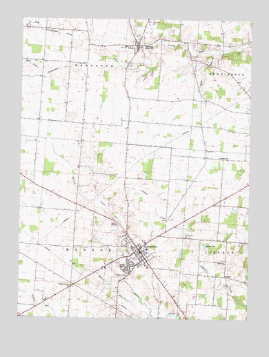
Johnstown, OH USGS Topographic Map
Click on map above to begin viewing in our Map Viewer.

This topographic map contains these locations and features:
Feature Name Type Latitude Longitude GNIS ID View Map
Beaver LakeLakeN40.1556°W82.6486°1037760View Map
Belle Hall BridgeBridgeN40.2356°W82.6407°1052215View Map
Bluejay School (historical)SchoolN40.1790°W82.6685°1052222View Map
Bosveld Library On Applied PoetryBuildingN40.1548°W82.6852°1807300View Map
Bowl RunStreamN40.2370°W82.6474°1038224View Map
Bowl Run School (historical)SchoolN40.2056°W82.6471°1052216View Map
Braeburn HeliportAirportN40.1365°W82.6946°1082232View Map
Buttercrest Jersey FarmLocaleN40.2208°W82.7258°2651875View Map
Channel CemeteryCemeteryN40.1576°W82.6346°1954710View Map
Clark School (historical)SchoolN40.1556°W82.7391°1052233View Map
ConcordPopulated PlaceN40.1431°W82.6379°1048624View Map
Concord CemeteryCemeteryN40.1481°W82.6382°1954711View Map
Concord ChurchChurchN40.1487°W82.6374°1039295View Map
Conway School (historical)SchoolN40.1337°W82.6960°1052227View Map
Cramer Dairy FarmLocaleN40.2325°W82.7322°2634669View Map
CrotonPopulated PlaceN40.2387°W82.6924°1085655View Map
Croton Post OfficePost OfficeN40.2386°W82.6869°1082157View Map
Croton United Methodist ChurchChurchN40.2401°W82.6874°1071322View Map
Dutch Cross School (historical)SchoolN40.2401°W82.6407°1052214View Map
Foster School (historical)SchoolN40.1315°W82.6482°1052218View Map
Gould CemeteryCemeteryN40.2368°W82.7139°1954714View Map
Green (historical)Populated PlaceN40.1809°W82.7424°1069012View Map
Green Hill CemeteryCemeteryN40.1645°W82.6979°1041102View Map
Green Post Office (historical)Post OfficeN40.1806°W82.7430°2026073View Map
Harmony ChurchChurchN40.1926°W82.6413°1041342View Map
Hartford CemeteryCemeteryN40.2402°W82.6831°1954715View Map
Hartford Volunteer Fire DepartmentBuildingN40.2356°W82.6883°2549887View Map
Hill School (historical)SchoolN40.1806°W82.7424°1052231View Map
JohnstownPopulated PlaceN40.1537°W82.6852°1048875View Map
Johnstown CemeteryCemeteryN40.1523°W82.6899°1954726View Map
Johnstown Police DepartmentBuildingN40.1442°W82.6768°2732907View Map
Johnstown Post OfficePost OfficeN40.1542°W82.6846°2026089View Map
Johnstown-Monroe High SchoolSchoolN40.1465°W82.6799°1052225View Map
Kiber RunStreamN40.1323°W82.6832°1042251View Map
Lake CemeteryCemeteryN40.1956°W82.6486°1042373View Map
Mc Knight AirportAirportN40.1925°W82.6547°1082761View Map
Miller ChurchChurchN40.1320°W82.7357°1043365View Map
Miller School (historical)SchoolN40.1323°W82.7346°1052234View Map
Monroe Township Fire DepartmentBuildingN40.1531°W82.6854°2549890View Map
Morris Woods State Nature PreserveParkN40.1673°W82.6341°1955119View Map
Northridge Hartford Elementary SchoolSchoolN40.2387°W82.6932°1052219View Map
Ogilvie School (historical)SchoolN40.2065°W82.7243°1052229View Map
Ohio Poetry Therapy CenterBuildingN40.1548°W82.6852°1807301View Map
Oregon Elementary SchoolSchoolN40.1548°W82.6885°1052224View Map
P E Grubb LakeReservoirN40.2273°W82.6790°1079202View Map
P E Grubb Lake DamDamN40.2284°W82.6782°1079201View Map
Patterson CemeteryCemeteryN40.2323°W82.7430°1954723View Map
Perfect School (historical)SchoolN40.2123°W82.6904°1052220View Map
Rice School (historical)SchoolN40.1820°W82.6402°1052217View Map
Searfoss Elementary SchoolSchoolN40.1473°W82.6810°1052226View Map
Sinkey School (historical)SchoolN40.2323°W82.7241°1052228View Map
Taylor School (historical)SchoolN40.1840°W82.6921°1052221View Map
Township of HartfordCivilN40.2367°W82.7043°1086462View Map
Township of MonroeCivilN40.1612°W82.7099°1086472View Map
Tuller CemeteryCemeteryN40.1379°W82.7215°1954724View Map
Twelve CornersLocaleN40.1392°W82.7193°1047240View Map
Village of HartfordCivilN40.2396°W82.6884°1085658View Map
Village of HartfordCivilN40.2402°W82.6880°2398257View Map
Village of JohnstownCivilN40.1499°W82.6881°2398307View Map
Warner School (historical)SchoolN40.2434°W82.6638°1052213View Map
Wesley Chapel (historical)ChurchN40.2048°W82.7166°1052230View Map
White School (historical)SchoolN40.1728°W82.7191°1052232View Map
Willis C Adams Middle SchoolSchoolN40.1545°W82.6882°1052223View Map
Willison CornersLocaleN40.2073°W82.7399°1061830View Map
WXLE-FM (Johnstown)TowerN40.2290°W82.6588°1083843View Map

Note: Coordinates in the location and feature list above are referenced to NAD83 datum.


Copyright (C) 2008-2024 Ryan Niemi / Sunset Dynamics ... All Rights Reserved