TopoQuest Logo
Do you find TopoQuest useful?
Help keep TopoQuest running and adding new maps/features by donating!
Bitcoin:  19c7KJd3qBynnjoSw5npx9KScwjBe4ifkT
Litecoin:  LXs6TkuXGGXo1vDsWCkWVdjQX94eUKd6ui
Home View Maps Find Maps Find Places Resources & Links


Grass Valley, Oregon Topographic Map

USGS Map Title: Grass Valley, OR
USGS Map MRC: 45120C7
DRG (GeoTIFF) Download: o45120c7.tif


Neighboring USGS Topographic Map Quads:


  Summit Ridge, OR  
45120D8
 

  Erskine, OR  
45120D7
 

  Moro, OR  
45120D6
 

  Sinamox, OR  
45120C8
 

  Grass Valley, OR  
45120C7
 

  Rosebush, OR  
45120C6
 

  Dead Dog Canyon, OR  
45120B8
 

  Bronx Canyon, OR  
45120B7
 

  Kent, OR  
45120B6


Map MRC Location:

N46°
W121°
N46°
W120°
H8 H7 H6 H5 H4 H3 H2 H1
G8 G7 G6 G5 G4 G3 G2 G1
F8 F7 F6 F5 F4 F3 F2 F1
E8 E7 E6 E5 E4 E3 E2 E1
D8 D7 D6 D5 D4 D3 D2 D1
C8 C7 C6 C5 C4 C3 C2 C1
B8 B7 B6 B5 B4 B3 B2 B1
A8 A7 A6 A5 A4 A3 A2 A1
N45°
W121°
N45°
W120°

Grass Valley, OR USGS 1:24K Topographic Map Preview:
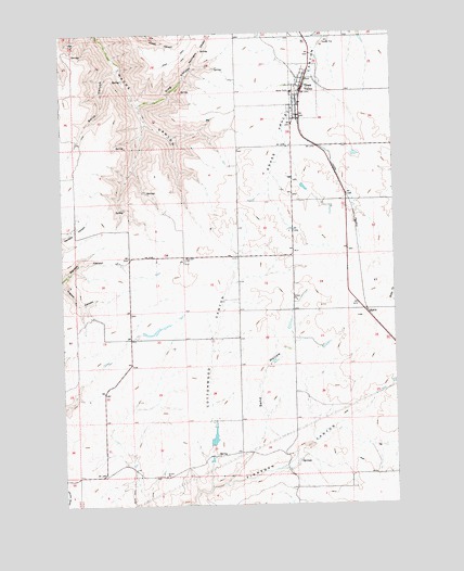
Grass Valley, OR USGS Topographic Map
Click on map above to begin viewing in our Map Viewer.

This topographic map contains these locations and features:
Feature Name Type Latitude Longitude GNIS ID View Map
Buether DamDamN45.2648°W120.8212°1133471View Map
Buether ReservoirReservoirN45.2671°W120.8199°1129588View Map
City of Grass ValleyCivilN45.3590°W120.7841°2410652View Map
Cooks CornerLocaleN45.3448°W120.7892°1638475View Map
Cottonwood CanyonValleyN45.2551°W120.8212°1119314View Map
Coxs CornerLocaleN45.3304°W120.7892°1638476View Map
Draw CreekStreamN45.3065°W120.7512°1120078View Map
EakinLocaleN45.3004°W120.7612°1136238View Map
Finnegans CornerLocaleN45.2546°W120.7892°1638479View Map
Grass ValleyPopulated PlaceN45.3601°W120.7856°1121305View Map
Grass Valley City HallBuildingN45.3598°W120.7853°2699403View Map
Grass Valley City ParkParkN45.3626°W120.7834°2058231View Map
Grass Valley Post OfficePost OfficeN45.3608°W120.7846°1165341View Map
Grass Valley Public Works DepartmentBuildingN45.3598°W120.7853°2699404View Map
Hodges CornerLocaleN45.2579°W120.8614°1638470View Map
Holmes CanyonValleyN45.2504°W120.8270°1121927View Map
King CanyonValleyN45.3565°W120.8481°1122740View Map
Michigan (historical)LocaleN45.2946°W120.8484°1130342View Map
Michigan CemeteryCemeteryN45.3146°W120.8298°1124082View Map
Remington CanyonValleyN45.3657°W120.8281°1125942View Map
Rickmans CornerLocaleN45.3160°W120.8095°1638477View Map
Sand HollowValleyN45.2562°W120.8156°1126560View Map
Schillings CornerLocaleN45.3160°W120.8512°1638478View Map
Smith CanyonValleyN45.3654°W120.8545°1127103View Map
South Sherman Elementary SchoolSchoolN45.3624°W120.7813°1161816View Map
South Sherman Fire Protection District Station 1BuildingN45.3598°W120.7853°2577147View Map

Note: Coordinates in the location and feature list above are referenced to NAD83 datum.


Copyright (C) 2008-2025 Ryan Niemi / Sunset Dynamics ... All Rights Reserved