TopoQuest Logo
Do you find TopoQuest useful?
Help keep TopoQuest running and adding new maps/features by donating!
Bitcoin:  19c7KJd3qBynnjoSw5npx9KScwjBe4ifkT
Litecoin:  LXs6TkuXGGXo1vDsWCkWVdjQX94eUKd6ui
Home View Maps Find Maps Find Places Resources & Links


Grave Point, Idaho Topographic Map

USGS Map Title: Grave Point, ID
USGS Map MRC: 45116F4
DRG (GeoTIFF) Download: o45116f4.tif


Neighboring USGS Topographic Map Quads:


  Wolf Creek, ID  
45116G5
 

  Joseph, ID  
45116G4
 

  White Bird, ID  
45116G3
 

  Lord Flat, OR  
45116F5
 

  Grave Point, ID  
45116F4
 

  Slate Creek, ID  
45116F3
 

  Temperance Creek, OR  
45116E5
 

  Kirkwood Creek, ID  
45116E4
 

  Lucile, ID  
45116E3


Map MRC Location:

N46°
W117°
N46°
W116°
H8 H7 H6 H5 H4 H3 H2 H1
G8 G7 G6 G5 G4 G3 G2 G1
F8 F7 F6 F5 F4 F3 F2 F1
E8 E7 E6 E5 E4 E3 E2 E1
D8 D7 D6 D5 D4 D3 D2 D1
C8 C7 C6 C5 C4 C3 C2 C1
B8 B7 B6 B5 B4 B3 B2 B1
A8 A7 A6 A5 A4 A3 A2 A1
N45°
W117°
N45°
W116°

Grave Point, ID USGS 1:24K Topographic Map Preview:
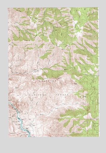
Grave Point, ID USGS Topographic Map
Click on map above to begin viewing in our Map Viewer.

This topographic map contains these locations and features:
Feature Name Type Latitude Longitude GNIS ID View Map
Bear GulchValleyN45.6910°W116.4599°397417View Map
Big Canyon SaddleGapN45.6896°W116.4246°377459View Map
Buckpasture GulchValleyN45.6274°W116.4804°1137384View Map
Bull SpringsSpringN45.6378°W116.3818°378482View Map
Camp Howard Cow CampLocaleN45.7285°W116.4079°378802View Map
Camp Howard RidgeRidgeN45.7168°W116.4076°378803View Map
Christie Creek Forest Service StationLocaleN45.6288°W116.3788°400552View Map
Circle C RanchLocaleN45.6368°W116.4690°379352View Map
Cottonwood CreekStreamN45.6918°W116.4524°379831View Map
Cowen GulchValleyN45.6846°W116.3840°379975View Map
Coyote RidgeRidgeN45.7310°W116.4276°380002View Map
Deer GulchValleyN45.7371°W116.4504°380459View Map
Fir CreekStreamN45.6871°W116.4921°381700View Map
Fourth of July SpringSpringN45.7392°W116.4635°381976View Map
Grand Canyon of the Snake RiverValleyN45.6596°W116.4718°1156666View Map
Grave PointSummitN45.6424°W116.3807°382590View Map
Highrange RidgeRidgeN45.7271°W116.4601°383191View Map
Indian CreekStreamN45.7496°W116.4482°383648View Map
Kurry CreekStreamN45.6366°W116.4815°384317View Map
Little Fir CreekStreamN45.6868°W116.4938°384831View Map
Lower Pittsburg LandingLocaleN45.6324°W116.4751°396825View Map
Lower Pittsburg RapidsRapidsN45.6371°W116.4825°1123580View Map
Middle Pittsburg RapidsRapidsN45.6296°W116.4723°1130985View Map
Motthorn SaddleGapN45.6766°W116.4046°387278View Map
North Fork Klopton CreekStreamN45.6266°W116.4193°387722View Map
Pittsburg BarBarN45.6343°W116.4824°388573View Map
Pittsburg BarBarN45.6274°W116.4721°1125454View Map
Pittsburg CreekStreamN45.6288°W116.4729°1147783View Map
Pittsburg SaddleGapN45.6641°W116.3938°388574View Map
Pleasant Valley CreekStreamN45.6474°W116.4879°1147803View Map
Pleasant Valley IslandIslandN45.6418°W116.4843°1125483View Map
Pleasant Valley RapidsRapidsN45.6491°W116.4874°1125484View Map
Red Rock SpringSpringN45.6724°W116.4907°389239View Map
TaylorPopulated PlaceN45.6854°W116.3835°400551View Map
Upper Pittsburg LandingLocaleN45.6254°W116.4710°398298View Map
Upper Pleasant Valley RapidsRapidsN45.6424°W116.4842°392644View Map
Upper Pleasant Valley RapidsRapidsN45.6410°W116.4844°1128469View Map
Walters RanchLocaleN45.6899°W116.4607°392807View Map
West CreekStreamN45.6460°W116.4871°393025View Map
West Fork West CreekStreamN45.6491°W116.4751°393222View Map
Wild Horse ButteSummitN45.6818°W116.4338°393420View Map
Wild Horse RidgeRidgeN45.6796°W116.4646°393426View Map

Note: Coordinates in the location and feature list above are referenced to NAD83 datum.


Copyright (C) 2008-2024 Ryan Niemi / Sunset Dynamics ... All Rights Reserved