TopoQuest Logo
Do you find TopoQuest useful?
Help keep TopoQuest running and adding new maps/features by donating!
Bitcoin:  19c7KJd3qBynnjoSw5npx9KScwjBe4ifkT
Litecoin:  LXs6TkuXGGXo1vDsWCkWVdjQX94eUKd6ui
Home View Maps Find Maps Find Places Resources & Links


Joseph, Idaho Topographic Map

USGS Map Title: Joseph, ID
USGS Map MRC: 45116G4
DRG (GeoTIFF) Download: o45116g4.tif


Neighboring USGS Topographic Map Quads:


  Boles, ID  
45116H5
 

  Moughmer Point, ID  
45116H4
 

  Fenn, ID  
45116H3
 

  Wolf Creek, ID  
45116G5
 

  Joseph, ID  
45116G4
 

  White Bird, ID  
45116G3
 

  Lord Flat, OR  
45116F5
 

  Grave Point, ID  
45116F4
 

  Slate Creek, ID  
45116F3


Map MRC Location:

N46°
W117°
N46°
W116°
H8 H7 H6 H5 H4 H3 H2 H1
G8 G7 G6 G5 G4 G3 G2 G1
F8 F7 F6 F5 F4 F3 F2 F1
E8 E7 E6 E5 E4 E3 E2 E1
D8 D7 D6 D5 D4 D3 D2 D1
C8 C7 C6 C5 C4 C3 C2 C1
B8 B7 B6 B5 B4 B3 B2 B1
A8 A7 A6 A5 A4 A3 A2 A1
N45°
W117°
N45°
W116°

Joseph, ID USGS 1:24K Topographic Map Preview:
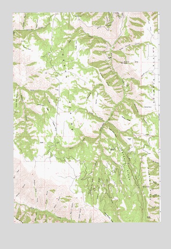
Joseph, ID USGS Topographic Map
Click on map above to begin viewing in our Map Viewer.

This topographic map contains these locations and features:
Feature Name Type Latitude Longitude GNIS ID View Map
Abercombie RidgeRidgeN45.8193°W116.4793°371188View Map
Annie GulchValleyN45.7563°W116.4699°371247View Map
Bear GulchValleyN45.7560°W116.4713°397418View Map
Biddle RidgeRidgeN45.8093°W116.4038°371475View Map
Big GulchValleyN45.7513°W116.4513°371498View Map
Blind GulchValleyN45.7574°W116.4738°371599View Map
Box FlatFlatN45.8738°W116.4093°371668View Map
Brust CreekStreamN45.8018°W116.4268°371726View Map
Canfield CemeteryCemeteryN45.8379°W116.3823°378844View Map
Center CreekStreamN45.7910°W116.4240°371949View Map
Center RidgeRidgeN45.7860°W116.4046°371952View Map
Christmas Tree GulchValleyN45.7771°W116.4329°372019View Map
Crows Nest BasinBasinN45.8254°W116.4988°372277View Map
Deadhorse SaddleGapN45.7929°W116.4185°372338View Map
Dewey GulchValleyN45.8649°W116.4807°372396View Map
Fall CreekStreamN45.8546°W116.4157°372655View Map
Fall PointSummitN45.8668°W116.4224°396477View Map
Fick PointCapeN45.8660°W116.3835°372687View Map
Garden GulchValleyN45.7582°W116.4807°382186View Map
Gibbons CanyonValleyN45.8640°W116.4996°372839View Map
Gillespie GulchValleyN45.8649°W116.4910°372847View Map
Grouse RidgeRidgeN45.8329°W116.4213°372936View Map
JosephPopulated PlaceN45.7971°W116.4779°396717View Map
Joseph CemeteryCemeteryN45.7972°W116.4639°373347View Map
Kerlee RidgeRidgeN45.8238°W116.4290°373400View Map
Kidder FlatFlatN45.8474°W116.4193°373406View Map
Lacey FlatFlatN45.8304°W116.4021°373437View Map
Lyda SpringSpringN45.8731°W116.4461°373779View Map
Mockmer ButteSummitN45.8449°W116.4060°387064View Map
Mollie PointSummitN45.8179°W116.3815°396911View Map
Moonshine CanyonValleyN45.8243°W116.4057°374008View Map
Nelson GulchValleyN45.7507°W116.4449°374117View Map
Pimble PointFlatN45.8538°W116.4907°374397View Map
Rail CreekStreamN45.8093°W116.4199°389027View Map
Reed PointFlatN45.8554°W116.4468°374633View Map
Rose Lewis PointCapeN45.8043°W116.4176°374777View Map
Saddle Horse RidgeRidgeN45.7707°W116.4263°374832View Map
Scully CreekStreamN45.8099°W116.4204°374937View Map
Seven Springs CanyonValleyN45.8527°W116.4165°374958View Map
Sheep SpringSpringN45.7712°W116.3903°390258View Map
Shillam FlatFlatN45.8002°W116.4010°375003View Map
Shuck SaddleGapN45.7529°W116.3863°375019View Map
Soldiers Home CreekStreamN45.7585°W116.4815°375115View Map
Talbot GulchValleyN45.7877°W116.4271°375396View Map
Twogood FlatFlatN45.8071°W116.4649°375653View Map
Wells GulchValleyN45.8349°W116.4076°375788View Map

Note: Coordinates in the location and feature list above are referenced to NAD83 datum.


Copyright (C) 2008-2025 Ryan Niemi / Sunset Dynamics ... All Rights Reserved