TopoQuest Logo
Do you find TopoQuest useful?
Help keep TopoQuest running and adding new maps/features by donating!
Bitcoin:  19c7KJd3qBynnjoSw5npx9KScwjBe4ifkT
Litecoin:  LXs6TkuXGGXo1vDsWCkWVdjQX94eUKd6ui
Home View Maps Find Maps Find Places Resources & Links


Grayback Mountain, Oregon Topographic Map

USGS Map Title: Grayback Mountain, OR
USGS Map MRC: 42123A3
DRG (GeoTIFF) Download: o42123a3.tif


Neighboring USGS Topographic Map Quads:


  Kerby Peak, OR  
42123B4
 

  Williams, OR  
42123B3
 

  Tallowbox Mountain, OR  
42123B2
 

  Oregon Caves, OR  
42123A4
 

  Grayback Mountain, OR  
42123A3
 

  Carberry Creek, OR  
42123A2
 

  Deadman Point, CA  
41123H4
 

  Figurehead Mountain, CA  
41123H3
 

  Kangaroo Mountain, CA  
41123H2


Map MRC Location:

N43°
W124°
N43°
W123°
H8 H7 H6 H5 H4 H3 H2 H1
G8 G7 G6 G5 G4 G3 G2 G1
F8 F7 F6 F5 F4 F3 F2 F1
E8 E7 E6 E5 E4 E3 E2 E1
D8 D7 D6 D5 D4 D3 D2 D1
C8 C7 C6 C5 C4 C3 C2 C1
B8 B7 B6 B5 B4 B3 B2 B1
A8 A7 A6 A5 A4 A3 A2 A1
N42°
W124°
N42°
W123°

Grayback Mountain, OR USGS 1:24K Topographic Map Preview:
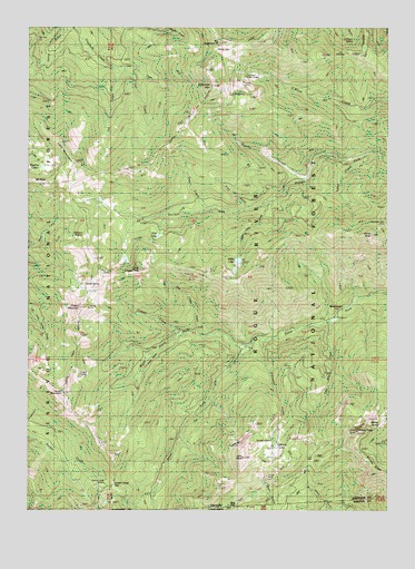
Grayback Mountain, OR USGS Topographic Map
Click on map above to begin viewing in our Map Viewer.

This topographic map contains these locations and features:
Feature Name Type Latitude Longitude GNIS ID View Map
Arnold MineMineN42.0087°W123.2937°1137301View Map
Arnold MountainSummitN42.0135°W123.3014°1144782View Map
Bee FlatFlatN42.0001°W123.3012°256780View Map
Big Sugarloaf PeakSummitN42.1213°W123.3103°1138085View Map
Bigelow CabinsLocaleN42.0798°W123.3498°1138101View Map
Bigelow CreekStreamN42.0860°W123.2789°1138102View Map
Browntown (historical)Populated PlaceN42.0529°W123.2639°1158144View Map
Camp GulchValleyN42.0001°W123.2706°257880View Map
Cold SpringSpringN42.1089°W123.3068°1139966View Map
Craggy CreekStreamN42.0460°W123.3226°1140356View Map
Craggy MountainSummitN42.0521°W123.3580°1140357View Map
Deer CreekStreamN42.0782°W123.3137°1140820View Map
Denman CabinLocaleN42.0546°W123.3564°1140893View Map
Elk CreekStreamN42.1137°W123.3470°1141745View Map
Elkhorn PrairieFlatN42.0710°W123.3564°1141822View Map
Fan CreekStreamN42.1137°W123.3470°1142007View Map
Fish LakeLakeN42.0710°W123.3308°1142158View Map
Fosters TempleLocaleN42.0062°W123.3512°1142345View Map
Grayback MountainSummitN42.1097°W123.3125°1143011View Map
Grayback ShelterLocaleN42.1126°W123.3009°1143013View Map
Green ValleyValleyN42.0351°W123.3531°1143058View Map
Green Valley TrailTrailN42.0421°W123.3434°1143061View Map
Grizzly CampLocaleN42.0387°W123.3581°1162489View Map
Hinkle LakeLakeN42.0164°W123.2897°1143613View Map
Horse SpringSpringN42.0583°W123.3563°1134127View Map
Horse Spring CampLocaleN42.0573°W123.3581°1143793View Map
Kendall CabinLocaleN42.0182°W123.2914°1134126View Map
Klamath MountainsRangeN42.0001°W123.3345°1158897View Map
Krause CabinLocaleN42.1110°W123.3006°1144707View Map
Lake MountainSummitN42.0901°W123.3599°1144780View Map
Larkspur SpringSpringN42.1217°W123.2633°1144833View Map
Lewis CreekStreamN42.0918°W123.2531°1144964View Map
Little Craggy CreekStreamN42.0454°W123.3181°1145131View Map
Little Craggy PeakSummitN42.0621°W123.3377°1145132View Map
Little CreekStreamN42.1137°W123.3448°1145136View Map
Little Miller LakeLakeN42.0617°W123.3044°1155100View Map
Low GapGapN42.0137°W123.2776°1145587View Map
Low Gap CreekStreamN42.0490°W123.2706°1145589View Map
Low Gap TrailTrailN42.0235°W123.2726°262997View Map
Miller LakeLakeN42.0645°W123.3030°1146274View Map
Miller Lake CreekStreamN42.0801°W123.2939°1146277View Map
Miller Lake DamDamN42.0652°W123.3024°1155618View Map
Mount ElijahSummitN42.0845°W123.3705°1141735View Map
Mountain View MineMineN42.0746°W123.2517°1134125View Map
O'Connell CreekStreamN42.0443°W123.2939°1147103View Map
Pine GulchValleyN42.0787°W123.3003°1147712View Map
Right Hand Fork Steve ForkStreamN42.0429°W123.2989°1148446View Map
Steve Fork TrailTrailN42.0471°W123.2820°267727View Map
Steve PeakSummitN42.0712°W123.2572°1150414View Map
Sucker Creek GapGapN42.0065°W123.3470°1150521View Map
Sucker Creek ShelterLocaleN42.0073°W123.3481°1150522View Map
Swan MountainSummitN42.0301°W123.3642°1150764View Map
Swan ValleyValleyN42.0407°W123.3345°1150765View Map
Whisky PeakSummitN42.0203°W123.2615°1152208View Map
Whisky SpringSpringN42.0221°W123.2539°1152210View Map
Windy GapGapN42.1187°W123.3098°1152508View Map

Note: Coordinates in the location and feature list above are referenced to NAD83 datum.


Copyright (C) 2008-2025 Ryan Niemi / Sunset Dynamics ... All Rights Reserved