TopoQuest Logo
Do you find TopoQuest useful?
Help keep TopoQuest running and adding new maps/features by donating!
Bitcoin:  19c7KJd3qBynnjoSw5npx9KScwjBe4ifkT
Litecoin:  LXs6TkuXGGXo1vDsWCkWVdjQX94eUKd6ui
Home View Maps Find Maps Find Places Resources & Links


Oregon Caves, Oregon Topographic Map

USGS Map Title: Oregon Caves, OR
USGS Map MRC: 42123A4
DRG (GeoTIFF) Download: o42123a4.tif


Neighboring USGS Topographic Map Quads:


  Holland, OR  
42123B5
 

  Kerby Peak, OR  
42123B4
 

  Williams, OR  
42123B3
 

  Takilma, OR  
42123A5
 

  Oregon Caves, OR  
42123A4
 

  Grayback Mountain, OR  
42123A3
 

  Polar Bear Mountain, CA  
41123H5
 

  Deadman Point, CA  
41123H4
 

  Figurehead Mountain, CA  
41123H3


Map MRC Location:

N43°
W124°
N43°
W123°
H8 H7 H6 H5 H4 H3 H2 H1
G8 G7 G6 G5 G4 G3 G2 G1
F8 F7 F6 F5 F4 F3 F2 F1
E8 E7 E6 E5 E4 E3 E2 E1
D8 D7 D6 D5 D4 D3 D2 D1
C8 C7 C6 C5 C4 C3 C2 C1
B8 B7 B6 B5 B4 B3 B2 B1
A8 A7 A6 A5 A4 A3 A2 A1
N42°
W124°
N42°
W123°

Oregon Caves, OR USGS 1:24K Topographic Map Preview:
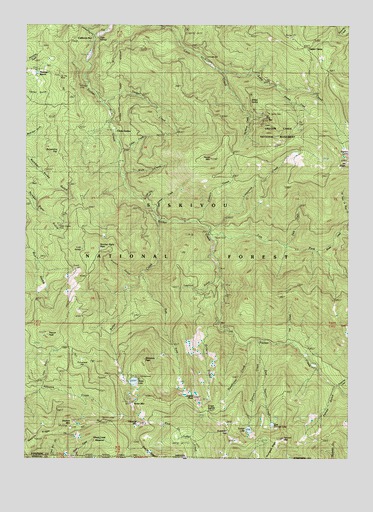
Oregon Caves, OR USGS Topographic Map
Click on map above to begin viewing in our Map Viewer.

This topographic map contains these locations and features:
Feature Name Type Latitude Longitude GNIS ID View Map
Althouse MountainSummitN42.0102°W123.4575°1137179View Map
Althouse TrailTrailN42.0315°W123.4878°1137180View Map
Big TreeLocaleN42.0962°W123.3959°1138090View Map
Bigelow LakesLakeN42.0897°W123.3782°1138103View Map
Blanket Ledge MineMineN42.0110°W123.4714°1134927View Map
Bolan CreekStreamN42.0685°W123.4492°1138389View Map
Bolan Creek MineMineN42.0690°W123.4509°1138390View Map
Bolan LakeLakeN42.0221°W123.4592°1138391View Map
Bolan Lake DamDamN42.0220°W123.4611°1153915View Map
Bolan Lake Recreation SiteLocaleN42.0232°W123.4573°1159254View Map
Bolan Lake TrailTrailN42.0457°W123.4820°1138392View Map
Bolan MineMineN42.0390°W123.4637°1138393View Map
Bolan MountainSummitN42.0144°W123.4583°1138394View Map
Boundary TrailTrailN42.0040°W123.3939°1138508View Map
Briggs CabinLocaleN42.0415°W123.4259°1138626View Map
Brush CreekStreamN42.0601°W123.3892°1138714View Map
Brush Creek CampLocaleN42.0587°W123.3856°1138719View Map
Brushy GulchValleyN42.1165°W123.4762°1155101View Map
California BarPopulated PlaceN42.1196°W123.4748°1139157View Map
Carr GulchValleyN42.0971°W123.4692°1155102View Map
Carson CabinLocaleN42.0548°W123.4267°1139397View Map
Cave Creek Recreation SiteLocaleN42.1179°W123.4359°1155103View Map
Cedar CampLocaleN42.0851°W123.3881°1139489View Map
China GardenLocaleN42.0946°W123.4664°1139676View Map
Cliff Nature TrailTrailN42.0968°W123.4109°1139831View Map
Cohen CreekStreamN42.0893°W123.4648°1139905View Map
Cold SpringSpringN42.0603°W123.4792°1139922View Map
Deadhorse CorralLocaleN42.0157°W123.4281°1140715View Map
Deadhorse CreekStreamN42.0329°W123.4156°1140716View Map
Deep CreekStreamN42.0612°W123.4014°1140791View Map
East Fork Bolan CreekStreamN42.0532°W123.4559°1141534View Map
East Fork Sucker Creek TrailTrailN42.0632°W123.4076°1141608View Map
East Tanner CreekStreamN42.0290°W123.4101°1141645View Map
East Tanner LakeLakeN42.0097°W123.4056°1141646View Map
Edmonds MineMineN42.0979°W123.4695°1141680View Map
Elkhorn CreekStreamN42.0685°W123.4351°1141810View Map
Fehley GulchValleyN42.0196°W123.3823°1142056View Map
Forest Service Bolan Lake Non - Motorized Boat LaunchLocaleN42.0229°W123.4576°2697244View Map
French GulchValleyN42.0523°W123.4576°1120986View Map
French PeakSummitN42.0355°W123.4924°1142472View Map
Fulk CabinLocaleN42.0679°W123.4398°1142532View Map
Gilmore Cutoff TrailTrailN42.0448°W123.4853°1142742View Map
Gold CenterLocaleN42.0223°W123.4631°1142807View Map
Gold Dollar CreekStreamN42.0746°W123.4559°1142818View Map
Goldsby GulchValleyN42.0179°W123.4998°1155106View Map
Green Creek MeadowFlatN42.0045°W123.4717°1143032View Map
Grizzly GulchValleyN42.0387°W123.4292°1143105View Map
Grizzly MineMineN42.0423°W123.4253°1143106View Map
Grizzly PeakSummitN42.0176°W123.4360°1143109View Map
Gypsy Queen MineMineN42.0679°W123.4890°1134928View Map
Horse MountainSummitN42.0863°W123.4298°1143771View Map
Iron GulchValleyN42.0201°W123.4948°1134926View Map
Jackass CreekStreamN42.0718°W123.4523°1134925View Map
Johnson GulchValleyN42.1223°W123.4756°1144352View Map
Julian GulchValleyN42.0193°W123.4956°1155105View Map
Kester MineMineN42.0637°W123.4278°1144575View Map
Kings SaddleGapN42.0132°W123.4314°1144624View Map
Lake CreekStreamN42.1121°W123.4259°1144752View Map
Lake Mountain TrailTrailN42.0929°W123.3901°1144781View Map
Layman GulchValleyN42.0518°W123.4264°1144896View Map
Left Fork Sucker CreekStreamN42.0654°W123.4292°1144922View Map
Left Hand Fork Brush CreekStreamN42.0687°W123.3756°1144923View Map
Limestone CreekStreamN42.0654°W123.4292°1145025View Map
Limestone TrailTrailN42.0835°W123.4184°1145027View Map
Lucky Strike MineMineN42.0168°W123.4653°1145667View Map
Luethye MineMineN42.0662°W123.4865°1145672View Map
Matz DrawStreamN42.0010°W123.3881°1155069View Map
Mountain RanchLocaleN42.1104°W123.4928°1146544View Map
Mule CreekStreamN42.0818°W123.4642°1146624View Map
No Name CreekStreamN42.0987°W123.4148°1155495View Map
Number Eight PeakSummitN42.0607°W123.4732°1147087View Map
Onion GulchValleyN42.0193°W123.4845°1155104View Map
Oregon Caves National Monument and PreserveParkN42.1032°W123.4019°1147260View Map
Oregon Caves Post Office (historical)Post OfficeN42.0982°W123.4131°1164567View Map
Panther CreekStreamN42.1073°W123.4053°1147386View Map
Pepper CampLocaleN42.1201°W123.3931°1147586View Map
Portuguese FlatFlatN42.0296°W123.4806°1147918View Map
Rainbow MineMineN42.1090°W123.4812°1148173View Map
Rasmussen HouseLocaleN42.1051°W123.4740°1148224View Map
Serpentine FlatFlatN42.0871°W123.4898°1149243View Map
SlaughterhouseLocaleN42.0857°W123.4642°1149669View Map
Sucker Creek TrailTrailN42.0310°W123.3926°1150523View Map
Sundown GapGapN42.0082°W123.4226°1150658View Map
Tannen Lakes TrailTrailN42.0110°W123.4103°1953497View Map
Tanner CreekStreamN42.0340°W123.4112°1150888View Map
Tanner LakeLakeN42.0083°W123.4145°1150889View Map
Tanner LakesLakeN42.0083°W123.4145°1953493View Map
Tanner MountainSummitN42.0057°W123.4013°1150890View Map
Thirteenmile CreekStreamN42.0215°W123.3806°1151068View Map
Tiger SpringsSpringN42.1208°W123.4730°1151218View Map
Tip Top MineMineN42.1096°W123.4890°1151275View Map
Weston MountainSummitN42.0105°W123.4825°1152155View Map
Weston RidgeRidgeN42.0065°W123.4956°1152157View Map
Whiskers PeakSummitN42.0285°W123.4549°1152181View Map
Willow SpringSpringN42.1031°W123.4140°1152432View Map
Yeager CreekStreamN42.1026°W123.4717°1152702View Map
Yeager MineMineN42.1026°W123.4715°1152703View Map
Yew CreekStreamN42.0337°W123.3989°1152729View Map

Note: Coordinates in the location and feature list above are referenced to NAD83 datum.


Copyright (C) 2008-2024 Ryan Niemi / Sunset Dynamics ... All Rights Reserved