TopoQuest Logo
Do you find TopoQuest useful?
Help keep TopoQuest running and adding new maps/features by donating!
Bitcoin:  19c7KJd3qBynnjoSw5npx9KScwjBe4ifkT
Litecoin:  LXs6TkuXGGXo1vDsWCkWVdjQX94eUKd6ui
Home View Maps Find Maps Find Places Resources & Links


Figurehead Mountain, California Topographic Map

USGS Map Title: Figurehead Mountain, CA
USGS Map MRC: 41123H3
DRG (GeoTIFF) Download: o41123h3.tif


Neighboring USGS Topographic Map Quads:


  Oregon Caves, OR  
42123A4
 

  Grayback Mountain, OR  
42123A3
 

  Carberry Creek, OR  
42123A2
 

  Deadman Point, CA  
41123H4
 

  Figurehead Mountain, CA  
41123H3
 

  Kangaroo Mountain, CA  
41123H2
 

  Happy Camp, CA  
41123G4
 

  Slater Butte, CA  
41123G3
 

  Seiad Valley, CA  
41123G2


Map MRC Location:

N42°
W124°
N42°
W123°
H8 H7 H6 H5 H4 H3 H2 H1
G8 G7 G6 G5 G4 G3 G2 G1
F8 F7 F6 F5 F4 F3 F2 F1
E8 E7 E6 E5 E4 E3 E2 E1
D8 D7 D6 D5 D4 D3 D2 D1
C8 C7 C6 C5 C4 C3 C2 C1
B8 B7 B6 B5 B4 B3 B2 B1
A8 A7 A6 A5 A4 A3 A2 A1
N41°
W124°
N41°
W123°

Figurehead Mountain, CA USGS 1:24K Topographic Map Preview:
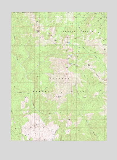
Figurehead Mountain, CA USGS Topographic Map
Click on map above to begin viewing in our Map Viewer.

This topographic map contains these locations and features:
Feature Name Type Latitude Longitude GNIS ID View Map
Azalea LakeLakeN41.9699°W123.3005°256390View Map
Baileys CabinLocaleN41.9471°W123.2931°256434View Map
Bean GulchValleyN41.9951°W123.2798°256615View Map
Bear Valley CreekStreamN41.9193°W123.3489°256721View Map
Bear WallowBasinN41.9179°W123.2792°1657569View Map
Bear Wallow CampLocaleN41.9171°W123.2839°256732View Map
Big CampLocaleN41.9162°W123.2626°256899View Map
Bill Fruit TrailTrailN41.9887°W123.2970°257056View Map
Boundary National Recreation TrailTrailN41.9296°W123.2553°277215View Map
Buck PeakSummitN41.9748°W123.3045°257578View Map
Bug CreekStreamN41.8776°W123.3223°257650View Map
Cameron MeadowsFlatN41.9696°W123.2706°257842View Map
Cedar BasinBasinN41.9660°W123.2887°258107View Map
Cedar CreekStreamN41.9379°W123.3592°258119View Map
East Fork Fort Goff CreekStreamN41.9157°W123.2714°259732View Map
East Fork Thompson CreekStreamN41.9496°W123.3667°259757View Map
Figurehead MountainSummitN41.9615°W123.3034°260102View Map
Fir GladeFlatN41.9968°W123.3092°260118View Map
Fourmile ButteSummitN41.9171°W123.3164°260303View Map
Fourmile CreekStreamN41.8954°W123.3339°260305View Map
Frog Pond GulchValleyN41.9943°W123.2501°260431View Map
Goff ButteSummitN41.9482°W123.2770°260635View Map
Jackson PeakSummitN41.8865°W123.3703°1656098View Map
Knox GulchValleyN41.9957°W123.2567°262228View Map
Lonesome LakeLakeN41.9497°W123.2970°262815View Map
Middle Fork Fort Goff CreekStreamN41.9096°W123.2820°263529View Map
Mill CreekStreamN41.8932°W123.3328°263593View Map
Morgan CreekStreamN41.9179°W123.3506°263820View Map
Mount EmilySummitN41.9715°W123.2767°259917View Map
North Fork CampLocaleN41.9707°W123.2776°1662524View Map
Phantom MeadowsFlatN41.9735°W123.3234°264677View Map
Pyramid PeakSummitN41.9810°W123.3439°265080View Map
Red Buttes WildernessReserveN41.9712°W123.2803°1167127View Map
Rhodonite MineMineN41.8954°W123.3728°277172View Map
Slide CreekStreamN41.8771°W123.3220°266295View Map
Snake LakeLakeN41.9573°W123.2998°267293View Map
Sugar Pine CampLocaleN41.9237°W123.2606°267839View Map
Sweaty GulchValleyN41.9890°W123.2892°268014View Map
Tims PeakSummitN41.8948°W123.3020°268293View Map
West Fork Fort Goff CreekStreamN41.9096°W123.2817°268900View Map

Note: Coordinates in the location and feature list above are referenced to NAD83 datum.


Copyright (C) 2008-2024 Ryan Niemi / Sunset Dynamics ... All Rights Reserved