TopoQuest Logo
Do you find TopoQuest useful?
Help keep TopoQuest running and adding new maps/features by donating!
Bitcoin:  19c7KJd3qBynnjoSw5npx9KScwjBe4ifkT
Litecoin:  LXs6TkuXGGXo1vDsWCkWVdjQX94eUKd6ui
Home View Maps Find Maps Find Places Resources & Links


Grayhorse Creek, Montana Topographic Map

USGS Map Title: Grayhorse Creek, MT
USGS Map MRC: 46113E8
DRG (GeoTIFF) Download: o46113e8.tif


Neighboring USGS Topographic Map Quads:


  Florence, MT  
46114F1
 

  Davis Point, MT  
46113F8
 

  Elk Mountain, MT  
46113F7
 

  Stevensville, MT  
46114E1
 

  Grayhorse Creek, MT  
46113E8
 

  Cleveland Mountain, MT  
46113E7
 

  Bing, MT  
46114D1
 

  Corley Gulch, MT  
46113D8
 

  Sawmill Saddle, MT  
46113D7


Map MRC Location:

N47°
W114°
N47°
W113°
H8 H7 H6 H5 H4 H3 H2 H1
G8 G7 G6 G5 G4 G3 G2 G1
F8 F7 F6 F5 F4 F3 F2 F1
E8 E7 E6 E5 E4 E3 E2 E1
D8 D7 D6 D5 D4 D3 D2 D1
C8 C7 C6 C5 C4 C3 C2 C1
B8 B7 B6 B5 B4 B3 B2 B1
A8 A7 A6 A5 A4 A3 A2 A1
N46°
W114°
N46°
W113°

Grayhorse Creek, MT USGS 1:24K Topographic Map Preview:
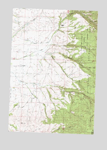
Grayhorse Creek, MT USGS Topographic Map
Click on map above to begin viewing in our Map Viewer.

This topographic map contains these locations and features:
Feature Name Type Latitude Longitude GNIS ID View Map
09N19W10BB__01 WellWellN46.5577°W113.9804°816814View Map
09N19W14CBCC01 WellWellN46.5341°W113.9607°816703View Map
09N19W14CBCD01 WellWellN46.5338°W113.9598°816702View Map
Grayhorse CreekStreamN46.5769°W113.9759°784245View Map
Iron Cap MineMineN46.5102°W113.9190°805095View Map
Left Fork Three Mile CreekStreamN46.6044°W113.9343°1803028View Map
Lone Rock SchoolSchoolN46.5666°W113.9840°786492View Map
Middle Fork Three Mile CreekStreamN46.6055°W113.9332°1803029View Map
Reed ButteSummitN46.5088°W113.9793°801869View Map
Sheep CreekStreamN46.5516°W113.9890°790321View Map
Spring GulchValleyN46.5894°W113.9401°791304View Map
Sunnyside CemeteryCemeteryN46.5657°W113.9926°1803177View Map
Three Mile Creek MineMineN46.6138°W113.8843°805106View Map
Three Mile Fire District Station 1BuildingN46.5666°W113.9866°2546653View Map
Threemile State Wildlife Management AreaParkN46.5902°W113.8779°806884View Map
Wheelbarrow CreekStreamN46.5796°W113.9445°793155View Map

Note: Coordinates in the location and feature list above are referenced to NAD83 datum.


Copyright (C) 2008-2025 Ryan Niemi / Sunset Dynamics ... All Rights Reserved