TopoQuest Logo
Do you find TopoQuest useful?
Help keep TopoQuest running and adding new maps/features by donating!
Bitcoin:  19c7KJd3qBynnjoSw5npx9KScwjBe4ifkT
Litecoin:  LXs6TkuXGGXo1vDsWCkWVdjQX94eUKd6ui
Home View Maps Find Maps Find Places Resources & Links


Bing, Montana Topographic Map

USGS Map Title: Bing, MT
USGS Map MRC: 46114D1
DRG (GeoTIFF) Download: o46114d1.tif


Neighboring USGS Topographic Map Quads:


  Saint Mary Peak, MT  
46114E2
 

  Stevensville, MT  
46114E1
 

  Grayhorse Creek, MT  
46113E8
 

  Victor, MT  
46114D2
 

  Bing, MT  
46114D1
 

  Corley Gulch, MT  
46113D8
 

  Hamilton North, MT  
46114C2
 

  Corvallis, MT  
46114C1
 

  Willow Mountain, MT  
46113C8


Map MRC Location:

N47°
W115°
N47°
W114°
H8 H7 H6 H5 H4 H3 H2 H1
G8 G7 G6 G5 G4 G3 G2 G1
F8 F7 F6 F5 F4 F3 F2 F1
E8 E7 E6 E5 E4 E3 E2 E1
D8 D7 D6 D5 D4 D3 D2 D1
C8 C7 C6 C5 C4 C3 C2 C1
B8 B7 B6 B5 B4 B3 B2 B1
A8 A7 A6 A5 A4 A3 A2 A1
N46°
W115°
N46°
W114°

Bing, MT USGS 1:24K Topographic Map Preview:
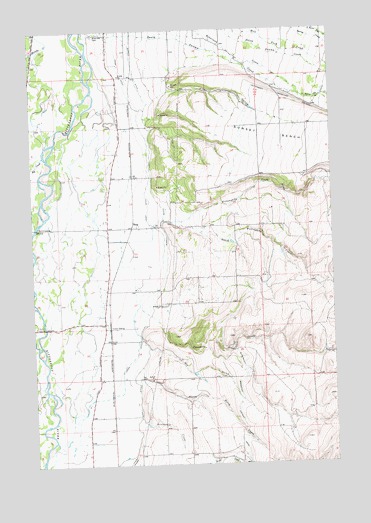
Bing, MT USGS Topographic Map
Click on map above to begin viewing in our Map Viewer.

This topographic map contains these locations and features:
Feature Name Type Latitude Longitude GNIS ID View Map
07N20W02BDDA01 WellWellN46.3935°W114.0620°815987View Map
07N20W03BA__01 WellWellN46.3980°W114.0854°816036View Map
07N20W04AA__01 WellWellN46.3980°W114.0957°816037View Map
07N20W09AB__01 WellWellN46.3835°W114.1009°815924View Map
08N19W06CC__01 WellWellN46.4741°W114.0290°816429View Map
08N19W07CBBD01 WellWellN46.4633°W114.0290°816386View Map
08N20W01DAAD01 WellWellN46.4777°W114.0318°816455View Map
08N20W01DABD01 WellWellN46.4780°W114.0334°816458View Map
08N20W02BB__01 WellWellN46.4838°W114.0704°816483View Map
08N20W03BA__01 WellWellN46.4838°W114.0862°816484View Map
08N20W03BD__02 WellWellN46.4802°W114.0862°816464View Map
08N20W05DC__01 WellWellN46.4730°W114.1229°816422View Map
08N20W10BB__01 WellWellN46.4694°W114.0915°816402View Map
08N20W14CB__01 WellWellN46.4477°W114.0704°816313View Map
08N20W15BA__01 WellWellN46.4549°W114.0862°816352View Map
08N20W16BADC01 WellWellN46.4541°W114.1062°816349View Map
08N20W21BA__01 WellWellN46.4402°W114.1070°816279View Map
08N20W23CDDD01 WellWellN46.4291°W114.0629°816212View Map
08N20W28AD__01 WellWellN46.4221°W114.0965°816174View Map
08N20W28BACD01 WellWellN46.4255°W114.1079°816198View Map
08N20W28BDBA01 WellWellN46.4249°W114.1073°816195View Map
08N20W28CC__01 WellWellN46.4149°W114.1123°816123View Map
08N20W28DC__01 WellWellN46.4149°W114.1018°816122View Map
09N19W31AA__02 WellWellN46.4996°W114.0273°816541View Map
09N20W34AB__01 WellWellN46.4991°W114.0962°816537View Map
09N20W34AB__04 WellWellN46.4991°W114.0962°816538View Map
09N20W34AC__01 WellWellN46.4955°W114.0962°816519View Map
Bell CrossingPopulated PlaceN46.4433°W114.1240°779667View Map
Big CreekStreamN46.4716°W114.1148°779786View Map
BingPopulated PlaceN46.4433°W114.0843°779922View Map
Bing (historical)LocaleN46.4433°W114.0843°1803203View Map
Brier Patch AirportAirportN46.4739°W114.0539°2717682View Map
Bunkhouse CreekStreamN46.3841°W114.0826°780606View Map
Cinnabar CourtPopulated PlaceN46.4821°W114.0882°1802984View Map
Dry GulchValleyN46.4085°W114.0784°782617View Map
Etna (historical)Populated PlaceN46.4360°W114.0843°1803088View Map
Etna Post Office (historical)Post OfficeN46.4360°W114.0843°1803087View Map
Etna School (historical)SchoolN46.4313°W114.0965°794458View Map
Mountain Shadows EstatesPopulated PlaceN46.4966°W114.0912°1802987View Map
North Birch CreekStreamN46.4033°W114.0812°788067View Map
Our Savior Lutheran ChurchChurchN46.4871°W114.0829°1803127View Map
Pine HollowValleyN46.4824°W114.0668°788897View Map
Riverside CemeteryCemeteryN46.4985°W114.0993°789612View Map
Robertson CreekStreamN46.4980°W114.0748°789640View Map
Rosemont AirportAirportN46.4439°W114.0022°2650694View Map
Sandersville (historical)LocaleN46.4360°W114.0843°1803063View Map
Silverthorn (historical)LocaleN46.4930°W114.1232°1803062View Map
South Burnt Fork CreekStreamN46.4810°W114.0140°790886View Map
South Fork Willoughby CreekStreamN46.4563°W114.0001°791088View Map
South Willoughby CreekStreamN46.4446°W114.0676°791116View Map
Spooner CreekStreamN46.4205°W114.0815°791176View Map
Stevensville Rural Fire StationBuildingN46.4422°W114.0947°2546516View Map
Stevensville Seventh Day Adventist ChurchChurchN46.4871°W114.0843°1803126View Map
Sunset BenchBenchN46.4674°W114.0093°791711View Map
Treece GulchValleyN46.4716°W114.0762°794457View Map
Tucker Crossing East Fishing Access SiteLocaleN46.3785°W114.1207°1744431View Map
Union DitchCanalN46.4483°W114.0779°792589View Map
Victor CrossingPopulated PlaceN46.4144°W114.1212°792702View Map
Victor SidingLocaleN46.4141°W114.0943°792704View Map
Willoughby CreekStreamN46.4871°W114.0993°793338View Map
Wood Lot Fishing Access SiteLocaleN46.4266°W114.1237°1744429View Map

Note: Coordinates in the location and feature list above are referenced to NAD83 datum.


Copyright (C) 2008-2024 Ryan Niemi / Sunset Dynamics ... All Rights Reserved