TopoQuest Logo
Do you find TopoQuest useful?
Help keep TopoQuest running and adding new maps/features by donating!
Bitcoin:  19c7KJd3qBynnjoSw5npx9KScwjBe4ifkT
Litecoin:  LXs6TkuXGGXo1vDsWCkWVdjQX94eUKd6ui
Home View Maps Find Maps Find Places Resources & Links


Auburn, Wyoming Topographic Map

USGS Map Title: Auburn, WY
USGS Map MRC: 42111G1
DRG (GeoTIFF) Download: o42111g1.tif


Neighboring USGS Topographic Map Quads:


  Stump Peak, ID  
42111H2
 

  Thayne West, WY  
42111H1
 

  Thayne East, WY  
42110H8
 

  Diamond Flat, ID  
42111G2
 

  Auburn, WY  
42111G1
 

  Grover, WY  
42110G8
 

  Stewart Flat, ID  
42111F2
 

  Sage Valley, ID  
42111F1
 

  Afton, WY  
42110F8


Map MRC Location:

N43°
W112°
N43°
W111°
H8 H7 H6 H5 H4 H3 H2 H1
G8 G7 G6 G5 G4 G3 G2 G1
F8 F7 F6 F5 F4 F3 F2 F1
E8 E7 E6 E5 E4 E3 E2 E1
D8 D7 D6 D5 D4 D3 D2 D1
C8 C7 C6 C5 C4 C3 C2 C1
B8 B7 B6 B5 B4 B3 B2 B1
A8 A7 A6 A5 A4 A3 A2 A1
N42°
W112°
N42°
W111°

Auburn, WY USGS 1:24K Topographic Map Preview:
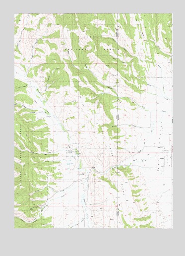
Auburn, WY USGS Topographic Map
Click on map above to begin viewing in our Map Viewer.

This topographic map contains these locations and features:
Feature Name Type Latitude Longitude GNIS ID View Map
AuburnPopulated PlaceN42.7921°W111.0033°1597836View Map
Auburn CemeteryCemeteryN42.7835°W111.0118°1597838View Map
Auburn Census Designated PlaceCensusN42.7944°W111.0135°2407780View Map
Auburn Post OfficePost OfficeN42.7923°W111.0013°2768538View Map
Cow CreekStreamN42.7924°W111.0760°379951View Map
Emigrant TrailTrailN42.8088°W111.0902°395357View Map
Graehl CanyonValleyN42.8302°W111.1038°382481View Map
Horse CreekStreamN42.7935°W111.0766°383368View Map
Hyde CanyonValleyN42.8405°W111.1158°383584View Map
Martha CreekStreamN42.8054°W111.0169°396854View Map
Marthas CanyonValleyN42.8084°W111.0244°386505View Map
Mill CanyonValleyN42.8199°W111.1022°386921View Map
Miller RanchLocaleN42.7533°W111.0647°394773View Map
North Fork Hyde CanyonValleyN42.8444°W111.1147°387713View Map
O E SpringSpringN42.8391°W111.0445°394864View Map
OE SpringSpringN42.8391°W111.0449°1601885View Map
Oe SpringSpringN42.8413°W111.0441°387917View Map
Petersons RanchLocaleN42.7727°W111.0672°394907View Map
Salt Lick CreekStreamN42.7549°W111.0685°397131View Map
Sheep CreekStreamN42.7549°W111.0019°1602833View Map
Spring CreekStreamN42.7780°W111.0674°391196View Map
Stadium CreekStreamN42.8171°W111.1013°391330View Map
State Line DitchCanalN42.8002°W111.0216°395992View Map
Stump Creek Guard StationLocaleN42.7935°W111.0802°391566View Map
The FallsFallsN42.7619°W111.1127°395370View Map
The Falls CreekStreamN42.7633°W111.1030°395372View Map
Toms CanyonValleyN42.8249°W111.0280°392229View Map
Tygee CreekStreamN42.7816°W111.0674°392574View Map
Tygee RidgeRidgeN42.7613°W111.0441°1603852View Map
Tygee RidgeRidgeN42.8071°W111.0610°398287View Map
Water CanyonValleyN42.8258°W111.0022°1604006View Map
Water CanyonValleyN42.8480°W111.0258°399620View Map
Water CreekStreamN42.8252°W111.0005°398323View Map
Webster CanyonValleyN42.7583°W111.1049°398442View Map
Webster CreekStreamN42.7780°W111.0674°392975View Map
West Fork Toms CanyonValleyN42.8441°W111.0672°393214View Map
West Fork Water CanyonValleyN42.8513°W111.0308°393219View Map
West Fork Water CanyonValleyN42.8496°W111.0302°1604082View Map
White CanyonValleyN42.8335°W111.1144°393320View Map

Note: Coordinates in the location and feature list above are referenced to NAD83 datum.


Copyright (C) 2008-2024 Ryan Niemi / Sunset Dynamics ... All Rights Reserved