TopoQuest Logo
Do you find TopoQuest useful?
Help keep TopoQuest running and adding new maps/features by donating!
Bitcoin:  19c7KJd3qBynnjoSw5npx9KScwjBe4ifkT
Litecoin:  LXs6TkuXGGXo1vDsWCkWVdjQX94eUKd6ui
Home View Maps Find Maps Find Places Resources & Links


Thayne West, Wyoming Topographic Map

USGS Map Title: Thayne West, WY
USGS Map MRC: 42111H1
DRG (GeoTIFF) Download: o42111h1.tif


Neighboring USGS Topographic Map Quads:


  Tincup Mountain, ID  
43111A2
 

  Etna, WY  
43111A1
 

  Stewart Peak, WY  
43110A8
 

  Stump Peak, ID  
42111H2
 

  Thayne West, WY  
42111H1
 

  Thayne East, WY  
42110H8
 

  Diamond Flat, ID  
42111G2
 

  Auburn, WY  
42111G1
 

  Grover, WY  
42110G8


Map MRC Location:

N43°
W112°
N43°
W111°
H8 H7 H6 H5 H4 H3 H2 H1
G8 G7 G6 G5 G4 G3 G2 G1
F8 F7 F6 F5 F4 F3 F2 F1
E8 E7 E6 E5 E4 E3 E2 E1
D8 D7 D6 D5 D4 D3 D2 D1
C8 C7 C6 C5 C4 C3 C2 C1
B8 B7 B6 B5 B4 B3 B2 B1
A8 A7 A6 A5 A4 A3 A2 A1
N42°
W112°
N42°
W111°

Thayne West, WY USGS 1:24K Topographic Map Preview:
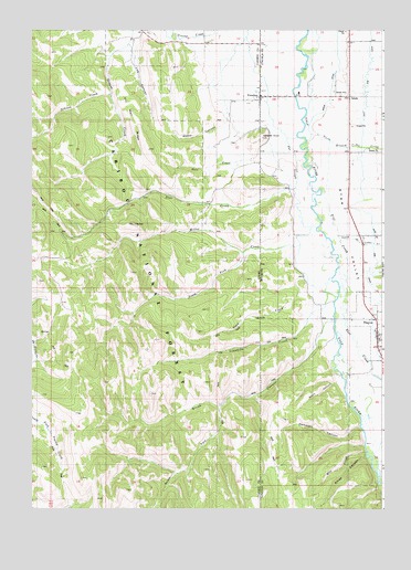
Thayne West, WY USGS Topographic Map
Click on map above to begin viewing in our Map Viewer.

This topographic map contains these locations and features:
Feature Name Type Latitude Longitude GNIS ID View Map
Allred CanyonValleyN42.8883°W111.0060°1597724View Map
Beard CanyonValleyN42.9096°W111.0152°1598029View Map
Dale CreekStreamN42.9660°W111.0488°380219View Map
Deer CreekStreamN42.9583°W111.0333°380411View Map
East Side CanalCanalN42.9819°W111.0060°1599518View Map
Flat CreekStreamN42.9324°W111.0155°1599751View Map
FreedomPopulated PlaceN42.9827°W111.0438°397726View Map
Freedom CemeteryCemeteryN42.9704°W111.0536°382033View Map
Freedom Census Designated PlaceCensusN42.9853°W111.0296°2631321View Map
Freedom Post OfficePost OfficeN42.9821°W111.0438°2768518View Map
Freedom School (historical)SchoolN42.9960°W111.0447°395400View Map
Haderlie CreekStreamN42.9988°W111.0730°382791View Map
Haderlie KnollSummitN42.9719°W111.0433°1600158View Map
Hemmert CanyonValleyN42.8966°W111.0083°1600292View Map
Holdaway SchoolSchoolN42.9208°W111.0022°1795563View Map
Limekiln CreekStreamN42.9299°W111.0165°384670View Map
Log CanyonValleyN42.9933°W111.0902°385043View Map
Mill CreekStreamN42.8899°W111.0066°1601448View Map
Miller CreekStreamN42.9484°W111.0241°386964View Map
North Branch Cedar CreekStreamN42.9733°W111.0258°1601719View Map
Old Man RidgeRidgeN42.9688°W111.0849°387933View Map
Schiess CreekStreamN42.9830°W111.0988°390013View Map
Smith CanyonValleyN42.9213°W111.0224°390655View Map
South Branch Cedar CreekValleyN42.9449°W111.0160°1603096View Map
South Fork Hemmert CanyonValleyN42.8916°W111.0069°1603143View Map
South Fork Miller CreekStreamN42.9413°W111.0516°390974View Map
South Fork Smith CanyonValleyN42.9013°W111.0585°391028View Map
Strawberry CreekStreamN42.8846°W111.0016°1604495View Map
Swab CreekStreamN42.9366°W111.0285°391697View Map
ThaynePopulated PlaceN42.9208°W111.0022°1603591View Map
Thayne AmbulanceBuildingN42.9141°W111.0011°2673553View Map
Thayne and Rural Volunteer Fire DepartmentBuildingN42.9193°W111.0020°2673420View Map
Thayne Post OfficePost OfficeN42.9214°W111.0019°2767900View Map
The SloughGutN42.9691°W111.0344°1603619View Map
Weber CanyonValleyN42.9760°W111.0577°392970View Map

Note: Coordinates in the location and feature list above are referenced to NAD83 datum.


Copyright (C) 2008-2024 Ryan Niemi / Sunset Dynamics ... All Rights Reserved