TopoQuest Logo
Do you find TopoQuest useful?
Help keep TopoQuest running and adding new maps/features by donating!
Bitcoin:  19c7KJd3qBynnjoSw5npx9KScwjBe4ifkT
Litecoin:  LXs6TkuXGGXo1vDsWCkWVdjQX94eUKd6ui
Home View Maps Find Maps Find Places Resources & Links


Graysville, Missouri Topographic Map

USGS Map Title: Graysville, MO
USGS Map MRC: 40092D7
DRG (GeoTIFF) Download: o40092d7.tif


Neighboring USGS Topographic Map Quads:


  Mendota, MO  
40092E8
 

  Omaha, MO  
40092E7
 

  Coatsville, MO  
40092E6
 

  Unionville East, MO  
40092D8
 

  Graysville, MO  
40092D7
 

  Livonia, MO  
40092D6
 

  Green City, MO  
40092C8
 

  Stahl, MO  
40092C7
 

  Connelsville, MO  
40092C6


Map MRC Location:

N41°
W93°
N41°
W92°
H8 H7 H6 H5 H4 H3 H2 H1
G8 G7 G6 G5 G4 G3 G2 G1
F8 F7 F6 F5 F4 F3 F2 F1
E8 E7 E6 E5 E4 E3 E2 E1
D8 D7 D6 D5 D4 D3 D2 D1
C8 C7 C6 C5 C4 C3 C2 C1
B8 B7 B6 B5 B4 B3 B2 B1
A8 A7 A6 A5 A4 A3 A2 A1
N40°
W93°
N40°
W92°

Graysville, MO USGS 1:24K Topographic Map Preview:
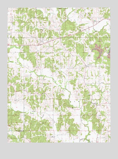
Graysville, MO USGS Topographic Map
Click on map above to begin viewing in our Map Viewer.

This topographic map contains these locations and features:
Feature Name Type Latitude Longitude GNIS ID View Map
Bland CemeteryCemeteryN40.4072°W92.7974°714353View Map
Bradshaw School (historical)SchoolN40.4403°W92.8474°741564View Map
Bunker CemeteryCemeteryN40.4333°W92.8324°715046View Map
Burns SchoolSchoolN40.4031°W92.8749°741565View Map
ElkoPopulated PlaceN40.4150°W92.8649°740827View Map
Elm Township Fire Protection DistrictBuildingN40.4113°W92.7733°2621267View Map
Faith TabernacleChurchN40.4553°W92.7771°717831View Map
Fowler SchoolSchoolN40.4914°W92.7741°741562View Map
GlendalePopulated PlaceN40.4867°W92.7635°740873View Map
GraysvillePopulated PlaceN40.4459°W92.7791°735633View Map
Graysville School (historical)SchoolN40.4459°W92.7780°733790View Map
HartfordPopulated PlaceN40.4697°W92.8358°719177View Map
Hartford School (historical)SchoolN40.4695°W92.8330°733789View Map
Haynes School (historical)SchoolN40.4367°W92.8119°741561View Map
Hogg CemeteryCemeteryN40.4303°W92.7619°719690View Map
Johnson CemeteryCemeteryN40.4650°W92.8066°720363View Map
Ledford CemeteryCemeteryN40.4042°W92.8416°720880View Map
Ledford School (historical)SchoolN40.4045°W92.8294°741566View Map
Lick CreekStreamN40.4242°W92.8046°721023View Map
Lipp CemeteryCemeteryN40.3797°W92.8196°721141View Map
Little Sandy CreekStreamN40.4945°W92.8233°721313View Map
Lone Pine CemeteryCemeteryN40.4189°W92.7741°721456View Map
MartinstownPopulated PlaceN40.4106°W92.7705°721940View Map
McCune CemeteryCemeteryN40.4795°W92.7855°722079View Map
North Blackbird CreekStreamN40.3778°W92.7796°723432View Map
Pickering SchoolSchoolN40.4936°W92.8399°741563View Map
Rehobeth ChurchChurchN40.4909°W92.8408°725205View Map
Rose CemeteryCemeteryN40.4345°W92.7827°725559View Map
Sandy CreekStreamN40.4995°W92.8130°726041View Map
South Blackbird CreekStreamN40.3781°W92.7799°726701View Map
Township of ElmCivilN40.4057°W92.7720°767238View Map
Williams BranchStreamN40.4495°W92.8633°728881View Map
Young CemeteryCemeteryN40.3931°W92.8338°729208View Map

Note: Coordinates in the location and feature list above are referenced to NAD83 datum.


Copyright (C) 2008-2024 Ryan Niemi / Sunset Dynamics ... All Rights Reserved