TopoQuest Logo
Do you find TopoQuest useful?
Help keep TopoQuest running and adding new maps/features by donating!
Bitcoin:  19c7KJd3qBynnjoSw5npx9KScwjBe4ifkT
Litecoin:  LXs6TkuXGGXo1vDsWCkWVdjQX94eUKd6ui
Home View Maps Find Maps Find Places Resources & Links


Green City, Missouri Topographic Map

USGS Map Title: Green City, MO
USGS Map MRC: 40092C8
DRG (GeoTIFF) Download: o40092c8.tif


Neighboring USGS Topographic Map Quads:


  Unionville West, MO  
40093D1
 

  Unionville East, MO  
40092D8
 

  Graysville, MO  
40092D7
 

  Pollock, MO  
40093C1
 

  Green City, MO  
40092C8
 

  Stahl, MO  
40092C7
 

  Milan East, MO  
40093B1
 

  Mystic, MO  
40092B8
 

  Pure Air, MO  
40092B7


Map MRC Location:

N41°
W93°
N41°
W92°
H8 H7 H6 H5 H4 H3 H2 H1
G8 G7 G6 G5 G4 G3 G2 G1
F8 F7 F6 F5 F4 F3 F2 F1
E8 E7 E6 E5 E4 E3 E2 E1
D8 D7 D6 D5 D4 D3 D2 D1
C8 C7 C6 C5 C4 C3 C2 C1
B8 B7 B6 B5 B4 B3 B2 B1
A8 A7 A6 A5 A4 A3 A2 A1
N40°
W93°
N40°
W92°

Green City, MO USGS 1:24K Topographic Map Preview:
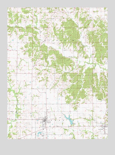
Green City, MO USGS Topographic Map
Click on map above to begin viewing in our Map Viewer.

This topographic map contains these locations and features:
Feature Name Type Latitude Longitude GNIS ID View Map
Beulah School (historical)SchoolN40.2961°W92.9691°733924View Map
Bookout BranchStreamN40.3247°W92.9135°714527View Map
Boon Hill School (historical)SchoolN40.3170°W92.9688°741548View Map
Brown (historical)Populated PlaceN40.3470°W92.9744°740189View Map
City of Green CityCivilN40.2639°W92.9563°2394975View Map
City of GreencastleCivilN40.2607°W92.8784°2394981View Map
Green CastlePopulated PlaceN40.2625°W92.8780°735634View Map
Green Castle Community Volunteer Fire DepartmentBuildingN40.2621°W92.8780°2620919View Map
Green Castle Post OfficePost OfficeN40.2622°W92.8785°760183View Map
Green CityPopulated PlaceN40.2686°W92.9533°735635View Map
Green City CemeteryCemeteryN40.2767°W92.9510°718787View Map
Green City Fire RescueBuildingN40.2756°W92.9536°2621738View Map
Green City Large ReservoirReservoirN40.2557°W92.9611°760440View Map
Green City Post OfficePost OfficeN40.2679°W92.9533°2782702View Map
Green City Rural Fire DepartmentBuildingN40.2660°W92.9563°2621061View Map
Green City Section 16 DamDamN40.2650°W92.9202°761763View Map
Green City Section 18 DamDamN40.2550°W92.9635°760439View Map
Harlan School (historical)SchoolN40.3270°W92.9138°741550View Map
Hawkeye CemeteryCemeteryN40.2761°W92.9974°719230View Map
Hazel Ridge School (historical)SchoolN40.2914°W92.9352°741551View Map
Kiddville School (historical)SchoolN40.2614°W92.9897°733925View Map
Mount Olive CemeteryCemeteryN40.2617°W92.9352°722805View Map
North Spring CreekStreamN40.3217°W92.8985°723495View Map
Overstreet CemeteryCemeteryN40.2878°W92.8816°723901View Map
Overstreet School (historical)SchoolN40.2839°W92.8888°733926View Map
PennvillePopulated PlaceN40.3628°W92.9469°741145View Map
Pennville School (historical)SchoolN40.3647°W92.9446°733927View Map
Spears BranchStreamN40.3364°W92.9508°726837View Map
Terry School (historical)SchoolN40.2611°W92.9069°741552View Map
Thompson School (historical)SchoolN40.3678°W92.8852°741549View Map
Township of BuchananCivilN40.3418°W92.9409°767442View Map
Township of PennCivilN40.2546°W92.9409°767448View Map
Victory School (historical)SchoolN40.3636°W92.9683°741547View Map
Widmark AirportAirportN40.2549°W92.9566°758704View Map

Note: Coordinates in the location and feature list above are referenced to NAD83 datum.


Copyright (C) 2008-2024 Ryan Niemi / Sunset Dynamics ... All Rights Reserved