TopoQuest Logo
Do you find TopoQuest useful?
Help keep TopoQuest running and adding new maps/features by donating!
Bitcoin:  19c7KJd3qBynnjoSw5npx9KScwjBe4ifkT
Litecoin:  LXs6TkuXGGXo1vDsWCkWVdjQX94eUKd6ui
Home View Maps Find Maps Find Places Resources & Links


Greenough, Montana Topographic Map

USGS Map Title: Greenough, MT
USGS Map MRC: 46113H4
DRG (GeoTIFF) Download: o46113h4.tif


Neighboring USGS Topographic Map Quads:


  Belmont Point, MT  
47113A5
 

  Salmon Lake, MT  
47113A4
 

  Woodworth, MT  
47113A3
 

  Potomac, MT  
46113H5
 

  Greenough, MT  
46113H4
 

  Bata Mountain, MT  
46113H3
 

  Mineral Ridge, MT  
46113G5
 

  Union Peak, MT  
46113G4
 

  Elevation Mountain, MT  
46113G3


Map MRC Location:

N47°
W114°
N47°
W113°
H8 H7 H6 H5 H4 H3 H2 H1
G8 G7 G6 G5 G4 G3 G2 G1
F8 F7 F6 F5 F4 F3 F2 F1
E8 E7 E6 E5 E4 E3 E2 E1
D8 D7 D6 D5 D4 D3 D2 D1
C8 C7 C6 C5 C4 C3 C2 C1
B8 B7 B6 B5 B4 B3 B2 B1
A8 A7 A6 A5 A4 A3 A2 A1
N46°
W114°
N46°
W113°

Greenough, MT USGS 1:24K Topographic Map Preview:
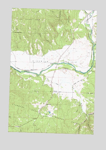
Greenough, MT USGS Topographic Map
Click on map above to begin viewing in our Map Viewer.

This topographic map contains these locations and features:
Feature Name Type Latitude Longitude GNIS ID View Map
13N14W06BCAB01 WellWellN46.9141°W113.4251°819348View Map
14N14W04BCCD01 WellWellN46.9974°W113.3854°820033View Map
14N14W04BDBD01 WellWellN46.9991°W113.3804°820044View Map
14N15W24DDAC01 WellWellN46.9483°W113.4306°819570View Map
14N15W24DDCD01 WellWellN46.9469°W113.4329°819565View Map
BaritePopulated PlaceN46.9452°W113.4387°779358View Map
Big Blackfoot Railroad Historical MarkerParkN46.9994°W113.3801°1813137View Map
Black CanyonValleyN46.9572°W113.4879°779989View Map
Blanchard CreekStreamN46.9960°W113.3865°780089View Map
Cap Wallace GulchValleyN46.8941°W113.3842°780922View Map
Clearwater RiverStreamN46.9647°W113.3787°781367View Map
Clearwater State ForestForestN46.9330°W113.4076°781368View Map
Elk CreekStreamN46.9344°W113.4565°783066View Map
Fish CreekStreamN46.9427°W113.3812°783431View Map
GreenoughPopulated PlaceN46.9166°W113.4367°784307View Map
Greenough Post Office (historical)Post OfficeN46.9169°W113.4347°784311View Map
Greenough Potomac Fire Station 2BuildingN46.9473°W113.4316°2546508View Map
Haywire GulchValleyN46.9052°W113.3967°784675View Map
Hunter Point Lookout TowerTowerN46.9405°W113.4212°799324View Map
Jamison GulchValleyN46.9585°W113.4395°785417View Map
Jones MeadowFlatN46.8952°W113.4367°785563View Map
Jones Meadow DamDamN46.8966°W113.4426°796274View Map
Little Fish CreekStreamN46.9391°W113.3859°786289View Map
Lubrecht CampLocaleN46.8922°W113.4498°786699View Map
Lubrecht Camp Ski AreaLocaleN46.8955°W113.4481°794316View Map
Lubrecht State Experimental ForestForestN46.8916°W113.4342°1781219View Map
Ninemile PrairieFlatN46.9474°W113.4412°788015View Map
Roundup Fishing Access SiteLocaleN46.9435°W113.4348°1744389View Map
Stinkwater CreekStreamN46.8919°W113.3840°791532View Map
SunsetPopulated PlaceN46.9380°W113.4667°791710View Map
Sunset HillSummitN46.9269°W113.4029°791714View Map
Sunset SchoolSchoolN46.9163°W113.4281°791724View Map
Warren CreekStreamN46.9099°W113.3948°792842View Map
Woodchuck CanyonValleyN46.9641°W113.4106°793494View Map

Note: Coordinates in the location and feature list above are referenced to NAD83 datum.


Copyright (C) 2008-2025 Ryan Niemi / Sunset Dynamics ... All Rights Reserved