TopoQuest Logo
Do you find TopoQuest useful?
Help keep TopoQuest running and adding new maps/features by donating!
Bitcoin:  19c7KJd3qBynnjoSw5npx9KScwjBe4ifkT
Litecoin:  LXs6TkuXGGXo1vDsWCkWVdjQX94eUKd6ui
Home View Maps Find Maps Find Places Resources & Links


Potomac, Montana Topographic Map

USGS Map Title: Potomac, MT
USGS Map MRC: 46113H5
DRG (GeoTIFF) Download: o46113h5.tif


Neighboring USGS Topographic Map Quads:


  Gold Creek Peak, MT  
47113A6
 

  Belmont Point, MT  
47113A5
 

  Salmon Lake, MT  
47113A4
 

  Sunflower Mountain, MT  
46113H6
 

  Potomac, MT  
46113H5
 

  Greenough, MT  
46113H4
 

  Clinton, MT  
46113G6
 

  Mineral Ridge, MT  
46113G5
 

  Union Peak, MT  
46113G4


Map MRC Location:

N47°
W114°
N47°
W113°
H8 H7 H6 H5 H4 H3 H2 H1
G8 G7 G6 G5 G4 G3 G2 G1
F8 F7 F6 F5 F4 F3 F2 F1
E8 E7 E6 E5 E4 E3 E2 E1
D8 D7 D6 D5 D4 D3 D2 D1
C8 C7 C6 C5 C4 C3 C2 C1
B8 B7 B6 B5 B4 B3 B2 B1
A8 A7 A6 A5 A4 A3 A2 A1
N46°
W114°
N46°
W113°

Potomac, MT USGS 1:24K Topographic Map Preview:
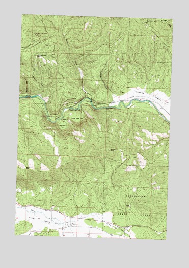
Potomac, MT USGS Topographic Map
Click on map above to begin viewing in our Map Viewer.

This topographic map contains these locations and features:
Feature Name Type Latitude Longitude GNIS ID View Map
Ashby CreekStreamN46.8824°W113.5895°779165View Map
Belmont CreekStreamN46.9541°W113.5704°779674View Map
Belmont Creek Fishing Access SiteLocaleN46.9533°W113.5665°1744384View Map
Blixit CreekStreamN46.8780°W113.6073°780113View Map
Buck CreekStreamN46.9538°W113.6193°780509View Map
Camas CreekStreamN46.8849°W113.5962°780806View Map
Camas PrairieFlatN46.8869°W113.6212°780814View Map
Corricks Riverbed Fishing Access SiteLocaleN46.9513°W113.5384°1744269View Map
Dunnigan GulchValleyN46.9533°W113.5484°782711View Map
Goforth (historical)LocaleN46.9527°W113.5426°1781288View Map
Goose RockPillarN46.9477°W113.5770°784115View Map
Goose Rock FlatFlatN46.9416°W113.5773°784116View Map
Greenough Potomac Fire Department Station 1BuildingN46.8808°W113.5756°1781334View Map
Little Belmont CreekStreamN46.9535°W113.6087°786237View Map
Little Belmont PointSummitN46.9769°W113.6129°786238View Map
Morrison PeakSummitN46.9249°W113.5495°787716View Map
Ninemile Prairie Fishing Access SiteLocaleN46.9444°W113.5026°1744388View Map
PotomacPopulated PlaceN46.8816°W113.5795°789137View Map
Potomac (historical)LocaleN46.8816°W113.5795°1781316View Map
Potomac Elementary SchoolSchoolN46.8816°W113.5798°1781394View Map
Potomac Post Office (historical)Post OfficeN46.8819°W113.5791°789138View Map
Potomac School (historical)SchoolN46.8816°W113.5795°1781317View Map
R Wills DamDamN46.8999°W113.6176°796275View Map
Red RockPillarN46.9410°W113.5901°789475View Map
Red Rock FlatFlatN46.9374°W113.5895°789478View Map
Steves PassGapN46.9130°W113.6190°791507View Map
SW Section 23 MineMineN46.9388°W113.5795°803088View Map
Thibideau RapidsRapidsN46.9532°W113.6213°792061View Map
Thibodeau Fishing Access SiteLocaleN46.9524°W113.6118°1744383View Map
Whitaker BridgeBridgeN46.9427°W113.6020°793183View Map
Whitaker Bridge Fishing Access SiteLocaleN46.9427°W113.5998°1744386View Map

Note: Coordinates in the location and feature list above are referenced to NAD83 datum.


Copyright (C) 2008-2024 Ryan Niemi / Sunset Dynamics ... All Rights Reserved