TopoQuest Logo
Do you find TopoQuest useful?
Help keep TopoQuest running and adding new maps/features by donating!
Bitcoin:  19c7KJd3qBynnjoSw5npx9KScwjBe4ifkT
Litecoin:  LXs6TkuXGGXo1vDsWCkWVdjQX94eUKd6ui
Home View Maps Find Maps Find Places Resources & Links


Salmon Lake, Montana Topographic Map

USGS Map Title: Salmon Lake, MT
USGS Map MRC: 47113A4
DRG (GeoTIFF) Download: o47113a4.tif


Neighboring USGS Topographic Map Quads:


  Seeley Lake West, MT  
47113B5
 

  Seeley Lake East, MT  
47113B4
 

  Morrell Mountain, MT  
47113B3
 

  Belmont Point, MT  
47113A5
 

  Salmon Lake, MT  
47113A4
 

  Woodworth, MT  
47113A3
 

  Potomac, MT  
46113H5
 

  Greenough, MT  
46113H4
 

  Bata Mountain, MT  
46113H3


Map MRC Location:

N48°
W114°
N48°
W113°
H8 H7 H6 H5 H4 H3 H2 H1
G8 G7 G6 G5 G4 G3 G2 G1
F8 F7 F6 F5 F4 F3 F2 F1
E8 E7 E6 E5 E4 E3 E2 E1
D8 D7 D6 D5 D4 D3 D2 D1
C8 C7 C6 C5 C4 C3 C2 C1
B8 B7 B6 B5 B4 B3 B2 B1
A8 A7 A6 A5 A4 A3 A2 A1
N47°
W114°
N47°
W113°

Salmon Lake, MT USGS 1:24K Topographic Map Preview:
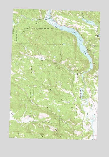
Salmon Lake, MT USGS Topographic Map
Click on map above to begin viewing in our Map Viewer.

This topographic map contains these locations and features:
Feature Name Type Latitude Longitude GNIS ID View Map
15N14W05ABAB01 WellWellN47.0913°W113.3959°820686View Map
15N14W09BBCA01 WellWellN47.0749°W113.3854°820580View Map
15N14W09CBBC01 WellWellN47.0688°W113.3867°820539View Map
Big Sky LakeLakeN47.1145°W113.3916°783441View Map
Blanchard LakeLakeN47.0191°W113.3819°780092View Map
Boyd MountainSummitN47.0630°W113.3767°780335View Map
ClearwaterPopulated PlaceN47.0002°W113.3779°781365View Map
Clearwater (historical)LocaleN47.0002°W113.3767°1781309View Map
Clearwater Junction Fishing Access SiteLocaleN47.0044°W113.3823°1744375View Map
Clearwater Post Office (historical)Post OfficeN47.0002°W113.3767°1781308View Map
Cold BrookStreamN47.0191°W113.4959°781487View Map
Elbow LakeLakeN47.0427°W113.3966°783027View Map
Fish CreekStreamN47.0944°W113.4004°783433View Map
Harpers LakeLakeN47.0230°W113.3808°784561View Map
Harpers Lake Fishing Access SiteLocaleN47.0210°W113.3876°1744372View Map
Lost Horse CreekStreamN47.0344°W113.3965°786601View Map
Lost PrairieFlatN47.0780°W113.4595°786628View Map
Lost Prairie CreekStreamN47.0502°W113.4006°786630View Map
North Fork Blanchard CreekStreamN47.0160°W113.4195°788099View Map
Owl CreekStreamN47.1152°W113.4429°788545View Map
Saint Joseph ChurchChurchN47.0747°W113.3856°789934View Map
Salmon LakeLakeN47.0998°W113.4076°798929View Map
Salmon LakeLakeN47.0949°W113.4031°789971View Map
Salmon Lake CampgroundLocaleN47.0869°W113.3926°1781537View Map
Salmon Lake State ParkParkN47.0930°W113.3967°1781521View Map
Sourdough IslandIslandN47.1041°W113.4109°790865View Map
Sourdough Island on Salmon Lake HeliportAirportN47.0997°W113.4184°806520View Map

Note: Coordinates in the location and feature list above are referenced to NAD83 datum.


Copyright (C) 2008-2025 Ryan Niemi / Sunset Dynamics ... All Rights Reserved