TopoQuest Logo
Do you find TopoQuest useful?
Help keep TopoQuest running and adding new maps/features by donating!
Bitcoin:  19c7KJd3qBynnjoSw5npx9KScwjBe4ifkT
Litecoin:  LXs6TkuXGGXo1vDsWCkWVdjQX94eUKd6ui
Home View Maps Find Maps Find Places Resources & Links


Greenville, Maine Topographic Map

USGS Map Title: Greenville, ME
USGS Map MRC: 45069D5
DRG (GeoTIFF) Download: o45069d5.tif


Neighboring USGS Topographic Map Quads:


  Moosehead, ME  
45069E6
 

  Lily Bay, ME  
45069E5
 

  Number Four Mountain, ME  
45069E4
 

  Big Squaw Pond, ME  
45069D6
 

  Greenville, ME  
45069D5
 

  Barren Mountain West, ME  
45069D4
 

  Bald Mountain Pond, ME  
45069C6
 

  Monson West, ME  
45069C5
 

  Monson East, ME  
45069C4


Map MRC Location:

N46°
W70°
N46°
W69°
H8 H7 H6 H5 H4 H3 H2 H1
G8 G7 G6 G5 G4 G3 G2 G1
F8 F7 F6 F5 F4 F3 F2 F1
E8 E7 E6 E5 E4 E3 E2 E1
D8 D7 D6 D5 D4 D3 D2 D1
C8 C7 C6 C5 C4 C3 C2 C1
B8 B7 B6 B5 B4 B3 B2 B1
A8 A7 A6 A5 A4 A3 A2 A1
N45°
W70°
N45°
W69°

Greenville, ME USGS 1:24K Topographic Map Preview:
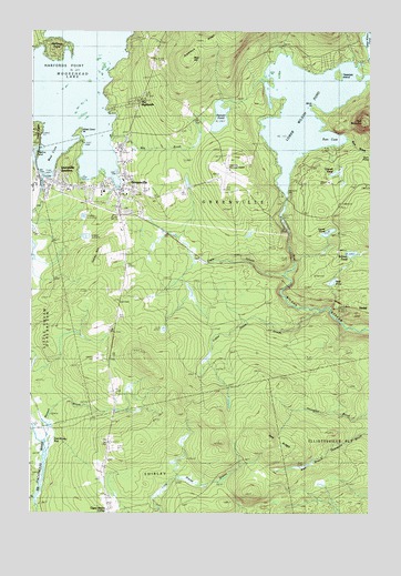
Greenville, ME USGS Topographic Map
Click on map above to begin viewing in our Map Viewer.

This topographic map contains these locations and features:
Feature Name Type Latitude Longitude GNIS ID View Map
Big Wilson Stream ReservoirReservoirN45.4539°W69.5317°1774604View Map
Birch PointCapeN45.4800°W69.5212°562342View Map
Blair HillSummitN45.4923°W69.5668°562540View Map
Charles A Dean Memorial HospitalHospitalN45.4589°W69.6113°1910037View Map
Coffee House StreamStreamN45.4273°W69.5178°564150View Map
Community HouseBuildingN45.4595°W69.5942°1910042View Map
Cove PointCapeN45.4742°W69.6217°578869View Map
Cove Point TownshipCivilN45.4737°W69.6232°1987332View Map
Eagle StreamStreamN45.4367°W69.5309°565507View Map
East Shirley BogSwampN45.3953°W69.6176°565685View Map
GreenvillePopulated PlaceN45.4595°W69.5906°567303View Map
Greenville CemeteryCemeteryN45.4530°W69.5895°1910069View Map
Greenville Census Designated PlaceCensusN45.4663°W69.5881°2377914View Map
Greenville Consolidated SchoolSchoolN45.4584°W69.5980°1910071View Map
Greenville Forestry Seaplane BaseAirportN45.4667°W69.5989°582156View Map
Greenville JunctionPopulated PlaceN45.4609°W69.6162°567304View Map
Greenville Junction Post OfficePost OfficeN45.4605°W69.6134°1910072View Map
Greenville Municipal AirportAirportN45.4653°W69.5538°581981View Map
Greenville Police DepartmentBuildingN45.4581°W69.5910°2735901View Map
Greenville Post OfficePost OfficeN45.4604°W69.5898°2789367View Map
Greenville Post Office (historical)Post OfficeN45.4606°W69.5903°1910073View Map
Greenville Seaplane BaseAirportN45.4612°W69.5973°582155View Map
Greenville Town OfficeBuildingN45.4581°W69.5898°1910074View Map
Greenville Volunteer Fire StationBuildingN45.4586°W69.5908°1910070View Map
Grenell PondLakeN45.4632°W69.5131°567320View Map
Harfords PointCapeN45.4948°W69.6145°567641View Map
Harfords Point TownshipCivilN45.4988°W69.6247°1987337View Map
Indian HillSummitN45.4414°W69.6001°568573View Map
Katahdin MuseumBuildingN45.4631°W69.5937°1910090View Map
Lower Wilson PondReservoirN45.4798°W69.5239°570558View Map
Lower Wilson Pond DamDamN45.4571°W69.5302°1773811View Map
Mill BrookStreamN45.4723°W69.5956°571306View Map
Moosehead Family CampgroundLocaleN45.4412°W69.5884°1910125View Map
Moosehead Marine MuseumBuildingN45.4625°W69.5912°1910127View Map
Mud PondLakeN45.4351°W69.5134°571922View Map
Nickerson Elementary SchoolSchoolN45.4585°W69.5990°1910132View Map
Oak RidgeRidgeN45.3925°W69.5348°572635View Map
Penstock DamDamN45.4521°W69.5326°1774603View Map
Peoples United Methodist ChurchChurchN45.4609°W69.6156°1910153View Map
Rum BrookStreamN45.4720°W69.5081°574568View Map
Rum CoveBayN45.4728°W69.5131°574573View Map
Rum MountainSummitN45.4768°W69.5021°574577View Map
Salmon PondLakeN45.4425°W69.5065°574774View Map
Sawyer PondLakeN45.4778°W69.5554°574973View Map
Secret PondLakeN45.4480°W69.5151°575218View Map
Shadow PondLakeN45.4683°W69.6240°575277View Map
Shaw Public LibraryBuildingN45.4596°W69.5911°1910176View Map
Teasdale IslandIslandN45.4889°W69.5114°576697View Map
The HighlandsPopulated PlaceN45.4812°W69.5845°576822View Map
Town of GreenvilleCivilN45.4632°W69.5470°582502View Map
Upper Shirley CornerPopulated PlaceN45.3753°W69.5953°579787View Map
West CoveBayN45.4684°W69.6195°578123View Map
West Cove PointCapeN45.4745°W69.6064°578125View Map
Wilson Pond CampsLocaleN45.4581°W69.5317°1910212View Map

Note: Coordinates in the location and feature list above are referenced to NAD83 datum.


Copyright (C) 2008-2025 Ryan Niemi / Sunset Dynamics ... All Rights Reserved