TopoQuest Logo
Do you find TopoQuest useful?
Help keep TopoQuest running and adding new maps/features by donating!
Bitcoin:  19c7KJd3qBynnjoSw5npx9KScwjBe4ifkT
Litecoin:  LXs6TkuXGGXo1vDsWCkWVdjQX94eUKd6ui
Home View Maps Find Maps Find Places Resources & Links


Moosehead, Maine Topographic Map

USGS Map Title: Moosehead, ME
USGS Map MRC: 45069E6
DRG (GeoTIFF) Download: o45069e6.tif


Neighboring USGS Topographic Map Quads:


  Brassua Lake East, ME  
45069F7
 

  Mount Kineo, ME  
45069F6
 

  Spencer Bay, ME  
45069F5
 

  Indian Pond North, ME  
45069E7
 

  Moosehead, ME  
45069E6
 

  Lily Bay, ME  
45069E5
 

  Indian Pond South, ME  
45069D7
 

  Big Squaw Pond, ME  
45069D6
 

  Greenville, ME  
45069D5


Map MRC Location:

N46°
W70°
N46°
W69°
H8 H7 H6 H5 H4 H3 H2 H1
G8 G7 G6 G5 G4 G3 G2 G1
F8 F7 F6 F5 F4 F3 F2 F1
E8 E7 E6 E5 E4 E3 E2 E1
D8 D7 D6 D5 D4 D3 D2 D1
C8 C7 C6 C5 C4 C3 C2 C1
B8 B7 B6 B5 B4 B3 B2 B1
A8 A7 A6 A5 A4 A3 A2 A1
N45°
W70°
N45°
W69°

Moosehead, ME USGS 1:24K Topographic Map Preview:
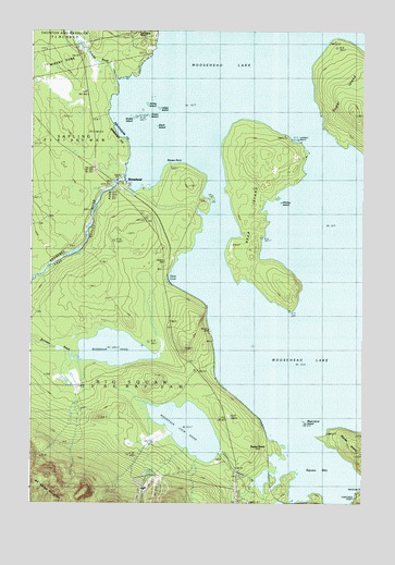
Moosehead, ME USGS Topographic Map
Click on map above to begin viewing in our Map Viewer.

This topographic map contains these locations and features:
Feature Name Type Latitude Longitude GNIS ID View Map
Big Moose TownshipCivilN45.5048°W69.7166°1987328View Map
Black IslandIslandN45.5992°W69.7026°562451View Map
Black Sand IslandIslandN45.5212°W69.6462°562508View Map
Burnham PondLakeN45.5409°W69.7185°563220View Map
Deep CoveBayN45.5595°W69.6973°564959View Map
Deer IslandIslandN45.5803°W69.6662°564987View Map
East Outlet DamDamN45.5859°W69.7146°1773671View Map
Forsythe BrookStreamN45.6117°W69.7170°566401View Map
Green IslandIslandN45.6023°W69.7051°567226View Map
Lambert IslandIslandN45.5959°W69.6489°569340View Map
Ledge IslandIslandN45.6046°W69.7018°569447View Map
Moose BayBayN45.5075°W69.6409°576183View Map
Moose BrookLocaleN45.5150°W69.6603°576184View Map
Moose IslandIslandN45.5156°W69.6289°571602View Map
Moose PointCapeN45.5898°W69.6920°576191View Map
MooseheadPopulated PlaceN45.5834°W69.7137°571640View Map
Moosehead LakeReservoirN45.5416°W69.6669°571641View Map
Mountain View PondLakeN45.5198°W69.6902°571817View Map
Sibley IslandIslandN45.6053°W69.7062°575446View Map
Snake IslandIslandN45.6020°W69.7109°575663View Map
Upper Moose BrookStreamN45.5095°W69.6528°577663View Map
Whiskey IslandIslandN45.5792°W69.6553°578333View Map

Note: Coordinates in the location and feature list above are referenced to NAD83 datum.


Copyright (C) 2008-2025 Ryan Niemi / Sunset Dynamics ... All Rights Reserved