TopoQuest Logo
Do you find TopoQuest useful?
Help keep TopoQuest running and adding new maps/features by donating!
Bitcoin:  19c7KJd3qBynnjoSw5npx9KScwjBe4ifkT
Litecoin:  LXs6TkuXGGXo1vDsWCkWVdjQX94eUKd6ui
Home View Maps Find Maps Find Places Resources & Links


Lily Bay, Maine Topographic Map

USGS Map Title: Lily Bay, ME
USGS Map MRC: 45069E5
DRG (GeoTIFF) Download: o45069e5.tif


Neighboring USGS Topographic Map Quads:


  Mount Kineo, ME  
45069F6
 

  Spencer Bay, ME  
45069F5
 

  Kokadjo, ME  
45069F4
 

  Moosehead, ME  
45069E6
 

  Lily Bay, ME  
45069E5
 

  Number Four Mountain, ME  
45069E4
 

  Big Squaw Pond, ME  
45069D6
 

  Greenville, ME  
45069D5
 

  Barren Mountain West, ME  
45069D4


Map MRC Location:

N46°
W70°
N46°
W69°
H8 H7 H6 H5 H4 H3 H2 H1
G8 G7 G6 G5 G4 G3 G2 G1
F8 F7 F6 F5 F4 F3 F2 F1
E8 E7 E6 E5 E4 E3 E2 E1
D8 D7 D6 D5 D4 D3 D2 D1
C8 C7 C6 C5 C4 C3 C2 C1
B8 B7 B6 B5 B4 B3 B2 B1
A8 A7 A6 A5 A4 A3 A2 A1
N45°
W70°
N45°
W69°

Lily Bay, ME USGS 1:24K Topographic Map Preview:
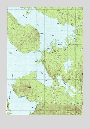
Lily Bay, ME USGS Topographic Map
Click on map above to begin viewing in our Map Viewer.

This topographic map contains these locations and features:
Feature Name Type Latitude Longitude GNIS ID View Map
Beaver CoveBayN45.5495°W69.5659°561923View Map
Beaver CreekStreamN45.5348°W69.5517°561924View Map
Birch IslandIslandN45.5712°W69.6203°562310View Map
Birch PointCapeN45.5498°W69.5798°562343View Map
Black PointCapeN45.5620°W69.5753°562484View Map
Bolton CoveBayN45.5206°W69.5962°562717View Map
Burgess BrookStreamN45.6056°W69.5264°563200View Map
Burnt Jacket MountainSummitN45.5314°W69.5939°563250View Map
Burnt Jacket PointCapeN45.5342°W69.6153°563252View Map
Caribou PointCapeN45.5420°W69.6098°563532View Map
Carleton PointCapeN45.6059°W69.5384°563547View Map
Dollar IslandIslandN45.5720°W69.5812°565189View Map
Doughnut CoveBayN45.6225°W69.5837°565232View Map
Galusha CoveBayN45.6050°W69.6012°566668View Map
Hyde IslandIslandN45.6181°W69.5914°568541View Map
Laker PointCapeN45.5873°W69.5409°569309View Map
Lily BayPopulated PlaceN45.6017°W69.5076°1988531View Map
Lily BayBayN45.5978°W69.5467°569553View Map
Lily Bay BrookStreamN45.5995°W69.5159°569555View Map
Lily Bay State ParkParkN45.5753°W69.5442°569557View Map
Little Mud PondLakeN45.5132°W69.5115°569927View Map
Mathews CoveBayN45.5800°W69.5381°570891View Map
McCuller IslandIslandN45.5739°W69.5728°570965View Map
Mud BrookStreamN45.5767°W69.5301°571841View Map
Mud CoveBayN45.5834°W69.5281°571857View Map
Mud PondLakeN45.5591°W69.5242°571925View Map
North BrookStreamN45.6006°W69.5081°572309View Map
Porcupine PointCapeN45.5939°W69.5706°573670View Map
Prong PondLakeN45.5340°W69.5280°573831View Map
Rowell CoveBayN45.5770°W69.5542°574554View Map
Sandy BayBayN45.5100°W69.5778°574865View Map
Scammon RidgeRidgeN45.5017°W69.5492°574983View Map
Ship IslandIslandN45.5720°W69.6026°575415View Map
Snake IslandIslandN45.5406°W69.5614°575662View Map
South BrookStreamN45.5945°W69.5173°575823View Map
Sugar IslandIslandN45.5970°W69.6089°576500View Map
Treasure IslandIslandN45.5467°W69.5620°577291View Map
Tussle BrookStreamN45.5814°W69.5112°577458View Map
Tussle LagoonLakeN45.5873°W69.5126°577459View Map
Twomile IslandIslandN45.5923°W69.5509°577514View Map

Note: Coordinates in the location and feature list above are referenced to NAD83 datum.


Copyright (C) 2008-2025 Ryan Niemi / Sunset Dynamics ... All Rights Reserved