TopoQuest Logo
Do you find TopoQuest useful?
Help keep TopoQuest running and adding new maps/features by donating!
Bitcoin:  19c7KJd3qBynnjoSw5npx9KScwjBe4ifkT
Litecoin:  LXs6TkuXGGXo1vDsWCkWVdjQX94eUKd6ui
Home View Maps Find Maps Find Places Resources & Links


Greenville Bench, Utah Topographic Map

USGS Map Title: Greenville Bench, UT
USGS Map MRC: 38112B6
DRG (GeoTIFF) Download: o38112b6.tif


Neighboring USGS Topographic Map Quads:


  Adamsville, UT  
38112C7
 

  Beaver, UT  
38112C6
 

  Black Ridge, UT  
38112C5
 

  Minersville Reservoir, UT  
38112B7
 

  Greenville Bench, UT  
38112B6
 

  Kane Canyon, UT  
38112B5
 

  Jack Henry Knoll, UT  
38112A7
 

  Buckhorn Flat, UT  
38112A6
 

  Burnt Peak, UT  
38112A5


Map MRC Location:

N39°
W113°
N39°
W112°
H8 H7 H6 H5 H4 H3 H2 H1
G8 G7 G6 G5 G4 G3 G2 G1
F8 F7 F6 F5 F4 F3 F2 F1
E8 E7 E6 E5 E4 E3 E2 E1
D8 D7 D6 D5 D4 D3 D2 D1
C8 C7 C6 C5 C4 C3 C2 C1
B8 B7 B6 B5 B4 B3 B2 B1
A8 A7 A6 A5 A4 A3 A2 A1
N38°
W113°
N38°
W112°

Greenville Bench, UT USGS 1:24K Topographic Map Preview:
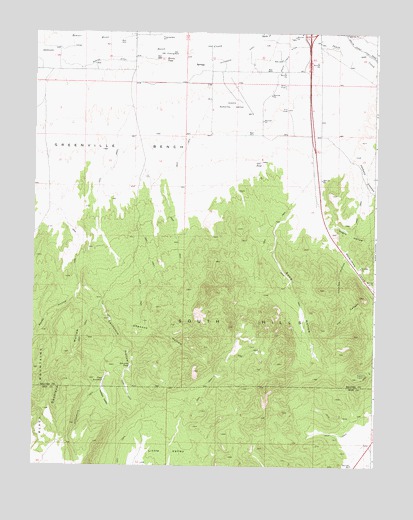
Greenville Bench, UT USGS Topographic Map
Click on map above to begin viewing in our Map Viewer.

This topographic map contains these locations and features:
Feature Name Type Latitude Longitude GNIS ID View Map
Aberdare CanalCanalN38.2450°W112.7405°1425036View Map
Barton DitchCanalN38.2419°W112.7236°1425306View Map
Beaver County Sheriff's Office BeaverBuildingN38.2427°W112.6519°2730356View Map
Beaver Municipal AirportAirportN38.2303°W112.6753°1434557View Map
California HollowValleyN38.1705°W112.7244°1426292View Map
CCC PondLakeN38.2126°W112.6670°1426247View Map
Devil CreekStreamN38.2469°W112.7213°1427363View Map
Doubleup HollowValleyN38.1719°W112.7311°1427457View Map
Greenville BenchBenchN38.2152°W112.7163°1428407View Map
Hell CanyonValleyN38.1727°W112.6261°1428637View Map
Howards PondLakeN38.1538°W112.7145°1428922View Map
Jims ReservoirReservoirN38.1497°W112.7241°1429170View Map
Jockeys CanyonValleyN38.2133°W112.6344°1442152View Map
Lockjaw HollowValleyN38.1852°W112.6361°1429845View Map
Morris PondLakeN38.2423°W112.7027°1430505View Map
Negro HollowValleyN38.1939°W112.6427°1430672View Map
Nevershine HollowValleyN38.1908°W112.6419°1443803View Map
Rattlesnake TrailTrailN38.1425°W112.7311°1431599View Map
Rocky HollowValleyN38.1755°W112.7336°1431960View Map
Sand HollowValleyN38.1939°W112.6613°1432190View Map
Shannon HollowValleyN38.1669°W112.7213°1432359View Map
South HillsSummitN38.1664°W112.6747°1432723View Map
Teddys ValleyValleyN38.1480°W112.7244°1433211View Map
Utah Highway Patrol Section 11 Beaver OfficeBuildingN38.2426°W112.6520°2730470View Map

Note: Coordinates in the location and feature list above are referenced to NAD83 datum.


Copyright (C) 2008-2025 Ryan Niemi / Sunset Dynamics ... All Rights Reserved