TopoQuest Logo
Do you find TopoQuest useful?
Help keep TopoQuest running and adding new maps/features by donating!
Bitcoin:  19c7KJd3qBynnjoSw5npx9KScwjBe4ifkT
Litecoin:  LXs6TkuXGGXo1vDsWCkWVdjQX94eUKd6ui
Home View Maps Find Maps Find Places Resources & Links


Greenville East, Ohio Topographic Map

USGS Map Title: Greenville East, OH
USGS Map MRC: 40084A5
DRG (GeoTIFF) Download: o40084a5.tif


Neighboring USGS Topographic Map Quads:


  Ansonia, OH  
40084B6
 

  Dawn, OH  
40084B5
 

  Versailles, OH  
40084B4
 

  Greenville West, OH  
40084A6
 

  Greenville East, OH  
40084A5
 

  Gettysburg, OH  
40084A4
 

  New Madison, OH  
39084H6
 

  Arcanum, OH  
39084H5
 

  Laura, OH  
39084H4


Map MRC Location:

N41°
W85°
N41°
W84°
H8 H7 H6 H5 H4 H3 H2 H1
G8 G7 G6 G5 G4 G3 G2 G1
F8 F7 F6 F5 F4 F3 F2 F1
E8 E7 E6 E5 E4 E3 E2 E1
D8 D7 D6 D5 D4 D3 D2 D1
C8 C7 C6 C5 C4 C3 C2 C1
B8 B7 B6 B5 B4 B3 B2 B1
A8 A7 A6 A5 A4 A3 A2 A1
N40°
W85°
N40°
W84°

Greenville East, OH USGS 1:24K Topographic Map Preview:
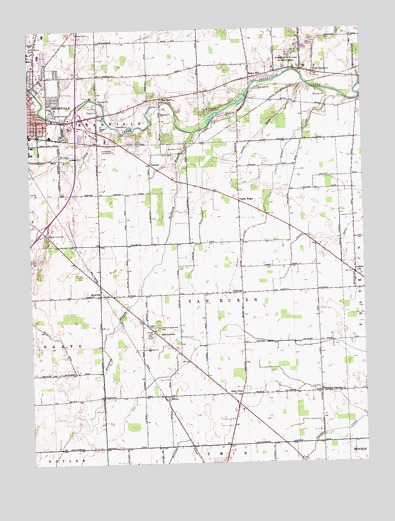
Greenville East, OH USGS Topographic Map
Click on map above to begin viewing in our Map Viewer.

This topographic map contains these locations and features:
Feature Name Type Latitude Longitude GNIS ID View Map
AbbottsvillePopulated PlaceN40.0375°W84.5783°1064291View Map
Abbottsville Post Office (historical)Post OfficeN40.0375°W84.5777°1968011View Map
Abbottsville United Methodist ChurchChurchN40.0381°W84.5788°1051874View Map
Abney FarmsLocaleN40.1092°W84.5811°2710761View Map
Arcanum Greenlawn CemeteryCemeteryN40.0395°W84.5774°1037465View Map
Baker Landing Field (historical)AirportN40.0098°W84.5222°1082462View Map
Bears MillPopulated PlaceN40.1109°W84.5408°1048497View Map
Besecker FarmLocaleN40.0400°W84.5503°2710780View Map
Bolton RunStreamN40.1131°W84.5261°1065932View Map
Bridge CreekStreamN40.0978°W84.5941°1038302View Map
Brumbaugh FarmsLocaleN40.0506°W84.5533°2710768View Map
City of GreenvilleCivilN40.1042°W84.6209°2394994View Map
ConcordPopulated PlaceN40.0862°W84.5786°1048623View Map
County Home CemeteryCemeteryN40.0664°W84.6186°1039401View Map
Darke Company Lake Wildlife Area PondReservoirN40.1195°W84.5210°1078626View Map
Darke Company Lake Wildlife Area Pond Five DamDamN40.1200°W84.5216°1078625View Map
Darke County Lake Wildlife AreaParkN40.1150°W84.5275°1075129View Map
DelislePopulated PlaceN40.0195°W84.5741°1064524View Map
Delisle Post Office (historical)Post OfficeN40.0195°W84.5736°1968026View Map
Dividing BranchStreamN40.0956°W84.5625°1065977View Map
East Zion Community CemeteryCemeteryN40.1048°W84.5749°1806160View Map
East Zion Congregational Christian ChurchChurchN40.1050°W84.5741°1061034View Map
Fourmans CornersPopulated PlaceN40.0201°W84.5177°1048753View Map
Greenville Area RescueBuildingN40.0920°W84.6171°2550954View Map
Greenville Country ClubLocaleN40.1023°W84.5563°1080107View Map
Greenville Electric Generating StationBuildingN40.0761°W84.6139°2542573View Map
Greenville Industrial ParkLocaleN40.0884°W84.5905°1055516View Map
Greenville Township Fire Department Station 5BuildingN40.0916°W84.6175°2550614View Map
Heller DitchCanalN40.0642°W84.5147°1041474View Map
JaysvillePopulated PlaceN40.0481°W84.5991°1048870View Map
Jaysville Post Office (historical)Post OfficeN40.0487°W84.5986°1782030View Map
LandisPopulated PlaceN40.0542°W84.5030°1048905View Map
Landis Post Office (historical)Post OfficeN40.0542°W84.5027°1968181View Map
Lansdowne Landing Strip (historical)AirportN40.0892°W84.5977°1074887View Map
Lindemuth FarmsLocaleN40.0356°W84.5583°2710783View Map
Martin CemeteryCemeteryN40.0892°W84.5699°1043018View Map
McQuay DitchCanalN40.0784°W84.5336°1043144View Map
New HarrisonPopulated PlaceN40.1123°W84.5175°1049009View Map
New Harrison Post Office (historical)Post OfficeN40.1125°W84.5180°1968189View Map
NinevehPopulated PlaceN40.0489°W84.5452°1049014View Map
Old Abbottsville CemeteryCemeteryN40.0395°W84.5830°1806183View Map
Olwine Mobile Home ParkPopulated PlaceN40.0917°W84.6111°2634655View Map
Oswalt FarmsLocaleN40.0033°W84.6081°2646640View Map
Poplar DitchCanalN40.0875°W84.5527°1044689View Map
Poplar RidgePopulated PlaceN40.0753°W84.5455°1049100View Map
Poplar Ridge Post Office (historical)Post OfficeN40.0750°W84.5458°1968195View Map
Ross FarmLocaleN40.0161°W84.5922°2710782View Map
Routzong PreserveParkN40.0737°W84.5352°1806190View Map
Saint Marys CemeteryCemeteryN40.1242°W84.6072°1806192View Map
Sampson (historical)Populated PlaceN40.0048°W84.5983°1084315View Map
Sampson Post Office (historical)Post OfficeN40.0042°W84.5986°1968200View Map
Steel PointPopulated PlaceN40.0198°W84.5472°1049209View Map
Tegtmeyer FarmsLocaleN40.0561°W84.5303°2710777View Map
Township of Van BurenCivilN40.0447°W84.5495°1086024View Map
Treaty City Airport (historical)AirportN40.1223°W84.6191°1084479View Map
Trump AirportAirportN40.1239°W84.5816°2442493View Map

Note: Coordinates in the location and feature list above are referenced to NAD83 datum.


Copyright (C) 2008-2024 Ryan Niemi / Sunset Dynamics ... All Rights Reserved