TopoQuest Logo
Do you find TopoQuest useful?
Help keep TopoQuest running and adding new maps/features by donating!
Bitcoin:  19c7KJd3qBynnjoSw5npx9KScwjBe4ifkT
Litecoin:  LXs6TkuXGGXo1vDsWCkWVdjQX94eUKd6ui
Home View Maps Find Maps Find Places Resources & Links


New Madison, Ohio Topographic Map

USGS Map Title: New Madison, OH
USGS Map MRC: 39084H6
DRG (GeoTIFF) Download: o39084h6.tif


Neighboring USGS Topographic Map Quads:


  Spartanburg, IN  
40084A7
 

  Greenville West, OH  
40084A6
 

  Greenville East, OH  
40084A5
 

  Whitewater, IN  
39084H7
 

  New Madison, OH  
39084H6
 

  Arcanum, OH  
39084H5
 

  New Paris, OH  
39084G7
 

  Eaton North, OH  
39084G6
 

  Lewisburg, OH  
39084G5


Map MRC Location:

N40°
W85°
N40°
W84°
H8 H7 H6 H5 H4 H3 H2 H1
G8 G7 G6 G5 G4 G3 G2 G1
F8 F7 F6 F5 F4 F3 F2 F1
E8 E7 E6 E5 E4 E3 E2 E1
D8 D7 D6 D5 D4 D3 D2 D1
C8 C7 C6 C5 C4 C3 C2 C1
B8 B7 B6 B5 B4 B3 B2 B1
A8 A7 A6 A5 A4 A3 A2 A1
N39°
W85°
N39°
W84°

New Madison, OH USGS 1:24K Topographic Map Preview:
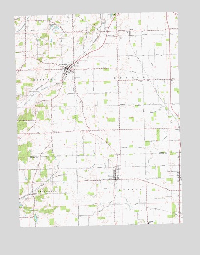
New Madison, OH USGS Topographic Map
Click on map above to begin viewing in our Map Viewer.

This topographic map contains these locations and features:
Feature Name Type Latitude Longitude GNIS ID View Map
Beard LateralCanalN39.9137°W84.6475°1037730View Map
BrinleyPopulated PlaceN39.8945°W84.7397°1062665View Map
Brinley Post Office (historical)Post OfficeN39.8945°W84.7402°2043833View Map
Butler Middle SchoolSchoolN39.9598°W84.6311°1055502View Map
C R Coblentz Middle SchoolSchoolN39.8756°W84.6516°1057762View Map
Coovert DitchCanalN39.8881°W84.6855°1039356View Map
Disher DitchCanalN39.9098°W84.6902°1039716View Map
EldoradoPopulated PlaceN39.9020°W84.6750°1061050View Map
Eldorado Post OfficePost OfficeN39.9022°W84.6768°2042497View Map
Eldorado United Methodist ChurchChurchN39.9053°W84.6761°1063213View Map
Eldorado Village Fire DepartmentBuildingN39.9019°W84.6749°2549660View Map
Etzler FarmsLocaleN39.9522°W84.6514°2710785View Map
First Universalist CemeteryCemeteryN39.9670°W84.7061°1806161View Map
First Universalist ChurchChurchN39.9664°W84.7063°1806162View Map
Foutz CemeteryCemeteryN39.9948°W84.6813°1040625View Map
Fox DitchCanalN39.8950°W84.6877°1040631View Map
Greenmound CemeteryCemeteryN39.9620°W84.7058°1041147View Map
Grossnickle DitchCanalN39.9423°W84.6411°1041192View Map
Halls LakeReservoirN39.8801°W84.7374°1041253View Map
HamburgPopulated PlaceN39.8873°W84.6763°1064780View Map
Hamburg CemeteryCemeteryN39.8870°W84.6790°1961427View Map
Harter CemeteryCemeteryN39.9748°W84.6950°1041373View Map
HewittPopulated PlaceN39.9892°W84.6830°1064828View Map
Lakeview School (historical)SchoolN39.9931°W84.7238°1055524View Map
M and M FarmsLocaleN39.8844°W84.7494°2724095View Map
Maple Swamp DitchCanalN39.9623°W84.6413°1042975View Map
Marland Peat PitsMineN39.9903°W84.7172°1043000View Map
Monroe CemeteryCemeteryN39.8878°W84.6563°1961432View Map
New MadisonPopulated PlaceN39.9678°W84.7091°1056450View Map
New Madison Fire Department Station 11BuildingN39.9698°W84.7071°2549731View Map
New Madison Police DepartmentBuildingN39.9664°W84.7093°2733045View Map
New Madison Post OfficePost OfficeN39.9680°W84.7075°1967972View Map
New Madison United Methodist ChurchChurchN39.9689°W84.7086°1051887View Map
North Central Ambulance DistrictBuildingN39.9034°W84.6751°2550935View Map
OtterbeinPopulated PlaceN39.9459°W84.6716°1062926View Map
Otterbein CemeteryCemeteryN39.9455°W84.6705°1806185View Map
Ritzy FarmLocaleN39.9986°W84.6675°2646637View Map
SavonaPopulated PlaceN39.9895°W84.6616°1065290View Map
Savona Post Office (historical)Post OfficeN39.9889°W84.6611°1968201View Map
Stephens DitchCanalN39.9245°W84.6380°1046672View Map
Sullenbarger FarmsLocaleN39.9614°W84.6503°2710781View Map
Township of ButlerCivilN39.9604°W84.6511°1086012View Map
Tri - Village Rescue ServicesBuildingN39.9729°W84.7043°2550792View Map
Tri-Village High SchoolSchoolN39.9648°W84.7116°1055558View Map
Unitarian Universalist ChurchChurchN39.9028°W84.6744°1063214View Map
Vanzant FarmsLocaleN39.8778°W84.7364°2724093View Map
Village of EldoradoCivilN39.9043°W84.6753°2398796View Map
Village of New MadisonCivilN39.9678°W84.7081°2399474View Map
Village of West ManchesterCivilN39.9033°W84.6263°2400137View Map
Village ParkParkN39.9081°W84.6730°1047459View Map
Welker LateralCanalN39.9520°W84.7036°1047665View Map
West ManchesterPopulated PlaceN39.9026°W84.6263°1061731View Map
West Manchester Fire DepartmentBuildingN39.9021°W84.6251°2550443View Map
West Manchester Post OfficePost OfficeN39.9021°W84.6259°2042491View Map
Wilt CemeteryCemeteryN39.9482°W84.7000°1047990View Map
YankeetownPopulated PlaceN39.9298°W84.7222°1056582View Map
Yankeetown CemeteryCemeteryN39.9357°W84.7217°1048179View Map
Yankeetown Post Office (historical)Post OfficeN39.9292°W84.7222°1968213View Map

Note: Coordinates in the location and feature list above are referenced to NAD83 datum.


Copyright (C) 2008-2024 Ryan Niemi / Sunset Dynamics ... All Rights Reserved