TopoQuest Logo
Do you find TopoQuest useful?
Help keep TopoQuest running and adding new maps/features by donating!
Bitcoin:  19c7KJd3qBynnjoSw5npx9KScwjBe4ifkT
Litecoin:  LXs6TkuXGGXo1vDsWCkWVdjQX94eUKd6ui
Home View Maps Find Maps Find Places Resources & Links


Arcanum, Ohio Topographic Map

USGS Map Title: Arcanum, OH
USGS Map MRC: 39084H5
DRG (GeoTIFF) Download: o39084h5.tif


Neighboring USGS Topographic Map Quads:


  Greenville West, OH  
40084A6
 

  Greenville East, OH  
40084A5
 

  Gettysburg, OH  
40084A4
 

  New Madison, OH  
39084H6
 

  Arcanum, OH  
39084H5
 

  Laura, OH  
39084H4
 

  Eaton North, OH  
39084G6
 

  Lewisburg, OH  
39084G5
 

  Brookville, OH  
39084G4


Map MRC Location:

N40°
W85°
N40°
W84°
H8 H7 H6 H5 H4 H3 H2 H1
G8 G7 G6 G5 G4 G3 G2 G1
F8 F7 F6 F5 F4 F3 F2 F1
E8 E7 E6 E5 E4 E3 E2 E1
D8 D7 D6 D5 D4 D3 D2 D1
C8 C7 C6 C5 C4 C3 C2 C1
B8 B7 B6 B5 B4 B3 B2 B1
A8 A7 A6 A5 A4 A3 A2 A1
N39°
W85°
N39°
W84°

Arcanum, OH USGS 1:24K Topographic Map Preview:
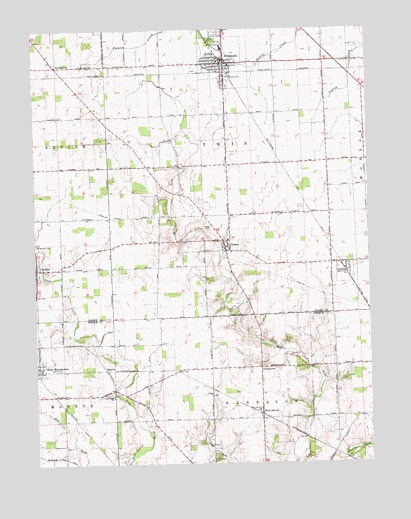
Arcanum, OH USGS Topographic Map
Click on map above to begin viewing in our Map Viewer.

This topographic map contains these locations and features:
Feature Name Type Latitude Longitude GNIS ID View Map
ArcanumPopulated PlaceN39.9901°W84.5533°1066324View Map
Arcanum City BuildingBuildingN39.9901°W84.5538°1960686View Map
Arcanum Community Rescue SquadBuildingN39.9884°W84.5535°2550746View Map
Arcanum Elementary SchoolSchoolN39.9951°W84.5544°1055492View Map
Arcanum High SchoolSchoolN39.9942°W84.5541°1055493View Map
Arcanum Post OfficePost OfficeN39.9903°W84.5527°1967965View Map
Arcanum Public LibraryBuildingN39.9923°W84.5536°1960687View Map
Arcanum Village Police DepartmentBuildingN39.9900°W84.5545°2732616View Map
Arcanum Volunteer Fire DepartmentBuildingN39.9880°W84.5536°2550045View Map
Beech Grove CemeteryCemeteryN39.9909°W84.6180°1806151View Map
Beech Grove Post Office (historical)Post OfficeN39.9889°W84.6166°1968015View Map
BeechgrovePopulated PlaceN39.9895°W84.6161°1064400View Map
Blumenstock School (historical)SchoolN39.9612°W84.5230°1055498View Map
Brown CemeteryCemeteryN39.8948°W84.5955°1961415View Map
BrownsPopulated PlaceN39.9026°W84.5997°1062668View Map
Brumbaugh Fruit FarmLocaleN39.9922°W84.5664°2710790View Map
Carrolls FarmLocaleN39.9400°W84.5564°2710784View Map
CastinePopulated PlaceN39.9317°W84.6244°1056774View Map
Castine Church of the BrethrenChurchN39.9312°W84.6222°1063173View Map
Castine Post OfficePost OfficeN39.9320°W84.6244°1967966View Map
Castine United Methodist ChurchChurchN39.9328°W84.6244°1063172View Map
Deejay FarmsLocaleN39.9589°W84.5908°2710786View Map
Dry Fork Baptist CemeteryCemeteryN39.8806°W84.6150°1961421View Map
Faith United Methodist ChurchChurchN39.9906°W84.5516°1051879View Map
Gebhart FarmLocaleN39.9044°W84.5658°2724174View Map
GeorgetownPopulated PlaceN39.9014°W84.5411°1062781View Map
GordonPopulated PlaceN39.9306°W84.5086°1064740View Map
Gordon CemeteryCemeteryN39.9284°W84.5063°1806165View Map
Gordon Post OfficePost OfficeN39.9306°W84.5083°1967970View Map
Heins FieldAirportN39.9704°W84.5419°2442593View Map
Holsapple School (historical)SchoolN39.9606°W84.6158°1055520View Map
Hunt CemeteryCemeteryN39.9100°W84.5313°1961429View Map
Immanuel Baptist ChurchChurchN39.9898°W84.5597°1051885View Map
IthacaPopulated PlaceN39.9373°W84.5533°1064893View Map
Ithaca CemeteryCemeteryN39.9431°W84.5597°1042013View Map
Ithaca Lutheran CemeteryCemeteryN39.9356°W84.5516°1806171View Map
Ithaca Post Office (historical)Post OfficeN39.9376°W84.5527°1968180View Map
Ithaca United Methodist ChurchChurchN39.9395°W84.5527°1083186View Map
Neely School (historical)SchoolN39.9909°W84.5205°1055534View Map
New Castine CemeteryCemeteryN39.9306°W84.6211°1806178View Map
Old Castine CemeteryCemeteryN39.9382°W84.6248°1044088View Map
Salisbury Tree FarmLocaleN39.8900°W84.5233°2724179View Map
Township of TwinCivilN39.9614°W84.5519°1086023View Map
Trinity United Methodist ChurchChurchN39.9898°W84.5552°1051895View Map
Twin Creek ChurchChurchN39.8942°W84.5966°1047242View Map
Village of ArcanumCivilN39.9923°W84.5543°2397978View Map
Village of CastineCivilN39.9310°W84.6247°2397574View Map
Village of GordonCivilN39.9303°W84.5091°2398179View Map
Village of IthacaCivilN39.9377°W84.5533°2398281View Map
Walnut Hill FarmLocaleN39.9450°W84.5717°2710792View Map
West Manchester United Methodist ChurchChurchN39.9034°W84.6250°1063215View Map
West SonoraPopulated PlaceN39.8889°W84.5411°1061753View Map
West Sonora Post Office (historical)Post OfficeN39.8889°W84.5416°2055832View Map
Wetzeln FarmLocaleN39.9700°W84.5953°2710787View Map

Note: Coordinates in the location and feature list above are referenced to NAD83 datum.


Copyright (C) 2008-2024 Ryan Niemi / Sunset Dynamics ... All Rights Reserved