TopoQuest Logo
Do you find TopoQuest useful?
Help keep TopoQuest running and adding new maps/features by donating!
Bitcoin:  19c7KJd3qBynnjoSw5npx9KScwjBe4ifkT
Litecoin:  LXs6TkuXGGXo1vDsWCkWVdjQX94eUKd6ui
Home View Maps Find Maps Find Places Resources & Links


Greenville SE, Texas Topographic Map

USGS Map Title: Greenville SE, TX
USGS Map MRC: 33096A1
DRG (GeoTIFF) Download: o33096a1.tif


Neighboring USGS Topographic Map Quads:


  Greenville NW, TX  
33096B2
 

  Greenville NE, TX  
33096B1
 

  Commerce South, TX  
33095B8
 

  Greenville SW, TX  
33096A2
 

  Greenville SE, TX  
33096A1
 

  Lone Oak North, TX  
33095A8
 

  Quinlan, TX  
32096H2
 

  West Tawakoni, TX  
32096H1
 

  Lone Oak South, TX  
32095H8


Map MRC Location:

N34°
W97°
N34°
W96°
H8 H7 H6 H5 H4 H3 H2 H1
G8 G7 G6 G5 G4 G3 G2 G1
F8 F7 F6 F5 F4 F3 F2 F1
E8 E7 E6 E5 E4 E3 E2 E1
D8 D7 D6 D5 D4 D3 D2 D1
C8 C7 C6 C5 C4 C3 C2 C1
B8 B7 B6 B5 B4 B3 B2 B1
A8 A7 A6 A5 A4 A3 A2 A1
N33°
W97°
N33°
W96°

Greenville SE, TX USGS 1:24K Topographic Map Preview:
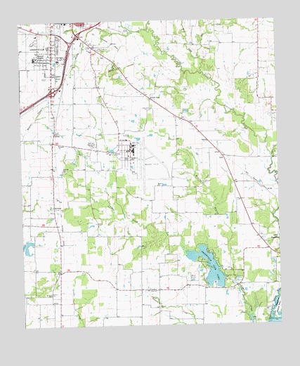
Greenville SE, TX USGS Topographic Map
Click on map above to begin viewing in our Map Viewer.

This topographic map contains these locations and features:
Feature Name Type Latitude Longitude GNIS ID View Map
American Medical Response / Hunt County Emergency Medical ServicesBuildingN33.1195°W96.1112°2720989View Map
Ashmore LakeReservoirN33.0435°W96.1219°1855181View Map
Ashmore Lake DamDamN33.0435°W96.1219°1855180View Map
Battle Ax ChurchChurchN33.0573°W96.0589°1330144View Map
Bowie Elementary SchoolSchoolN33.1098°W96.1075°2006270View Map
Bowie SchoolSchoolN33.1093°W96.1061°1331137View Map
Boyle CemeteryCemeteryN33.0793°W96.1086°1331161View Map
Cash Fire Department - First RespondersBuildingN33.0149°W96.1069°2655181View Map
Center PointPopulated PlaceN33.0923°W96.0611°2034640View Map
Center PointLocaleN33.0934°W96.0619°1332537View Map
Center Point CemeteryCemeteryN33.0887°W96.0622°1332543View Map
Church of GodChurchN33.1076°W96.1130°2020824View Map
City of GreenvilleCivilN33.1116°W96.1094°2410660View Map
Crossroads Shopping CenterLocaleN33.1048°W96.1114°2030409View Map
DixonPopulated PlaceN33.0693°W96.0269°1378215View Map
Emmanuel Missionary Baptist ChurchChurchN33.1062°W96.1136°2020803View Map
Etter Lake CemeteryCemeteryN33.0587°W96.0361°1335533View Map
First Church of the NazareneChurchN33.1054°W96.1094°2020835View Map
First Presbyterian ChurchChurchN33.1107°W96.1072°2020840View Map
Forest Park CemeteryCemeteryN33.1137°W96.0858°1336034View Map
Glen Oaks HospitalHospitalN33.1238°W96.0822°2718878View Map
Grace Presbyterian ChurchChurchN33.1162°W96.0997°2020841View Map
Greenville Club LakeReservoirN33.0187°W96.0366°1336984View Map
Greenville Club Lake DamDamN33.0201°W96.0269°1855178View Map
Greenville Fire Department Station 3BuildingN33.0990°W96.1180°2655234View Map
Greenville Fire Department Station 4BuildingN33.0935°W96.0843°2655152View Map
Greenville High SchoolSchoolN33.1062°W96.1225°2006235View Map
Greenville Post OfficePost OfficeN33.1247°W96.1172°2031143View Map
Hale CreekStreamN33.1098°W96.0377°1337233View Map
Hart CemeteryCemeteryN33.0235°W96.1200°1337417View Map
Highland Terrace Baptist ChurchChurchN33.1229°W96.1214°2020807View Map
Hillside Church of ChristChurchN33.0737°W96.1097°2020823View Map
Hunt CountyCivilN33.1236°W96.0855°1383901View Map
Hunt Regional Medical Center at GreenvilleHospitalN33.1223°W96.1239°2015792View Map
Long BranchStreamN33.1209°W96.0627°1340439View Map
Majors AirportAirportN33.0658°W96.0704°1386766View Map
Majors Army Air Field (historical)MilitaryN33.0678°W96.0656°2092791View Map
McGrew BranchStreamN33.0168°W96.0222°1341211View Map
MeadowviewPopulated PlaceN33.0593°W96.1244°2034626View Map
Memoryland Memorial ParkCemeteryN33.0740°W96.0905°1341359View Map
MHW ParkParkN33.1165°W96.0872°2029818View Map
Mineral HeightsPopulated PlaceN33.1101°W96.1161°1341712View Map
Mineral Heights Baptist ChurchChurchN33.1018°W96.1144°2020809View Map
Mount BethelPopulated PlaceN33.0485°W96.1094°1378705View Map
Mount Bethel ChurchChurchN33.0646°W96.1050°1342008View Map
Mount Bethel ChurchChurchN33.0748°W96.1069°1342009View Map
Mount Zion ChurchChurchN33.0129°W96.1116°1342157View Map
Ridgecrest Baptist ChurchChurchN33.1037°W96.1094°2020816View Map
Rollins LakeReservoirN33.0533°W96.0276°1864645View Map
Rollins Lake DamDamN33.0535°W96.0269°1864644View Map
Simmons CemeteryCemeteryN33.0137°W96.1116°1347144View Map
Timber CreekStreamN33.0684°W96.0027°1348573View Map
W C Cotton StadiumParkN33.1026°W96.1233°2027578View Map
WeilandPopulated PlaceN33.0146°W96.0641°1379251View Map
Weiland CemeteryCemeteryN33.0076°W96.0589°1349606View Map
Weiland Oil FieldOilfieldN33.0196°W96.0444°1349608View Map
Westminster Presbyterian ChurchChurchN33.0987°W96.1097°2020843View Map
Westview United Methodist ChurchChurchN33.1059°W96.1161°2020838View Map
WielandPopulated PlaceN33.0148°W96.0602°2034625View Map
Wolf CreekStreamN33.1034°W96.0361°1350469View Map

Note: Coordinates in the location and feature list above are referenced to NAD83 datum.


Copyright (C) 2008-2025 Ryan Niemi / Sunset Dynamics ... All Rights Reserved