TopoQuest Logo
Do you find TopoQuest useful?
Help keep TopoQuest running and adding new maps/features by donating!
Bitcoin:  19c7KJd3qBynnjoSw5npx9KScwjBe4ifkT
Litecoin:  LXs6TkuXGGXo1vDsWCkWVdjQX94eUKd6ui
Home View Maps Find Maps Find Places Resources & Links


Greenville NW, Texas Topographic Map

USGS Map Title: Greenville NW, TX
USGS Map MRC: 33096B2
DRG (GeoTIFF) Download: o33096b2.tif


Neighboring USGS Topographic Map Quads:


  Pike, TX  
33096C3
 

  Celeste, TX  
33096C2
 

  Wolfe City, TX  
33096C1
 

  Farmersville, TX  
33096B3
 

  Greenville NW, TX  
33096B2
 

  Greenville NE, TX  
33096B1
 

  Josephine, TX  
33096A3
 

  Greenville SW, TX  
33096A2
 

  Greenville SE, TX  
33096A1


Map MRC Location:

N34°
W97°
N34°
W96°
H8 H7 H6 H5 H4 H3 H2 H1
G8 G7 G6 G5 G4 G3 G2 G1
F8 F7 F6 F5 F4 F3 F2 F1
E8 E7 E6 E5 E4 E3 E2 E1
D8 D7 D6 D5 D4 D3 D2 D1
C8 C7 C6 C5 C4 C3 C2 C1
B8 B7 B6 B5 B4 B3 B2 B1
A8 A7 A6 A5 A4 A3 A2 A1
N33°
W97°
N33°
W96°

Greenville NW, TX USGS 1:24K Topographic Map Preview:
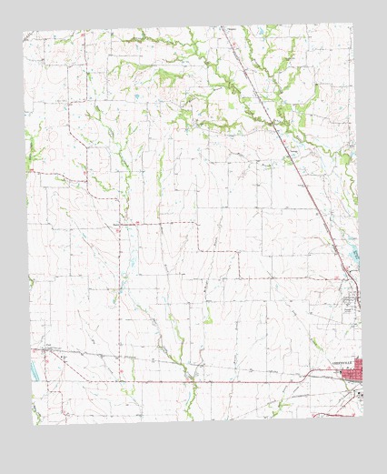
Greenville NW, TX USGS Topographic Map
Click on map above to begin viewing in our Map Viewer.

This topographic map contains these locations and features:
Feature Name Type Latitude Longitude GNIS ID View Map
Barnhart Boles CemeteryCemeteryN33.2396°W96.1511°1330075View Map
Briar BranchStreamN33.1432°W96.1933°1331242View Map
Carver Elementary SchoolSchoolN33.1401°W96.1333°2006277View Map
Carver High SchoolSchoolN33.1396°W96.1336°1332241View Map
Carver ParkParkN33.1362°W96.1353°2028667View Map
Cowleech CreekStreamN33.2446°W96.1850°1373265View Map
Elm ChurchChurchN33.1462°W96.2228°1335349View Map
FloydPopulated PlaceN33.1487°W96.2450°1378308View Map
Floyd SchoolSchoolN33.1465°W96.2389°1335992View Map
Flyers FieldAirportN33.1893°W96.1919°1386767View Map
Greenville Fire Department Station 2BuildingN33.1406°W96.1319°2655319View Map
Hickory CreekStreamN33.2182°W96.1508°1374053View Map
Holder BranchStreamN33.2093°W96.1422°1337924View Map
KelloggPopulated PlaceN33.2093°W96.1511°1378519View Map
KTAQ-TV (Greenville)TowerN33.1590°W96.1422°1386081View Map
McWright BranchStreamN33.1387°W96.1891°1341285View Map
McWright CemeteryCemeteryN33.2190°W96.1861°1341286View Map
Money CemeteryCemeteryN33.2107°W96.1289°1341799View Map
Muriel BranchStreamN33.2309°W96.1733°1342278View Map
PenielPopulated PlaceN33.1629°W96.1269°1343827View Map
Peniel Church of the NazareneChurchN33.1643°W96.1264°2020836View Map
Price Temple Church of God in ChristChurchN33.1382°W96.1311°2020826View Map
Saint John Missionary Baptist ChurchChurchN33.1446°W96.1361°2020817View Map
WagnerPopulated PlaceN33.1879°W96.2153°1379220View Map
Wesley Chapel ChurchChurchN33.1426°W96.1289°2020849View Map

Note: Coordinates in the location and feature list above are referenced to NAD83 datum.


Copyright (C) 2008-2025 Ryan Niemi / Sunset Dynamics ... All Rights Reserved