TopoQuest Logo
Do you find TopoQuest useful?
Help keep TopoQuest running and adding new maps/features by donating!
Bitcoin:  19c7KJd3qBynnjoSw5npx9KScwjBe4ifkT
Litecoin:  LXs6TkuXGGXo1vDsWCkWVdjQX94eUKd6ui
Home View Maps Find Maps Find Places Resources & Links


Greenwich, Ohio Topographic Map

USGS Map Title: Greenwich, OH
USGS Map MRC: 41082A5
DRG (GeoTIFF) Download: o41082a5.tif


Neighboring USGS Topographic Map Quads:


  Monroeville, OH  
41082B6
 

  Norwalk, OH  
41082B5
 

  Clarksfield, OH  
41082B4
 

  Willard, OH  
41082A6
 

  Greenwich, OH  
41082A5
 

  New London, OH  
41082A4
 

  Shelby, OH  
40082H6
 

  Shiloh, OH  
40082H5
 

  Olivesburg, OH  
40082H4


Map MRC Location:

N42°
W83°
N42°
W82°
H8 H7 H6 H5 H4 H3 H2 H1
G8 G7 G6 G5 G4 G3 G2 G1
F8 F7 F6 F5 F4 F3 F2 F1
E8 E7 E6 E5 E4 E3 E2 E1
D8 D7 D6 D5 D4 D3 D2 D1
C8 C7 C6 C5 C4 C3 C2 C1
B8 B7 B6 B5 B4 B3 B2 B1
A8 A7 A6 A5 A4 A3 A2 A1
N41°
W83°
N41°
W82°

Greenwich, OH USGS 1:24K Topographic Map Preview:
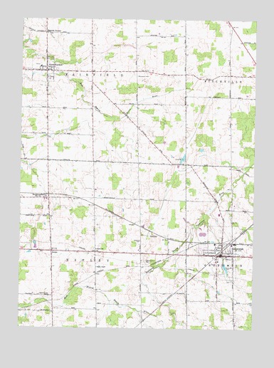
Greenwich, OH USGS Topographic Map
Click on map above to begin viewing in our Map Viewer.

This topographic map contains these locations and features:
Feature Name Type Latitude Longitude GNIS ID View Map
Barre Farm CemeteryCemeteryN41.0357°W82.5605°1806279View Map
BoughtonvillePopulated PlaceN41.0526°W82.6113°1064470View Map
Boughtonville Post Office (historical)Post OfficeN41.0528°W82.6110°2010357View Map
Branchwood EstatesPopulated PlaceN41.1006°W82.6133°2514853View Map
DelphiPopulated PlaceN41.0312°W82.6077°1064527View Map
Delphi CemeteryCemeteryN41.0309°W82.6120°1806286View Map
Edwards Grove CemeteryCemeteryN41.0275°W82.5582°1040090View Map
Fairfield Emergency Medical ServicesBuildingN41.1059°W82.6112°2551013View Map
Greenlawn CemeteryCemeteryN41.0398°W82.5174°1806296View Map
GreenwichPopulated PlaceN41.0301°W82.5157°1064763View Map
Greenwich Police DepartmentBuildingN41.0301°W82.5162°2732422View Map
Greenwich ReservoirReservoirN41.0248°W82.5149°1806297View Map
Hanville CornersPopulated PlaceN41.1192°W82.6124°1048815View Map
North Central Emergency Medical ServicesBuildingN41.0307°W82.5168°2550688View Map
North FairfieldPopulated PlaceN41.1039°W82.6118°1065166View Map
North Fairfield CemeteryCemeteryN41.1048°W82.6057°1806312View Map
North Fairfield Post OfficePost OfficeN41.1042°W82.6124°2011587View Map
North Fairfield Volunteer Fire DepartmentBuildingN41.1048°W82.6113°2550133View Map
Oney's Milkyway FarmLocaleN41.0631°W82.5133°2515264View Map
Reservoir ParkParkN41.0242°W82.5152°1044949View Map
Ripley SchoolSchoolN41.0320°W82.5838°1045030View Map
School Number 4 (historical)SchoolN41.1039°W82.5602°1069573View Map
School Number 5 (historical)SchoolN41.1056°W82.5868°1053273View Map
School Number 7 (historical)SchoolN41.0281°W82.6127°1053278View Map
School Number 9 (historical)SchoolN41.0837°W82.5624°1053279View Map
South Central Elementary SchoolSchoolN41.0276°W82.5191°1050236View Map
South Central High SchoolSchoolN41.0464°W82.5182°1050237View Map
South Central Middle SchoolSchoolN41.1059°W82.6143°1050235View Map
Township CemeteryCemeteryN41.0135°W82.6131°1047113View Map
Township of FairfieldCivilN41.1038°W82.5871°1086344View Map
Township of RipleyCivilN41.0309°W82.5841°1086358View Map
Tri - Community Joint Fire DepartmentBuildingN41.0301°W82.5160°2549950View Map
Village of GreenwichCivilN41.0318°W82.5199°2398206View Map
Village of North FairfieldCivilN41.1045°W82.6137°2399514View Map

Note: Coordinates in the location and feature list above are referenced to NAD83 datum.


Copyright (C) 2008-2024 Ryan Niemi / Sunset Dynamics ... All Rights Reserved