TopoQuest Logo
Do you find TopoQuest useful?
Help keep TopoQuest running and adding new maps/features by donating!
Bitcoin:  19c7KJd3qBynnjoSw5npx9KScwjBe4ifkT
Litecoin:  LXs6TkuXGGXo1vDsWCkWVdjQX94eUKd6ui
Home View Maps Find Maps Find Places Resources & Links


New London, Ohio Topographic Map

USGS Map Title: New London, OH
USGS Map MRC: 41082A4
DRG (GeoTIFF) Download: o41082a4.tif


Neighboring USGS Topographic Map Quads:


  Norwalk, OH  
41082B5
 

  Clarksfield, OH  
41082B4
 

  Brighton, OH  
41082B3
 

  Greenwich, OH  
41082A5
 

  New London, OH  
41082A4
 

  Nova, OH  
41082A3
 

  Shiloh, OH  
40082H5
 

  Olivesburg, OH  
40082H4
 

  Ashland North, OH  
40082H3


Map MRC Location:

N42°
W83°
N42°
W82°
H8 H7 H6 H5 H4 H3 H2 H1
G8 G7 G6 G5 G4 G3 G2 G1
F8 F7 F6 F5 F4 F3 F2 F1
E8 E7 E6 E5 E4 E3 E2 E1
D8 D7 D6 D5 D4 D3 D2 D1
C8 C7 C6 C5 C4 C3 C2 C1
B8 B7 B6 B5 B4 B3 B2 B1
A8 A7 A6 A5 A4 A3 A2 A1
N41°
W83°
N41°
W82°

New London, OH USGS 1:24K Topographic Map Preview:
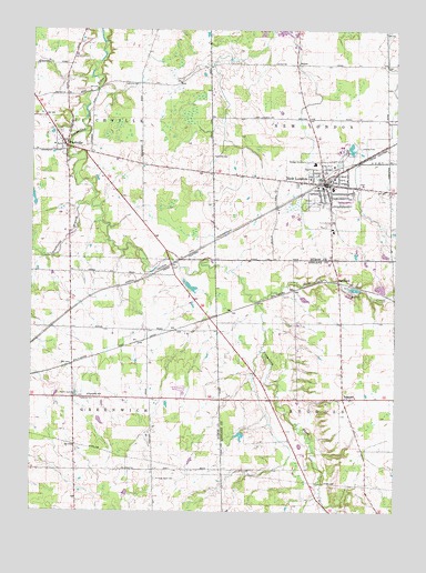
New London, OH USGS Topographic Map
Click on map above to begin viewing in our Map Viewer.

This topographic map contains these locations and features:
Feature Name Type Latitude Longitude GNIS ID View Map
Biglow Airfield (historical)AirportN41.0950°W82.3878°2120337View Map
Buck CreekStreamN41.0545°W82.4238°1038454View Map
Crall PondReservoirN41.0197°W82.4279°1077783View Map
Crall Pond DamDamN41.0201°W82.4266°1077782View Map
Day CemeteryCemeteryN41.1017°W82.3757°1039799View Map
Ekey School (historical)SchoolN41.0106°W82.4343°1050239View Map
Fayette CemeteryCemeteryN41.1109°W82.4638°1806291View Map
Firelands Ambulance ServiceBuildingN41.0863°W82.3972°2550881View Map
First Baptist ChurchChurchN41.0798°W82.3977°1807610View Map
FitchvillePopulated PlaceN41.0948°W82.4885°1064652View Map
Fitchville CemeteryCemeteryN41.0984°W82.4902°1052370View Map
Fitchville Elementary SchoolSchoolN41.0951°W82.4924°1050238View Map
Fitchville Post Office (historical)Post OfficeN41.0945°W82.4888°2010367View Map
Forks of Road Cemetery (historical)CemeteryN41.0948°W82.4882°1806293View Map
Golding CemeteryCemeteryN41.0923°W82.4379°1806295View Map
Grove Street CemeteryCemeteryN41.0800°W82.4016°1806298View Map
HereforkPopulated PlaceN41.0606°W82.3946°1064826View Map
Holy Cross Catholic CemeteryCemeteryN41.0853°W82.3877°1806301View Map
Kniffin CemeteryCemeteryN41.0305°W82.4856°1042320View Map
Millstone Hills Golf CourseLocaleN41.0756°W82.4141°1050240View Map
Mindzak Airfield (historical)AirportN41.0117°W82.4430°2442625View Map
New LondonPopulated PlaceN41.0851°W82.3999°1065472View Map
New London Elementary SchoolSchoolN41.0842°W82.3968°1050242View Map
New London Emergency Medical ServicesBuildingN41.0853°W82.3959°2551015View Map
New London Fire DepartmentBuildingN41.0841°W82.4010°2549958View Map
New London High SchoolSchoolN41.0839°W82.3966°1050243View Map
New London HospitalHospitalN41.0848°W82.4002°1050241View Map
New London Police DepartmentBuildingN41.0852°W82.3961°2732487View Map
New London Post OfficePost OfficeN41.0848°W82.3999°2011586View Map
New London Recreation ParkParkN41.0801°W82.4052°1806310View Map
New London United Methodist ChurchChurchN41.0848°W82.3979°1807611View Map
New London Upground ReservoirReservoirN41.0687°W82.4282°1079259View Map
New London Upground Reservoir DamDamN41.0701°W82.4266°1079258View Map
Ninevah Road CemeteryCemeteryN41.0084°W82.4568°1806311View Map
Our Lady of Lourdes ChurchChurchN41.0842°W82.3979°1807612View Map
Quaker CemeteryCemeteryN41.0292°W82.4779°1806317View Map
RugglesPopulated PlaceN41.0295°W82.3924°1080506View Map
Ruggles Elementary SchoolSchoolN41.0301°W82.3882°1051150View Map
Ruggles Post Office (historical)Post OfficeN41.0292°W82.3916°1958930View Map
Ruggles Township CemeteryCemeteryN41.0289°W82.4010°1806368View Map
Second Baptist ChurchChurchN41.0864°W82.3918°1807614View Map
Southwest Branch Vermilion RiverStreamN41.0795°W82.4802°1046510View Map
Staples PondReservoirN41.1001°W82.4882°1077990View Map
Staples Pond DamDamN41.1001°W82.4882°1077989View Map
Township of FitchvilleCivilN41.1023°W82.4880°1086345View Map
Township of GreenwichCivilN41.0292°W82.4831°1086347View Map
Township of New LondonCivilN41.1017°W82.3884°1086351View Map
Township of RugglesCivilN41.0294°W82.3852°1085714View Map
Uke Ranch PondReservoirN41.0567°W82.4082°1077781View Map
Uke Ranch Pond DamDamN41.0567°W82.4082°1077780View Map
Village of New LondonCivilN41.0796°W82.4066°2399472View Map
Woodlyn AcresPopulated PlaceN41.0317°W82.4481°2514849View Map

Note: Coordinates in the location and feature list above are referenced to NAD83 datum.


Copyright (C) 2008-2025 Ryan Niemi / Sunset Dynamics ... All Rights Reserved