TopoQuest Logo
Do you find TopoQuest useful?
Help keep TopoQuest running and adding new maps/features by donating!
Bitcoin:  19c7KJd3qBynnjoSw5npx9KScwjBe4ifkT
Litecoin:  LXs6TkuXGGXo1vDsWCkWVdjQX94eUKd6ui
Home View Maps Find Maps Find Places Resources & Links


Greenwood, New York Topographic Map

USGS Map Title: Greenwood, NY
USGS Map MRC: 42077B6
DRG (GeoTIFF) Download: o42077b6.tif


Neighboring USGS Topographic Map Quads:


  Alfred, NY  
42077C7
 

  Hornell, NY  
42077C6
 

  Canisteo, NY  
42077C5
 

  Andover, NY  
42077B7
 

  Greenwood, NY  
42077B6
 

  South Canisteo, NY  
42077B5
 

  Whitesville, NY  
42077A7
 

  Rexville, NY  
42077A6
 

  Troupsburg, NY  
42077A5


Map MRC Location:

N43°
W78°
N43°
W77°
H8 H7 H6 H5 H4 H3 H2 H1
G8 G7 G6 G5 G4 G3 G2 G1
F8 F7 F6 F5 F4 F3 F2 F1
E8 E7 E6 E5 E4 E3 E2 E1
D8 D7 D6 D5 D4 D3 D2 D1
C8 C7 C6 C5 C4 C3 C2 C1
B8 B7 B6 B5 B4 B3 B2 B1
A8 A7 A6 A5 A4 A3 A2 A1
N42°
W78°
N42°
W77°

Greenwood, NY USGS 1:24K Topographic Map Preview:
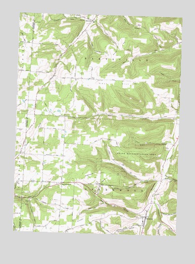
Greenwood, NY USGS Topographic Map
Click on map above to begin viewing in our Map Viewer.

This topographic map contains these locations and features:
Feature Name Type Latitude Longitude GNIS ID View Map
Anson Brewster CemeteryCemeteryN42.1537°W77.7336°2547942View Map
Atkins CemeteryCemeteryN42.1278°W77.7211°2547943View Map
Bar B R FarmsLocaleN42.1400°W77.7150°2703668View Map
Brown HollowValleyN42.1560°W77.6525°944917View Map
Call HillSummitN42.2117°W77.6603°945468View Map
Call Hill CemeteryCemeteryN42.2128°W77.7061°945469View Map
Call Hill School (historical)SchoolN42.2139°W77.7000°2370399View Map
Camp HarleyLocaleN42.2492°W77.7458°945590View Map
Canisteo - Greenwood Middle SchoolSchoolN42.1330°W77.6507°2597629View Map
Christian HollowValleyN42.1298°W77.6514°946634View Map
Colby CreekStreamN42.1837°W77.6272°947020View Map
Cole HollowValleyN42.1357°W77.6484°947109View Map
Dryden HillSummitN42.1312°W77.7036°948708View Map
Dryden Hill School (historical)SchoolN42.1317°W77.6892°2370406View Map
Erskin HollowValleyN42.1769°W77.6274°949695View Map
Fall Creek School (historical)SchoolN42.2311°W77.6400°2370397View Map
Fisher HollowValleyN42.1328°W77.6361°950159View Map
GreenwoodPopulated PlaceN42.1351°W77.6483°951782View Map
Greenwood CemeteryCemeteryN42.1484°W77.6427°951785View Map
Greenwood HillSummitN42.1576°W77.6911°951789View Map
Greenwood Post OfficePost OfficeN42.1355°W77.6482°2599078View Map
Greenwood Volunteer Fire DepartmentBuildingN42.1355°W77.6491°2701013View Map
HartsvillePopulated PlaceN42.2470°W77.6939°952316View Map
Krusen CemeteryCemeteryN42.1416°W77.7131°2547944View Map
Lane School (historical)SchoolN42.1450°W77.7350°2370405View Map
Letts CemeteryCemeteryN42.1530°W77.6800°2547945View Map
Meade School (historical)SchoolN42.1758°W77.7022°2370404View Map
Norton HollowValleyN42.1590°W77.6342°959012View Map
Purdy HillSummitN42.2278°W77.6744°961990View Map
Redmond School (historical)SchoolN42.1536°W77.6972°2370403View Map
Rock CreekStreamN42.1556°W77.6394°962696View Map
Rock Creek School (historical)SchoolN42.1592°W77.6583°2370402View Map
Shovel Hollow School (historical)SchoolN42.1708°W77.7458°2371547View Map
Slate Creek School (historical)SchoolN42.1922°W77.6456°2370400View Map
Stephens Tree FarmLocaleN42.2128°W77.7147°2544417View Map
Town of GreenwoodCivilN42.1455°W77.6790°979025View Map
Town of HartsvilleCivilN42.2353°W77.6820°979055View Map
Webb HollowValleyN42.2476°W77.6955°968974View Map
West GreenwoodPopulated PlaceN42.1537°W77.7136°973228View Map
White School (historical)SchoolN42.2150°W77.7228°2370398View Map
Woodward HollowValleyN42.1484°W77.6444°971728View Map
Woodward Hollow School (historical)SchoolN42.1286°W77.6278°2370407View Map

Note: Coordinates in the location and feature list above are referenced to NAD83 datum.


Copyright (C) 2008-2024 Ryan Niemi / Sunset Dynamics ... All Rights Reserved