TopoQuest Logo
Do you find TopoQuest useful?
Help keep TopoQuest running and adding new maps/features by donating!
Bitcoin:  19c7KJd3qBynnjoSw5npx9KScwjBe4ifkT
Litecoin:  LXs6TkuXGGXo1vDsWCkWVdjQX94eUKd6ui
Home View Maps Find Maps Find Places Resources & Links


Rexville, New York Topographic Map

USGS Map Title: Rexville, NY
USGS Map MRC: 42077A6
DRG (GeoTIFF) Download: o42077a6.tif


Neighboring USGS Topographic Map Quads:


  Andover, NY  
42077B7
 

  Greenwood, NY  
42077B6
 

  South Canisteo, NY  
42077B5
 

  Whitesville, NY  
42077A7
 

  Rexville, NY  
42077A6
 

  Troupsburg, NY  
42077A5
 

  Ulysses, PA  
41077H7
 

  Harrison Valley, PA  
41077H6
 

  Potter Brook, PA  
41077H5


Map MRC Location:

N43°
W78°
N43°
W77°
H8 H7 H6 H5 H4 H3 H2 H1
G8 G7 G6 G5 G4 G3 G2 G1
F8 F7 F6 F5 F4 F3 F2 F1
E8 E7 E6 E5 E4 E3 E2 E1
D8 D7 D6 D5 D4 D3 D2 D1
C8 C7 C6 C5 C4 C3 C2 C1
B8 B7 B6 B5 B4 B3 B2 B1
A8 A7 A6 A5 A4 A3 A2 A1
N42°
W78°
N42°
W77°

Rexville, NY USGS 1:24K Topographic Map Preview:
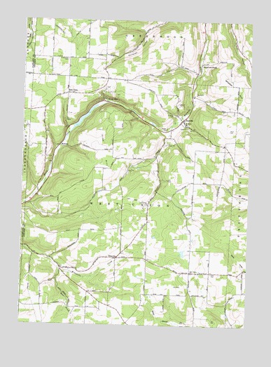
Rexville, NY USGS Topographic Map
Click on map above to begin viewing in our Map Viewer.

This topographic map contains these locations and features:
Feature Name Type Latitude Longitude GNIS ID View Map
A C Rochester Engineering Center HeliportAirportN42.0445°W77.6536°978264View Map
Barney MillsPopulated PlaceN42.0923°W77.7055°972199View Map
Catholic Church School (historical)SchoolN42.1092°W77.7247°2370449View Map
Davis CemeteryCemeteryN42.0801°W77.6364°948055View Map
Gilbert Hill School (historical)SchoolN42.0589°W77.6444°2370452View Map
Greenwood CemeteryCemeteryN42.1092°W77.7256°951784View Map
Hauber CemeteryCemeteryN42.0806°W77.6710°952379View Map
Irish HillSummitN42.0798°W77.7089°953760View Map
Irish Hill School (historical)SchoolN42.0683°W77.6989°2370451View Map
Kelly CemeteryCemeteryN42.0216°W77.6455°954471View Map
King Hill School (historical)SchoolN42.1031°W77.6764°2370429View Map
McGraw School (historical)SchoolN42.0814°W77.7256°2370450View Map
McGrawsPopulated PlaceN42.0734°W77.7297°972779View Map
RexvillePopulated PlaceN42.0842°W77.6622°962422View Map
Rose BrookStreamN42.0231°W77.7283°962898View Map
Rose School (historical)SchoolN42.0075°W77.7014°2370495View Map
Rough and ReadyPopulated PlaceN42.1076°W77.6522°973027View Map
Rough And Ready CemeteryCemeteryN42.1078°W77.6507°2547958View Map
Saint Marys CemeteryCemeteryN42.0858°W77.6672°963882View Map
Saint Marys ChurchChurchN42.0826°W77.6603°963935View Map
Saint Marys New Catholic CemeteryCemeteryN42.0823°W77.6603°2547959View Map
Saunders School (historical)SchoolN42.0167°W77.6569°2370494View Map
Town of West UnionCivilN42.0498°W77.6912°979629View Map
West UnionPopulated PlaceN42.0951°W77.7255°973253View Map
West Union CemeteryCemeteryN42.0952°W77.7242°2547960View Map
West Union ChurchChurchN42.0220°W77.6564°970884View Map
West Union Grange Hall (historical)BuildingN42.0278°W77.7325°2370496View Map
West Union Volunteer Fire DepartmentBuildingN42.0855°W77.6610°2701203View Map
Wheeler HillSummitN42.0937°W77.6319°971006View Map
WileyvillePopulated PlaceN42.0276°W77.6967°973270View Map

Note: Coordinates in the location and feature list above are referenced to NAD83 datum.


Copyright (C) 2008-2025 Ryan Niemi / Sunset Dynamics ... All Rights Reserved