TopoQuest Logo
Do you find TopoQuest useful?
Help keep TopoQuest running and adding new maps/features by donating!
Bitcoin:  19c7KJd3qBynnjoSw5npx9KScwjBe4ifkT
Litecoin:  LXs6TkuXGGXo1vDsWCkWVdjQX94eUKd6ui
Home View Maps Find Maps Find Places Resources & Links


Whitesville, New York Topographic Map

USGS Map Title: Whitesville, NY
USGS Map MRC: 42077A7
DRG (GeoTIFF) Download: o42077a7.tif


Neighboring USGS Topographic Map Quads:


  Wellsville North, NY  
42077B8
 

  Andover, NY  
42077B7
 

  Greenwood, NY  
42077B6
 

  Wellsville South, NY  
42077A8
 

  Whitesville, NY  
42077A7
 

  Rexville, NY  
42077A6
 

  Ellisburg, PA  
41077H8
 

  Ulysses, PA  
41077H7
 

  Harrison Valley, PA  
41077H6


Map MRC Location:

N43°
W78°
N43°
W77°
H8 H7 H6 H5 H4 H3 H2 H1
G8 G7 G6 G5 G4 G3 G2 G1
F8 F7 F6 F5 F4 F3 F2 F1
E8 E7 E6 E5 E4 E3 E2 E1
D8 D7 D6 D5 D4 D3 D2 D1
C8 C7 C6 C5 C4 C3 C2 C1
B8 B7 B6 B5 B4 B3 B2 B1
A8 A7 A6 A5 A4 A3 A2 A1
N42°
W78°
N42°
W77°

Whitesville, NY USGS 1:24K Topographic Map Preview:
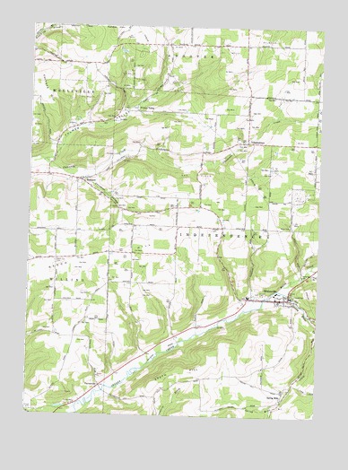
Whitesville, NY USGS Topographic Map
Click on map above to begin viewing in our Map Viewer.

This topographic map contains these locations and features:
Feature Name Type Latitude Longitude GNIS ID View Map
Beech HillSummitN42.0478°W77.8631°943512View Map
Beech Hill CemeteryCemeteryN42.0492°W77.8633°943513View Map
Briggs CemeteryCemeteryN42.0086°W77.8148°2057546View Map
Chenunda Creek FellowshipChurchN42.0878°W77.7834°2615700View Map
Christian HollowValleyN42.0761°W77.8521°946632View Map
Fulmer ValleyValleyN42.0817°W77.8678°950793View Map
Fulmer ValleyPopulated PlaceN42.0978°W77.8300°972522View Map
Fulmer Valley CemeteryCemeteryN42.0988°W77.8292°2544290View Map
HallsportPopulated PlaceN42.0753°W77.8522°952073View Map
Hallsport Union CemeteryCemeteryN42.0764°W77.8504°2544261View Map
Hillside CemeteryCemeteryN42.0394°W77.7604°952841View Map
IndependencePopulated PlaceN42.0881°W77.7814°972647View Map
Independence CemeteryCemeteryN42.0879°W77.7855°2544291View Map
Independence Emergency SquadBuildingN42.0381°W77.7679°2719189View Map
Kenyon Road CemeteryCemeteryN42.0290°W77.8015°2544293View Map
Marsh CreekStreamN42.0406°W77.7672°956551View Map
North Hill School (historical)SchoolN42.0272°W77.8544°2379179View Map
PaynesvillePopulated PlaceN42.0095°W77.8431°972924View Map
Pioneer CemeteryCemeteryN42.0605°W77.7961°960611View Map
RoundtopSummitN42.1245°W77.8394°970551View Map
School Number 3 (historical)SchoolN42.0097°W77.7722°2379187View Map
School Number 4 (historical)SchoolN42.0203°W77.8231°2379189View Map
School Number 5 (historical)SchoolN42.0503°W77.8633°2379192View Map
School Number 6 (historical)SchoolN42.1192°W77.7703°2379196View Map
School Number 7 (historical)SchoolN42.0672°W77.8114°2380731View Map
School Number 7 (historical)SchoolN42.1128°W77.8614°2380732View Map
South HillSummitN42.0140°W77.8044°965773View Map
Spring MillsPopulated PlaceN42.0078°W77.7636°973109View Map
Spring Mills CemeteryCemeteryN42.0097°W77.7610°2544296View Map
Spring Mills CreekStreamN42.0406°W77.7672°966082View Map
Town of IndependenceCivilN42.0514°W77.7941°979091View Map
United States CemeteryCemeteryN42.0083°W77.8144°2544294View Map
Vorhees HillSummitN42.1084°W77.8706°968607View Map
WhitesvillePopulated PlaceN42.0378°W77.7625°971167View Map
Whitesville Central SchoolSchoolN42.0385°W77.7802°2669133View Map
Whitesville Fire DepartmentBuildingN42.0381°W77.7672°2700775View Map
Whitesville Post OfficePost OfficeN42.0376°W77.7661°2618192View Map
Whitesville Public LibraryBuildingN42.0380°W77.7675°2617457View Map
Whitesville Rural CemeteryCemeteryN42.0394°W77.7761°2544292View Map
Wileyville CreekStreamN42.0326°W77.7533°971273View Map

Note: Coordinates in the location and feature list above are referenced to NAD83 datum.


Copyright (C) 2008-2024 Ryan Niemi / Sunset Dynamics ... All Rights Reserved