TopoQuest Logo
Do you find TopoQuest useful?
Help keep TopoQuest running and adding new maps/features by donating!
Bitcoin:  19c7KJd3qBynnjoSw5npx9KScwjBe4ifkT
Litecoin:  LXs6TkuXGGXo1vDsWCkWVdjQX94eUKd6ui
Home View Maps Find Maps Find Places Resources & Links


Griffin Point, Utah Topographic Map

USGS Map Title: Griffin Point, UT
USGS Map MRC: 37111G7
DRG (GeoTIFF) Download: o37111g7.tif


Neighboring USGS Topographic Map Quads:


  Grass Lakes, UT  
37111H8
 

  Barker Reservoir, UT  
37111H7
 

  Posy Lake, UT  
37111H6
 

  Sweetwater Creek, UT  
37111G8
 

  Griffin Point, UT  
37111G7
 

  Wide Hollow Reservoir, UT  
37111G6
 

  Pine Lake, UT  
37111F8
 

  Upper Valley, UT  
37111F7
 

  Canaan Creek, UT  
37111F6


Map MRC Location:

N38°
W112°
N38°
W111°
H8 H7 H6 H5 H4 H3 H2 H1
G8 G7 G6 G5 G4 G3 G2 G1
F8 F7 F6 F5 F4 F3 F2 F1
E8 E7 E6 E5 E4 E3 E2 E1
D8 D7 D6 D5 D4 D3 D2 D1
C8 C7 C6 C5 C4 C3 C2 C1
B8 B7 B6 B5 B4 B3 B2 B1
A8 A7 A6 A5 A4 A3 A2 A1
N37°
W112°
N37°
W111°

Griffin Point, UT USGS 1:24K Topographic Map Preview:
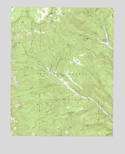
Griffin Point, UT USGS Topographic Map
Click on map above to begin viewing in our Map Viewer.

This topographic map contains these locations and features:
Feature Name Type Latitude Longitude GNIS ID View Map
Barker HollowValleyN37.8217°W111.8444°1454657View Map
Birch CanyonValleyN37.8122°W111.8302°1425588View Map
Birch SpringSpringN37.8159°W111.8487°1425613View Map
Boiling SpringSpringN37.8603°W111.8605°1425862View Map
Cherry CreekStreamN37.7819°W111.7699°1426556View Map
Cherry Creek MineMineN37.7725°W111.8049°1426558View Map
Cherry HollowValleyN37.7969°W111.8321°1439657View Map
Corn CreekStreamN37.7903°W111.7924°1426868View Map
Corn Creek MineMineN37.7861°W111.8116°1426869View Map
Davis PointSummitN37.8086°W111.8130°1427233View Map
Dry ForkStreamN37.7847°W111.7560°1427534View Map
Flat TopSummitN37.7650°W111.8071°1427997View Map
Griffin PointSummitN37.8692°W111.8282°1428413View Map
Hall CreekStreamN37.8155°W111.8313°1441551View Map
Jake HollowValleyN37.8405°W111.7596°1429121View Map
Little Jake HollowValleyN37.8130°W111.8238°1437880View Map
Marts PastureFlatN37.8228°W111.7946°1430129View Map
Mitchell SpringSpringN37.8688°W111.8141°1430386View Map
North Creek DamDamN37.8417°W111.7607°1434648View Map
North Creek ReservoirReservoirN37.8438°W111.7587°1430769View Map
Right Fork Little Jake HollowValleyN37.8122°W111.8207°1431803View Map
Spencer CanyonValleyN37.8080°W111.8216°1445958View Map
Twin TreesAreaN37.7747°W111.7777°1454931View Map
Twin Trees CampgroundLocaleN37.7789°W111.7666°1433756View Map
Water CanyonValleyN37.8017°W111.8132°1447039View Map
West Fork North CreekStreamN37.8675°W111.7732°1447151View Map
White MountainSummitN37.8447°W111.7846°1434172View Map
Whites CoveValleyN37.8705°W111.7738°1447292View Map
Whites FlatFlatN37.8747°W111.7510°1455714View Map

Note: Coordinates in the location and feature list above are referenced to NAD83 datum.


Copyright (C) 2008-2025 Ryan Niemi / Sunset Dynamics ... All Rights Reserved