TopoQuest Logo
Do you find TopoQuest useful?
Help keep TopoQuest running and adding new maps/features by donating!
Bitcoin:  19c7KJd3qBynnjoSw5npx9KScwjBe4ifkT
Litecoin:  LXs6TkuXGGXo1vDsWCkWVdjQX94eUKd6ui
Home View Maps Find Maps Find Places Resources & Links


Willow Lake, Oregon Topographic Map

USGS Map Title: Willow Lake, OR
USGS Map MRC: 42122D4
DRG (GeoTIFF) Download: o42122d4.tif


Neighboring USGS Topographic Map Quads:


  Butte Falls, OR  
42122E5
 

  Big Butte Springs, OR  
42122E4
 

  Rustler Peak, OR  
42122E3
 

  Lakecreek, OR  
42122D5
 

  Willow Lake, OR  
42122D4
 

  Mount McLoughlin, OR  
42122D3
 

  Grizzly Peak, OR  
42122C5
 

  Robinson Butte, OR  
42122C4
 

  Brown Mountain, OR  
42122C3


Map MRC Location:

N43°
W123°
N43°
W122°
H8 H7 H6 H5 H4 H3 H2 H1
G8 G7 G6 G5 G4 G3 G2 G1
F8 F7 F6 F5 F4 F3 F2 F1
E8 E7 E6 E5 E4 E3 E2 E1
D8 D7 D6 D5 D4 D3 D2 D1
C8 C7 C6 C5 C4 C3 C2 C1
B8 B7 B6 B5 B4 B3 B2 B1
A8 A7 A6 A5 A4 A3 A2 A1
N42°
W123°
N42°
W122°

Willow Lake, OR USGS 1:24K Topographic Map Preview:
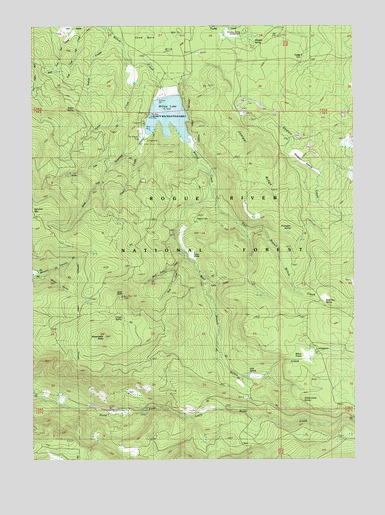
Willow Lake, OR USGS Topographic Map
Click on map above to begin viewing in our Map Viewer.

This topographic map contains these locations and features:
Feature Name Type Latitude Longitude GNIS ID View Map
Ash SwaleBasinN42.4979°W122.4853°1137315View Map
Bear Pan SpringSpringN42.4192°W122.3874°1117391View Map
Bieberstedt ButteSummitN42.4107°W122.4737°1137964View Map
Bieberstedt CreekStreamN42.4601°W122.4689°1137965View Map
Bieberstedt TrailTrailN42.4099°W122.4470°1137966View Map
Buck PointSummitN42.4218°W122.4664°1161289View Map
Buck Point CreekStreamN42.4329°W122.4422°1138814View Map
Buck Point LookoutLocaleN42.4221°W122.4664°1160926View Map
Buck Point TrailTrailN42.4407°W122.4945°1138815View Map
Camp TwoLocaleN42.4926°W122.3947°1161303View Map
City of Medford WatershedAreaN42.4790°W122.3872°1167645View Map
Cook BurnAreaN42.4987°W122.4528°1140052View Map
Cougar SpringSpringN42.4158°W122.4661°1140247View Map
Dead End TrailTrailN42.4704°W122.3884°1140687View Map
Duel CreekStreamN42.4685°W122.4556°1141376View Map
East Branch Willow CreekStreamN42.4640°W122.4384°1141508View Map
Elder RanchLocaleN42.3785°W122.4614°1155790View Map
Elder SpringSpringN42.3762°W122.4609°1155039View Map
Farva CreekStreamN42.4249°W122.4334°1142027View Map
Horse CreekStreamN42.4887°W122.4614°1143746View Map
Indian CreekStreamN42.4985°W122.4717°1144021View Map
Indian GladeFlatN42.4337°W122.4395°1144058View Map
Indian SpringSpringN42.4755°W122.4845°1144075View Map
Jack SpringSpringN42.3996°W122.4169°1144173View Map
Juniper RidgeRidgeN42.4574°W122.4136°1144461View Map
McCallister Soda Spring Forest Camp (historical)LocaleN42.3887°W122.4592°1145920View Map
Miller GulchValleyN42.4265°W122.4959°1146273View Map
Mosquito CampLocaleN42.4643°W122.4022°1146487View Map
Mosquito Fish Lake TrailTrailN42.4401°W122.3859°1146493View Map
Nork CreekStreamN42.4299°W122.4456°1146875View Map
North Fork Bieberstedt CreekStreamN42.4599°W122.4686°1146907View Map
Parker MeadowFlatN42.4924°W122.4128°1147452View Map
Pennington RanchLocaleN42.4893°W122.4639°1155788View Map
Porcupine SpringSpringN42.4417°W122.4002°1147898View Map
Shake CampLocaleN42.3918°W122.3972°1126785View Map
Shake Camp SpringSpringN42.3913°W122.3964°1155037View Map
Skeeters CreekStreamN42.4896°W122.4309°1149583View Map
Skeeters SwampSwampN42.4629°W122.3987°1158488View Map
South Fork Bieberstedt CreekStreamN42.4604°W122.4692°1149931View Map
Stanley Ranch (historical)LocaleN42.4971°W122.4267°1155789View Map
Swamp CreekStreamN42.3874°W122.4706°1155038View Map
Swamp Creek ReservoirReservoirN42.3789°W122.4673°1167648View Map
Swede CabinLocaleN42.4435°W122.4372°1150772View Map
Walch CreekStreamN42.4374°W122.4442°1155036View Map
West Branch Willow CreekStreamN42.4640°W122.4381°1152033View Map
Whiskey SpringSpringN42.4952°W122.4144°1155401View Map
Whiskey Spring Recreation SiteLocaleN42.4951°W122.4164°1152214View Map
Willow Creek DamDamN42.4782°W122.4484°1161639View Map
Willow Creek ResortLocaleN42.4735°W122.4561°1152423View Map
Willow LakeReservoirN42.4735°W122.4480°1161593View Map
Willow Lake County ParkParkN42.4740°W122.4567°1160925View Map
Willow Lake Jackson County Boat RampLocaleN42.4699°W122.4571°2699956View Map
Willow PrairieFlatN42.4046°W122.3943°1152429View Map
Willow Prairie Recreation SiteLocaleN42.4071°W122.3922°1152430View Map

Note: Coordinates in the location and feature list above are referenced to NAD83 datum.


Copyright (C) 2008-2024 Ryan Niemi / Sunset Dynamics ... All Rights Reserved