TopoQuest Logo
Do you find TopoQuest useful?
Help keep TopoQuest running and adding new maps/features by donating!
Bitcoin:  19c7KJd3qBynnjoSw5npx9KScwjBe4ifkT
Litecoin:  LXs6TkuXGGXo1vDsWCkWVdjQX94eUKd6ui
Home View Maps Find Maps Find Places Resources & Links


Hagansport, Texas Topographic Map

USGS Map Title: Hagansport, TX
USGS Map MRC: 33095C2
DRG (GeoTIFF) Download: o33095c2.tif


Neighboring USGS Topographic Map Quads:


  Cunningham, TX  
33095D3
 

  Bogata, TX  
33095D2
 

  Cuthand, TX  
33095D1
 

  Mitchell Creek, TX  
33095C3
 

  Hagansport, TX  
33095C2
 

  Talco, TX  
33095C1
 

  Saltillo, TX  
33095B3
 

  Mount Vernon, TX  
33095B2
 

  Winfield, TX  
33095B1


Map MRC Location:

N34°
W96°
N34°
W95°
H8 H7 H6 H5 H4 H3 H2 H1
G8 G7 G6 G5 G4 G3 G2 G1
F8 F7 F6 F5 F4 F3 F2 F1
E8 E7 E6 E5 E4 E3 E2 E1
D8 D7 D6 D5 D4 D3 D2 D1
C8 C7 C6 C5 C4 C3 C2 C1
B8 B7 B6 B5 B4 B3 B2 B1
A8 A7 A6 A5 A4 A3 A2 A1
N33°
W96°
N33°
W95°

Hagansport, TX USGS 1:24K Topographic Map Preview:
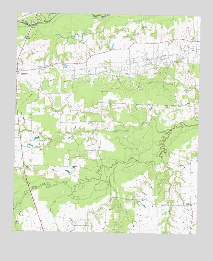
Hagansport, TX USGS Topographic Map
Click on map above to begin viewing in our Map Viewer.

This topographic map contains these locations and features:
Feature Name Type Latitude Longitude GNIS ID View Map
Bear Pen CreekStreamN33.2729°W95.2097°1372448View Map
Campbell CreekStreamN33.2893°W95.1813°1372899View Map
Chapel LakeLakeN33.2876°W95.2422°1354304View Map
Cobb Jones CreekStreamN33.3093°W95.1433°1373151View Map
DaphnePopulated PlaceN33.2668°W95.1297°1379635View Map
HagansportPopulated PlaceN33.3415°W95.2494°1358621View Map
Hagansport CemeteryCemeteryN33.3409°W95.2316°1358622View Map
KALK-FM (Winfield)TowerN33.3526°W95.1294°1388100View Map
LakeviewPopulated PlaceN33.2957°W95.2455°2034845View Map
Lick CreekStreamN33.2912°W95.1480°1374523View Map
Midway ChurchChurchN33.3232°W95.1461°1362803View Map
Mount Olive ChurchChurchN33.3440°W95.2327°1363293View Map
Murphy CemeteryCemeteryN33.3240°W95.1844°1363499View Map
North Franklin County Volunteer Fire DepartmentBuildingN33.3406°W95.2491°2655610View Map
Prairie Academy CemeteryCemeteryN33.3487°W95.1419°1365710View Map
Romal LakeReservoirN33.2843°W95.1423°1860750View Map
Romal Lake DamDamN33.2868°W95.1419°1860749View Map
Terry LakeLakeN33.3615°W95.2086°1369745View Map
Texas No Name Number 34 DamDamN33.2951°W95.1352°1864687View Map
Timber CreekStreamN33.2659°W95.2474°1376461View Map
Wimms Family CemeteryCemeteryN33.3679°W95.1652°1371740View Map

Note: Coordinates in the location and feature list above are referenced to NAD83 datum.


Copyright (C) 2008-2024 Ryan Niemi / Sunset Dynamics ... All Rights Reserved