TopoQuest Logo
Do you find TopoQuest useful?
Help keep TopoQuest running and adding new maps/features by donating!
Bitcoin:  19c7KJd3qBynnjoSw5npx9KScwjBe4ifkT
Litecoin:  LXs6TkuXGGXo1vDsWCkWVdjQX94eUKd6ui
Home View Maps Find Maps Find Places Resources & Links


Winfield, Texas Topographic Map

USGS Map Title: Winfield, TX
USGS Map MRC: 33095B1
DRG (GeoTIFF) Download: o33095b1.tif


Neighboring USGS Topographic Map Quads:


  Hagansport, TX  
33095C2
 

  Talco, TX  
33095C1
 

  Wilkinson, TX  
33094C8
 

  Mount Vernon, TX  
33095B2
 

  Winfield, TX  
33095B1
 

  Mount Pleasant, TX  
33094B8
 

  New Hope, TX  
33095A2
 

  Monticello, TX  
33095A1
 

  Harvard, TX  
33094A8


Map MRC Location:

N34°
W96°
N34°
W95°
H8 H7 H6 H5 H4 H3 H2 H1
G8 G7 G6 G5 G4 G3 G2 G1
F8 F7 F6 F5 F4 F3 F2 F1
E8 E7 E6 E5 E4 E3 E2 E1
D8 D7 D6 D5 D4 D3 D2 D1
C8 C7 C6 C5 C4 C3 C2 C1
B8 B7 B6 B5 B4 B3 B2 B1
A8 A7 A6 A5 A4 A3 A2 A1
N33°
W96°
N33°
W95°

Winfield, TX USGS 1:24K Topographic Map Preview:
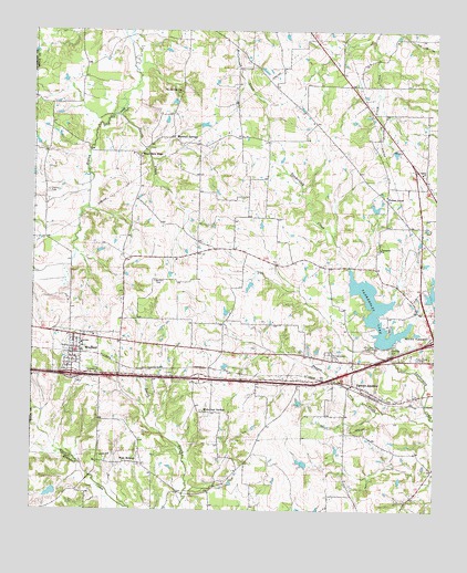
Winfield, TX USGS Topographic Map
Click on map above to begin viewing in our Map Viewer.

This topographic map contains these locations and features:
Feature Name Type Latitude Longitude GNIS ID View Map
Barrett CemeteryCemeteryN33.1848°W95.0869°1330084View Map
City of WinfieldCivilN33.1658°W95.1105°2412281View Map
Damascus ChurchChurchN33.1932°W95.0172°1334023View Map
Davis Newsom DamDamN33.1301°W95.1169°1862150View Map
Davis Newsom LakeReservoirN33.1301°W95.1169°1862151View Map
Dorsey CreekStreamN33.2279°W95.0980°1334503View Map
Farmers AcademyLocaleN33.1582°W95.0252°1335710View Map
Farmers AcademyPopulated PlaceN33.1582°W95.0255°2034844View Map
Forest GroveLocaleN33.2060°W95.0152°1336019View Map
Forrest Lawn CemeteryCemeteryN33.1651°W95.0327°1336041View Map
Glover AirportAirportN33.1375°W95.0200°2676621View Map
John B Stephens Junior LakeReservoirN33.1369°W95.0400°1862155View Map
John B Stephens Junior Lake DamDamN33.1368°W95.0385°1862154View Map
John W May LakeReservoirN33.1806°W95.0018°1862153View Map
John W May Lake DamDamN33.1801°W95.0019°1862152View Map
KALK-FM (Winfield)TowerN33.1610°W95.1044°1386054View Map
KIMP-AM (Mount Pleasant)TowerN33.1651°W95.0077°1385643View Map
Marshall SpringsPopulated PlaceN33.2221°W95.0808°1378644View Map
Marshall Springs CemeteryCemeteryN33.2343°W95.0788°1340996View Map
Millers CovePopulated PlaceN33.1562°W95.1144°1388608View Map
Ripley ChurchChurchN33.2132°W95.0044°1345249View Map
Sam Parker FieldParkN33.1771°W95.0058°2027650View Map
Tankersley DamDamN33.1685°W95.0135°1862156View Map
Tankersley LakeReservoirN33.1766°W95.0180°1348231View Map
Town of Miller's CoveCivilN33.1559°W95.1148°2412997View Map
Tranquil CemeteryCemeteryN33.2082°W95.1205°1348698View Map
Trinity Baptist ChurchChurchN33.1876°W95.0047°2024638View Map
West MidwayPopulated PlaceN33.1373°W95.0949°1379253View Map
West New HopePopulated PlaceN33.2173°W95.0922°1379254View Map
White Oak SpringsPopulated PlaceN33.1510°W95.0719°1379266View Map
WinfieldPopulated PlaceN33.1673°W95.1119°1350413View Map
Winfield City HallBuildingN33.1672°W95.1124°2753953View Map
Winfield DivisionCivilN33.1485°W95.0788°1939329View Map
Winfield Police DepartmentBuildingN33.1670°W95.1125°2751176View Map
Winfield Post OfficePost OfficeN33.1667°W95.1131°2731814View Map

Note: Coordinates in the location and feature list above are referenced to NAD83 datum.


Copyright (C) 2008-2025 Ryan Niemi / Sunset Dynamics ... All Rights Reserved