TopoQuest Logo
Do you find TopoQuest useful?
Help keep TopoQuest running and adding new maps/features by donating!
Bitcoin:  19c7KJd3qBynnjoSw5npx9KScwjBe4ifkT
Litecoin:  LXs6TkuXGGXo1vDsWCkWVdjQX94eUKd6ui
Home View Maps Find Maps Find Places Resources & Links


Halls Canyon, California Topographic Map

USGS Map Title: Halls Canyon, CA
USGS Map MRC: 41121C1
DRG (GeoTIFF) Download: o41121c1.tif


Neighboring USGS Topographic Map Quads:


  Crank Mountain, CA  
41121D2
 

  Happy Camp Mountain, CA  
41121D1
 

  Washington Mountain, CA  
41120D8
 

  Donica Mountain, CA  
41121C2
 

  Halls Canyon, CA  
41121C1
 

  Adin Pass, CA  
41120C8
 

  Lookout, CA  
41121B2
 

  Big Swamp, CA  
41121B1
 

  Adin, CA  
41120B8


Map MRC Location:

N42°
W122°
N42°
W121°
H8 H7 H6 H5 H4 H3 H2 H1
G8 G7 G6 G5 G4 G3 G2 G1
F8 F7 F6 F5 F4 F3 F2 F1
E8 E7 E6 E5 E4 E3 E2 E1
D8 D7 D6 D5 D4 D3 D2 D1
C8 C7 C6 C5 C4 C3 C2 C1
B8 B7 B6 B5 B4 B3 B2 B1
A8 A7 A6 A5 A4 A3 A2 A1
N41°
W122°
N41°
W121°

Halls Canyon, CA USGS 1:24K Topographic Map Preview:
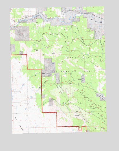
Halls Canyon, CA USGS Topographic Map
Click on map above to begin viewing in our Map Viewer.

This topographic map contains these locations and features:
Feature Name Type Latitude Longitude GNIS ID View Map
Allen ButteSummitN41.3599°W121.0878°218139View Map
Allen Camp (historical)LocaleN41.3696°W121.0861°253146View Map
Andrews SpringSpringN41.2974°W121.0858°218279View Map
Black ButteSummitN41.3279°W121.0839°253154View Map
Cat HillSummitN41.3704°W121.0703°253156View Map
Cove SpringSpringN41.3192°W121.0686°221685View Map
Deep Cut SpringSpringN41.3092°W121.0513°222156View Map
Dutch FlatFlatN41.2863°W121.0066°222762View Map
Eades SpringSpringN41.3340°W121.0858°222798View Map
Fox DrawValleyN41.2732°W121.1075°223782View Map
Fox FlatFlatN41.2793°W121.0550°223784View Map
Fox MountainSummitN41.2663°W121.0364°223788View Map
Fox Mountain SpringSpringN41.2693°W121.0222°223790View Map
Halls CanyonValleyN41.3016°W121.1061°224815View Map
Halls SpringsSpringN41.3071°W121.0741°224818View Map
Hays SpringsSpringN41.2531°W121.0474°225074View Map
Howell CanyonValleyN41.2929°W121.0947°225709View Map
Iron MountainSummitN41.3291°W121.0669°253171View Map
Miller FlatFlatN41.3229°W121.0280°228737View Map
Miller GulchValleyN41.3541°W121.0458°228739View Map
Miller SpringSpringN41.3285°W121.0329°228752View Map
Mud SpringSpringN41.2962°W121.0619°229264View Map
Nichols SpringSpringN41.3076°W121.0655°229543View Map
Ostrom PointSummitN41.3616°W121.1183°253182View Map
Pine SpringSpringN41.3462°W121.0682°230721View Map
Post CanyonValleyN41.3702°W121.0558°264977View Map
Pothole GulchValleyN41.3563°W121.0558°230989View Map
Quaking Aspen SpringSpringN41.3269°W121.0226°231117View Map
Rattlesnake ButteSummitN41.3327°W121.0897°231248View Map
Stone Coal CreekStreamN41.3677°W121.0291°267765View Map
Stone Coal ValleyStreamN41.3657°W121.0205°267766View Map
Studley SpringSpringN41.3064°W121.0321°235619View Map
Twin LakesLakeN41.3377°W121.0960°236699View Map

Note: Coordinates in the location and feature list above are referenced to NAD83 datum.


Copyright (C) 2008-2024 Ryan Niemi / Sunset Dynamics ... All Rights Reserved