TopoQuest Logo
Do you find TopoQuest useful?
Help keep TopoQuest running and adding new maps/features by donating!
Bitcoin:  19c7KJd3qBynnjoSw5npx9KScwjBe4ifkT
Litecoin:  LXs6TkuXGGXo1vDsWCkWVdjQX94eUKd6ui
Home View Maps Find Maps Find Places Resources & Links


Big Swamp, California Topographic Map

USGS Map Title: Big Swamp, CA
USGS Map MRC: 41121B1
DRG (GeoTIFF) Download: o41121b1.tif


Neighboring USGS Topographic Map Quads:


  Donica Mountain, CA  
41121C2
 

  Halls Canyon, CA  
41121C1
 

  Adin Pass, CA  
41120C8
 

  Lookout, CA  
41121B2
 

  Big Swamp, CA  
41121B1
 

  Adin, CA  
41120B8
 

  Bieber, CA  
41121A2
 

  Hog Valley, CA  
41121A1
 

  Letterbox Hill, CA  
41120A8


Map MRC Location:

N42°
W122°
N42°
W121°
H8 H7 H6 H5 H4 H3 H2 H1
G8 G7 G6 G5 G4 G3 G2 G1
F8 F7 F6 F5 F4 F3 F2 F1
E8 E7 E6 E5 E4 E3 E2 E1
D8 D7 D6 D5 D4 D3 D2 D1
C8 C7 C6 C5 C4 C3 C2 C1
B8 B7 B6 B5 B4 B3 B2 B1
A8 A7 A6 A5 A4 A3 A2 A1
N41°
W122°
N41°
W121°

Big Swamp, CA USGS 1:24K Topographic Map Preview:
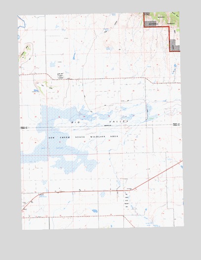
Big Swamp, CA USGS Topographic Map
Click on map above to begin viewing in our Map Viewer.

This topographic map contains these locations and features:
Feature Name Type Latitude Longitude GNIS ID View Map
Albaugh Number 1 1242 DamDamN41.1382°W121.0027°1664274View Map
Ash Creek State Wildlife AreaParkN41.1799°W121.0750°1665827View Map
Ash Creek Wildlife AreaParkN41.1885°W121.0558°253106View Map
Barber RidgeRidgeN41.2491°W121.0083°256507View Map
Bassett Hot SpringsSpringN41.1452°W121.1118°218724View Map
Big SwampSwampN41.1729°W121.1016°257034View Map
Big Valley CanalCanalN41.1466°W121.0747°219276View Map
Butte SchoolSchoolN41.2143°W121.1011°276410View Map
Hays CanyonValleyN41.2368°W121.0658°253163View Map
Hot SpringsPopulated PlaceN41.1463°W121.0386°276397View Map
Hot Springs SloughStreamN41.1485°W121.0505°253168View Map
Kellog Hot SpringsSpringN41.1260°W121.0250°226461View Map
LeonardPopulated PlaceN41.1346°W121.0308°1652952View Map
Long Billy SpringSpringN41.2405°W121.0558°253175View Map
Lookout RancheriaCivilN41.2139°W121.0934°227643View Map
Major CanyonValleyN41.2241°W121.0058°227975View Map
Meeks PlaceLocaleN41.1888°W121.0114°276398View Map
Mountain View CemeteryCemeteryN41.1329°W121.1200°229207View Map
O'Neals SpringsSpringN41.2299°W121.0545°229832View Map
Pilot ButteSummitN41.2102°W121.1153°230654View Map
Pundy RanchLocaleN41.2354°W121.0905°276412View Map
Roberts ButteSummitN41.2254°W121.1241°265454View Map
Service SpringSpringN41.2495°W121.0533°253185View Map
Southard FieldAirportN41.1388°W121.1241°1653262View Map
Turner CanyonValleyN41.2499°W121.0766°236650View Map
Turner RanchLocaleN41.2254°W121.0922°276411View Map

Note: Coordinates in the location and feature list above are referenced to NAD83 datum.


Copyright (C) 2008-2025 Ryan Niemi / Sunset Dynamics ... All Rights Reserved