TopoQuest Logo
Do you find TopoQuest useful?
Help keep TopoQuest running and adding new maps/features by donating!
Bitcoin:  19c7KJd3qBynnjoSw5npx9KScwjBe4ifkT
Litecoin:  LXs6TkuXGGXo1vDsWCkWVdjQX94eUKd6ui
Home View Maps Find Maps Find Places Resources & Links


Adin Pass, California Topographic Map

USGS Map Title: Adin Pass, CA
USGS Map MRC: 41120C8
DRG (GeoTIFF) Download: o41120c8.tif


Neighboring USGS Topographic Map Quads:


  Happy Camp Mountain, CA  
41121D1
 

  Washington Mountain, CA  
41120D8
 

  Canby, CA  
41120D7
 

  Halls Canyon, CA  
41121C1
 

  Adin Pass, CA  
41120C8
 

  Hermit Butte, CA  
41120C7
 

  Big Swamp, CA  
41121B1
 

  Adin, CA  
41120B8
 

  Ambrose Valley, CA  
41120B7


Map MRC Location:

N42°
W121°
N42°
W120°
H8 H7 H6 H5 H4 H3 H2 H1
G8 G7 G6 G5 G4 G3 G2 G1
F8 F7 F6 F5 F4 F3 F2 F1
E8 E7 E6 E5 E4 E3 E2 E1
D8 D7 D6 D5 D4 D3 D2 D1
C8 C7 C6 C5 C4 C3 C2 C1
B8 B7 B6 B5 B4 B3 B2 B1
A8 A7 A6 A5 A4 A3 A2 A1
N41°
W121°
N41°
W120°

Adin Pass, CA USGS 1:24K Topographic Map Preview:
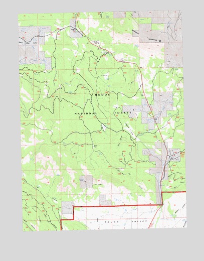
Adin Pass, CA USGS Topographic Map
Click on map above to begin viewing in our Map Viewer.

This topographic map contains these locations and features:
Feature Name Type Latitude Longitude GNIS ID View Map
Adin PassGapN41.3466°W120.9214°256121View Map
Adin Summit PondLakeN41.3374°W120.9355°256122View Map
Antelope SpringSpringN41.2666°W120.9268°256283View Map
Bennett CanyonValleyN41.2588°W120.8839°256830View Map
Conklin Sawmill (historical)BuildingN41.3510°W120.9344°1665950View Map
Conklin SpringSpringN41.2697°W120.9207°258643View Map
Cox CanyonValleyN41.2666°W120.9086°258823View Map
Dutch Flat CanyonValleyN41.2627°W120.9683°259633View Map
Fork SpringSpringN41.2990°W120.9691°260265View Map
Harper SpringSpringN41.2910°W120.9917°261100View Map
Harris SpringSpringN41.3508°W120.9299°261110View Map
Haw SpringSpringN41.2539°W120.8768°261157View Map
Higgins CanyonValleyN41.2779°W120.8916°261312View Map
Higgins FlatFlatN41.3071°W120.9191°261313View Map
Horse SpringsSpringN41.3421°W120.8825°261511View Map
Hoskins SpringSpringN41.3290°W120.9605°261546View Map
Johnson CreekStreamN41.2868°W120.8930°261974View Map
Lost Cabin MineMineN41.3582°W120.9427°262922View Map
Lower Rush Creek CampgroundLocaleN41.2927°W120.8789°263042View Map
McClure SpringSpringN41.2785°W120.9541°263321View Map
Niles CanyonValleyN41.3052°W120.9202°264093View Map
Niles FlatFlatN41.2988°W120.9455°264094View Map
Niles SpringSpringN41.2942°W120.9424°264095View Map
Plum SpringSpringN41.2818°W120.9751°264862View Map
Post CanyonValleyN41.2716°W120.8911°264976View Map
Quail SpringSpringN41.3150°W120.8857°265089View Map
Rice FlatFlatN41.3149°W120.9125°265394View Map
Rice SpringSpringN41.3326°W120.9342°265397View Map
Rice SpringsSpringN41.2574°W120.8852°265398View Map
Roney FlatFlatN41.3091°W120.9380°265560View Map
Ryan RidgeRidgeN41.2610°W120.9914°232066View Map
Schaffer MountainSummitN41.3635°W120.9150°265904View Map
Schaffer SpringSpringN41.3550°W120.9126°265905View Map
Shake SpringSpringN41.3719°W120.9310°266034View Map
The CliffsCliffN41.2757°W120.9427°268181View Map

Note: Coordinates in the location and feature list above are referenced to NAD83 datum.


Copyright (C) 2008-2025 Ryan Niemi / Sunset Dynamics ... All Rights Reserved