TopoQuest Logo
Do you find TopoQuest useful?
Help keep TopoQuest running and adding new maps/features by donating!
Bitcoin:  19c7KJd3qBynnjoSw5npx9KScwjBe4ifkT
Litecoin:  LXs6TkuXGGXo1vDsWCkWVdjQX94eUKd6ui
Home View Maps Find Maps Find Places Resources & Links


Horseshoe Lake, Wyoming Topographic Map

USGS Map Title: Horseshoe Lake, WY
USGS Map MRC: 42109H5
DRG (GeoTIFF) Download: o42109h5.tif


Neighboring USGS Topographic Map Quads:


  Bridger Lakes, WY  
43109A6
 

  Fremont Peak South, WY  
43109A5
 

  Alpine Lake, WY  
43109A4
 

  Fayette Lake, WY  
42109H6
 

  Horseshoe Lake, WY  
42109H5
 

  Halls Mountain, WY  
42109H4
 

  Boulder Lake, WY  
42109G6
 

  Scab Creek, WY  
42109G5
 

  Raid Lake, WY  
42109G4


Map MRC Location:

N43°
W110°
N43°
W109°
H8 H7 H6 H5 H4 H3 H2 H1
G8 G7 G6 G5 G4 G3 G2 G1
F8 F7 F6 F5 F4 F3 F2 F1
E8 E7 E6 E5 E4 E3 E2 E1
D8 D7 D6 D5 D4 D3 D2 D1
C8 C7 C6 C5 C4 C3 C2 C1
B8 B7 B6 B5 B4 B3 B2 B1
A8 A7 A6 A5 A4 A3 A2 A1
N42°
W110°
N42°
W109°

Horseshoe Lake, WY USGS 1:24K Topographic Map Preview:
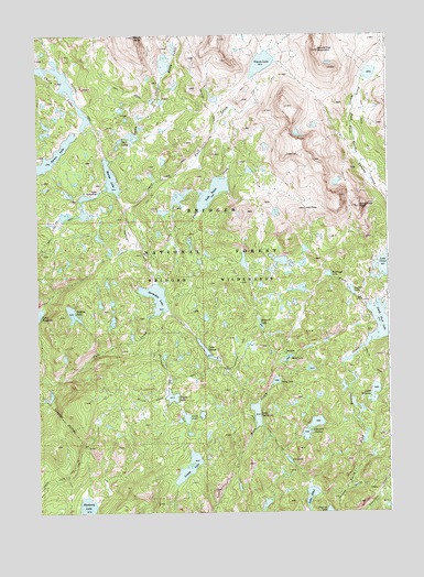
Horseshoe Lake, WY USGS Topographic Map
Click on map above to begin viewing in our Map Viewer.

This topographic map contains these locations and features:
Feature Name Type Latitude Longitude GNIS ID View Map
August LakeLakeN42.9327°W109.5132°1597839View Map
Baldy Lake TrailTrailN42.9944°W109.5679°1604759View Map
Baldy LakesLakeN42.9922°W109.5793°1597900View Map
Barnes LakeLakeN42.9624°W109.5986°1597932View Map
Bell LakesLakeN42.9724°W109.5954°1598099View Map
Bell Lakes TrailTrailN42.9852°W109.5915°1598100View Map
Blueberry LakeLakeN42.8764°W109.6081°1598270View Map
Bridger WildernessReserveN42.9990°W109.5804°1604901View Map
Chain LakesLakeN42.9882°W109.6155°2785676View Map
Chris LakeLakeN42.9006°W109.5477°1598752View Map
Coyote LakeLakeN42.9053°W109.5777°1598991View Map
Cross LakeLakeN42.8999°W109.5727°1599039View Map
Dugway LakeLakeN42.8755°W109.5223°1599405View Map
Edmond LakeLakeN42.9242°W109.5460°1599538View Map
Eds LakeLakeN42.8884°W109.5361°1599539View Map
Hat PassGapN42.9544°W109.5293°1600228View Map
Hay Pass TrailTrailN42.9741°W109.5085°1600252View Map
Hidden LakeLakeN42.9271°W109.6127°1600315View Map
Horseshoe LakeLakeN42.9311°W109.5815°1600426View Map
Horseshoe Lake TrailTrailN42.9213°W109.5813°1600429View Map
Lake EthelLakeN42.8794°W109.5285°1599636View Map
Lake Ethel TrailTrailN42.8941°W109.5410°1600796View Map
Lake GeorgeLakeN42.9172°W109.5650°1599927View Map
Lake JacqulineLakeN42.9587°W109.6030°1600585View Map
Lake SequaLakeN42.9587°W109.5626°1602798View Map
Lake WinonaLakeN42.9062°W109.5057°1604252View Map
Little Fall CreekStreamN42.9425°W109.5843°1600976View Map
Lovatt LakeLakeN42.8867°W109.5719°1601166View Map
Macs LakeLakeN42.9153°W109.5363°1601221View Map
Mount BaldySummitN42.9994°W109.5896°1597903View Map
Norman LakesLakeN42.8984°W109.5266°1601710View Map
North Fork LakeLakeN42.9242°W109.5026°1601781View Map
North Fork PeakSummitN42.9550°W109.5104°1601802View Map
Perry LakeLakeN42.9093°W109.5406°1602101View Map
Rambaud LakeLakeN42.9371°W109.5218°1602372View Map
Round Top MountainSummitN42.9958°W109.5243°1602639View Map
Ruff Lake TrailTrailN42.8794°W109.5924°1604760View Map
Spruce LakeLakeN42.9686°W109.6188°1603293View Map
The RuinSpringN42.8794°W109.5917°1848583View Map
Timico LakeLakeN42.9924°W109.5447°1603677View Map
Timico Lake TrailTrailN42.9483°W109.6193°1603678View Map
Wind River RangeRangeN43.0000°W109.5007°1604237View Map

Note: Coordinates in the location and feature list above are referenced to NAD83 datum.


Copyright (C) 2008-2024 Ryan Niemi / Sunset Dynamics ... All Rights Reserved